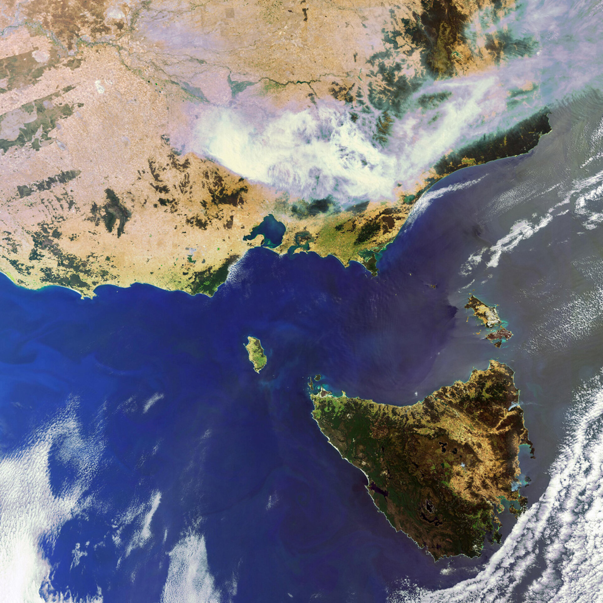
Earth from Space: Smoke over Australia
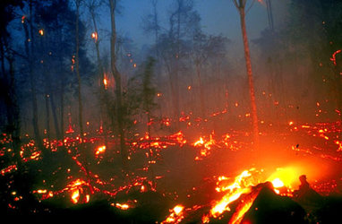
This Envisat image captures the smoke arising from raging fires burning across the state of Victoria in the southeastern corner of Australia. More than 10 massive blazes have burnt around 420 000 hectares since they began nearly two weeks ago.
Some 3 000 Australian and New Zealand fire fighters are battling the blazes, but their efforts have been hampered by smoke as 30 fire-fighting aircraft have had to be grounded due to poor visibility.
Authorities are warning the fires may become more active in the coming days as temperatures are expected to increase and humidity is expected to decrease. There are also fears that several fires northeast of Melbourne will merge into one huge blaze.
Australia has a history of bushfires, which have been responsible for many deaths and enormous economic losses. In February 1983, over 100 bushfires in Victoria and South Australia burnt over one million hectares and resulted in 76 deaths. This devastating series of fires has come to be known as ‘Ash Wednesday’.
The country’s predominantly flat, dry and warm landscape makes it prone to fires year round, but the risks increase during its hottest months – November through March. In addition, Australia’s native vegetation burns quickly and easily. Eucalyptus trees, for example, contain oil that makes them especially dangerous in a bushfire.
As well as detecting the smoke billowing from major conflagrations, satellites also detect the fires themselves. For a decade now, ESA satellites have been continuously surveying fires burning across the Earth’s surface. Worldwide fire maps based on this data are now available to users online in near-real time through ESA's ATSR World Fire Atlas (WFA).
The WFA data are based on results from the Along Track Scanning Radiometer (ATSR) instrument onboard ESA’s ERS-2 satellite and the Advanced Along Track Scanning Radiometer (AATSR) onboard Envisat. These twin radiometer sensors work like thermometers in the sky, measuring thermal infrared radiation to take the temperature of Earth's land surfaces.
This image was acquired on 7 December 2006 by Envisat’s Medium Resolution Imaging Spectrometer (MERIS) instrument while working in Full Resolution mode.