Earth from Space: Summer ice retreat
As we embrace the start of the summer months in the northern hemisphere, Envisat has captured this image of part of Greenland's ice sheet and east coast as the winter sea ice recedes.
Covering roughly 80% of the surface of Greenland, this ice sheet is the second largest body of ice in the world, after that of Antarctica.
However, last year's temperatures, along with those of 2005 and 1998, were the highest since modern global temperature record-keeping began in 1880, heightening concerns about the rates of ice melt.
Positioned in the Arctic, the 100 000 year-old Greenland ice sheet is particularly vulnerable to climate change. Ice melt from the sheet is likely to cause substantial sea-level rise in the coming decades.
Arctic sea ice is even more susceptible to climate change. In September 2007, the area covered by perennial sea ice shrunk to the smallest on record since satellite measurements began 30 years ago.
So far, this spring marks the third lowest extent of Arctic sea ice.
Satellites have played a crucial role in monitoring retreating glaciers and the extent of ice in the Arctic and Antarctic. However, to appreciate fully what is happening to Earth's ice as a consequence of climate change, there is also the need to understand how the volume is changing.
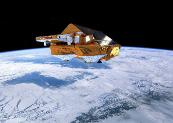
Scientists are now analysing the data from ESA's CryoSat mission, which is delivering precise measurements to study changes in the thickness of Earth's ice – both on land and floating in the oceans.
This new data together with the information on ice extent will build a comprehensive picture of how Earth's ice is changing.
This image was acquired on 23 June by Envisat’s Medium Resolution Imaging Spectrometer at a resolution of 300 m.