
Earth from Space: Tanzanian lake
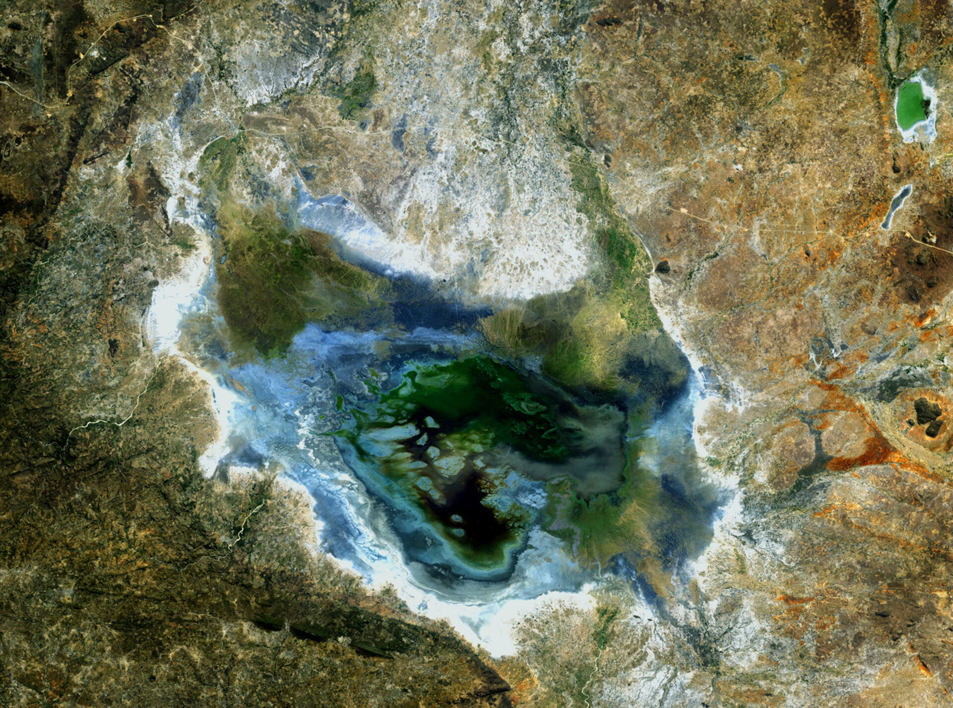
This image from Japan’s ALOS Earth observation satellite shows Lake Sulunga and surrounding areas in central Tanzania.
Measuring about 25 km wide and 42 km long, Sulunga lies 45 km west of the capital, Dodoma.
Sulunga straddles the border of the Dodoma and Singida regions. Singida is one of the poorest regions in Tanzania even though it is home to part of the Kizigo Game Reserve, which spreads into the two regions to the south.
The major sources of revenue in the region are agriculture and tourism. Along with Kenya, Tanzania is one of the most visited East African countries for safari and beach holidays.
A major road running east to west can be seen north of the lake with a railway running nearby. Agriculture is evident in the surrounding areas. This semi-arid area of the country experiences frequent droughts.
The Advanced Land Observation Satellite captured this image on 25 June 2009 with its AVNIR-2 Advanced Visible and Near Infrared Radiometer.
ALOS was supported as a Third Party Mission, which means that ESA used its multi-mission ground systems to acquire, process, distribute and archive data from the satellite to its user community. In April 2011 the satellite abruptly lost power while mapping Japan’s tsunami-hit coastline.

