
ESA's sharp eyes on coastal waters
Our growing reliance on coastal waters for food, trade and tourism means that these delicate ecosystems need to be more closely monitored to guarantee their future sustainability.
ESA's CoastColour project is helping scientists develop techniques to take full advantage of the unique capabilities of the Medium Resolution Imaging Spectrometer (MERIS) sensor on its Envisat satellite.

With a resolution of 300 m, MERIS provides the sharpest view of coastal waters to date, and includes spectral bands specially designed to characterise the complex mixing of pollutants, suspended sediments and phytoplankton typically found in coastal zones.
Stressing the need for information to help manage these ecosystems, more than 40 user organisations have already signed up to the CoastColour project, which is now processing MERIS data with state-of-the-art techniques over 27 high-priority coastal regions selected by users worldwide.
Coral reef monitoring
Arnold Dekker from Australia’s Commonwealth Scientific and Industrial Research Organisation is working with CoastColour to develop techniques to monitor the health of Australia’s Great Barrier Reef.
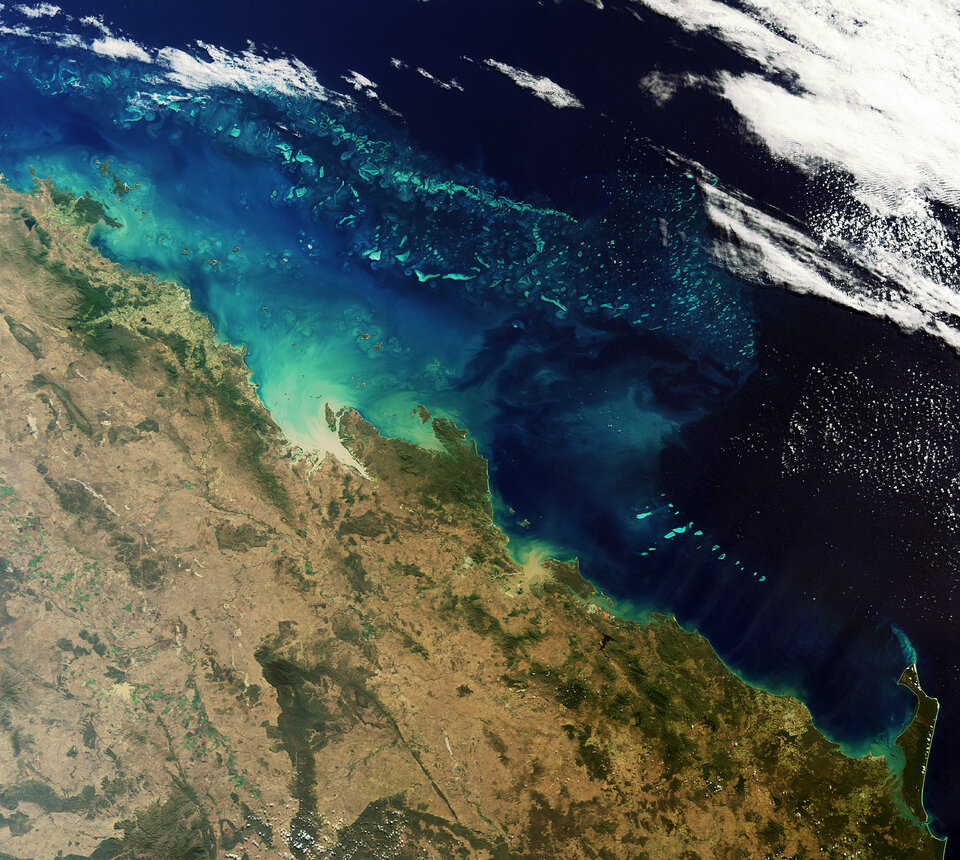
During the wet season large plumes of sediment-laden river water flows into the reef lagoon. Sediments can smother corals and deprive them of the sunlight they need to survive, while river-borne nutrients may influence the frequency of naturally occurring algal blooms.
"ESA is to be commended for supporting the use of Earth observation to help solve the management issues of these truly complex coastal aquatic ecosystems," Dr Dekker said.
Algal bloom monitoring
MERIS data are being used to monitor harmful algal booms along the west coast of South Africa in the Southern Benguela upwelling system. Red tides and algal blooms with extremely high phytoplankton concentrations frequently occur in the region’s bays, threatening fisheries and tourism.
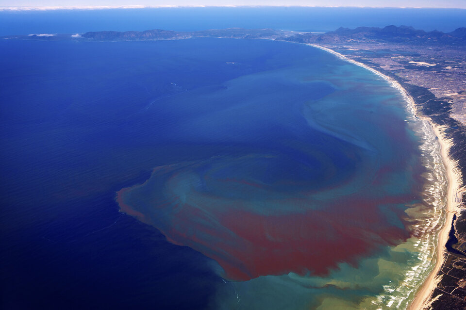
Dr Stewart Bernard of the Council for Scientific and Industrial Research is developing systems aiming to integrate the satellite data with hydrodynamic models to monitor and predict harmful algal blooms operationally.
Coastal resource managers and the aquaculture industry in the region greatly need these predictions to minimise risks to public safety and financial losses, according to Dr Bernard.
"The involvement of local scientists in CoastColour has already increased South Africa’s technical ocean-colour capability, and is expected to significantly aid the implementation of the ocean-colour components of developing African operational oceanography systems."
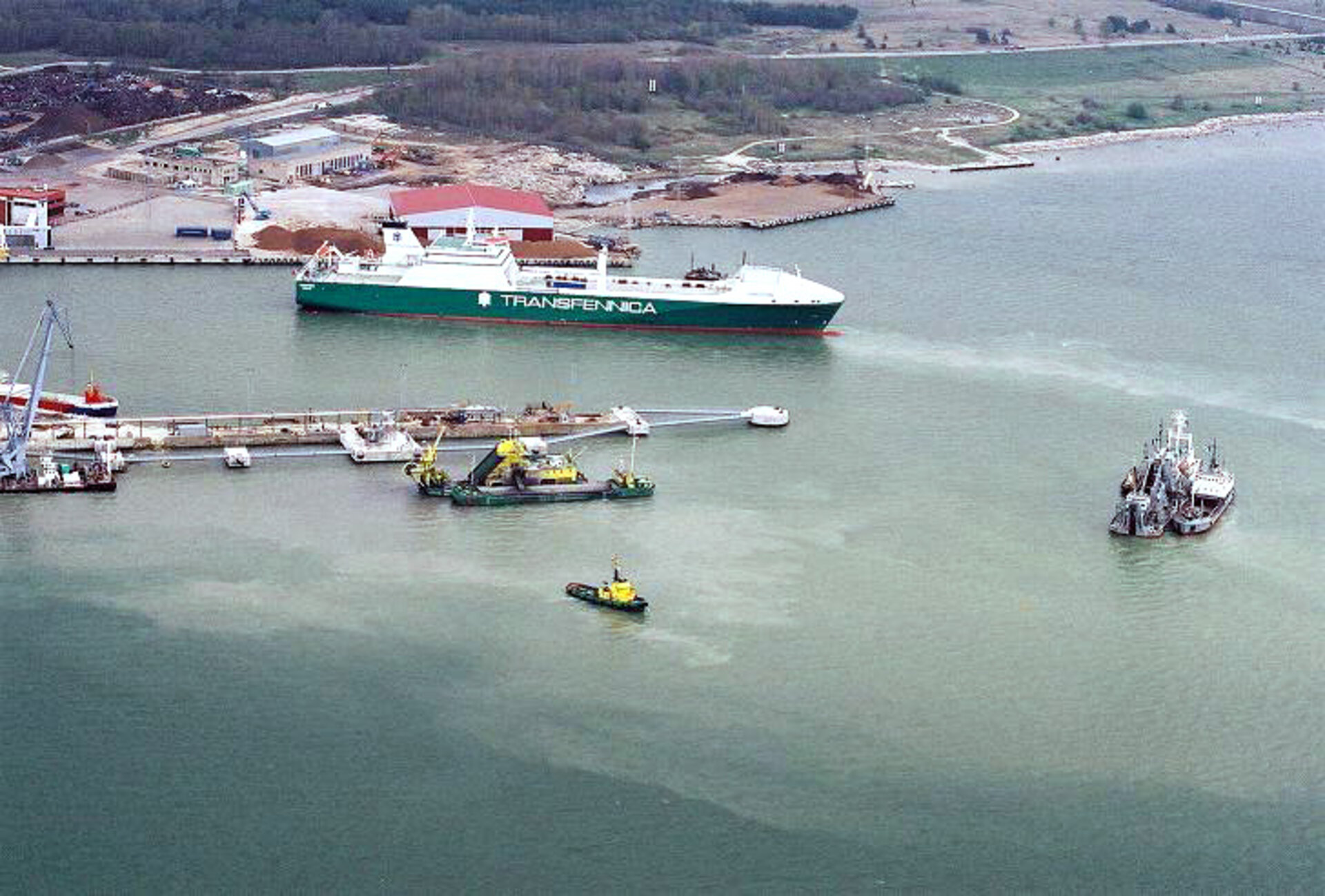
Port maintenance monitoring
In the Baltic Sea, the sustainable development of seaports requires shipping channels to be dredged every two years. Dredging mixes large amounts of suspended sediments into the water, affecting coastal water quality which is regulated by internationally agreed standards.
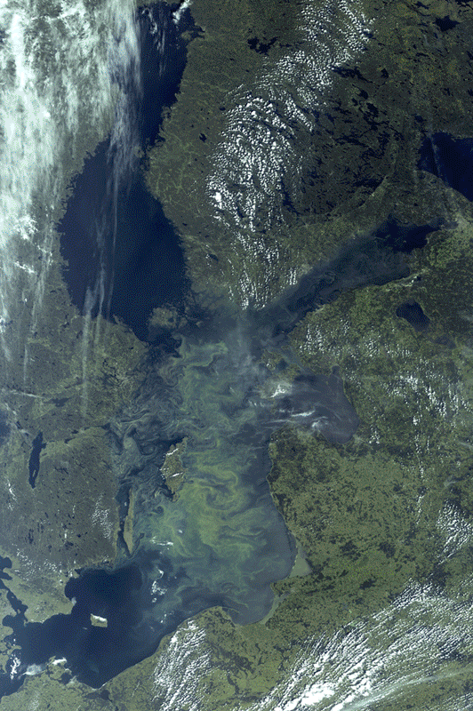
Dr Liis Sipelgas of the Tallinn University of Technology is working with the Port of Tallinn, which runs four harbours on the Estonian coast, to understand the environmental impact of their dredging operations by mapping sediment plumes.
"The new site-specific CoastColour water quality products improve significantly the operational environmental monitoring of harbour dredging activities," Dr Sipelgas said.
"The products also enable us to estimate and quantify the long-term water quality changes in the harbour area."
