Looking ahead to Sentinel-2
With the first Sentinel satellite already in orbit, scientists and users gathered in Italy last week to discuss the progress of the upcoming Sentinel-2 mission and its many applications.
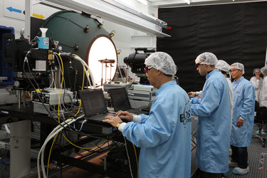
Over 400 attendees from 44 different countries convened at ESA’s ESRIN centre for Earth observation in Frascati, Italy, for the Sentinel-2 for Science workshop.
Sentinel-2 is the second satellite mission being developed for Europe’s Copernicus environment monitoring programme.
Through Copernicus, decision-makers will have access to reliable, timely and accurate information services to manage the environment, understand and mitigate the effects of climate change and ensure civil security.
The two-satellite mission will deliver frequent and high-resolution optical images that will be used for land cover and change detection mapping, agricultural monitoring, disaster control and many other applications.
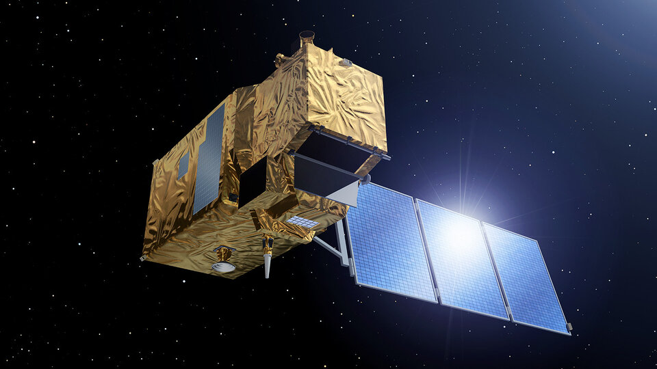
Owing to its high resolution of 10 m per pixel and wide swath of 290 km, global products from Sentinel-2 will be able to be applied locally.
“Timely, high-resolution data are needed for the assessment and monitoring of agricultural productivity. Sentinel-2 data at 10 m resolution will transform our ability to effectively monitor the status and trends of agriculture on a global basis, and will significantly assist those countries most at risk,” said John Latham from the UN Food and Agriculture Organisation (FAO).
“FAO is an active partner and champion user of Earth observation data, and an avid supporter of an integrated Earth observation strategy for resource monitoring built on Copernicus and Sentinel data.”
He also stressed the importance of coordination to continue the provision of consistent products as the user community transitions from using data from the US Landsat missions to Sentinel-2. Landsat provided optical imagery for over 40 years, but this role will be taken over by Sentinel-2, which also provides higher resolution and better coverage.
Last year, ESA and NASA entered into a collaborative agreement to provide compatible data products between Sentinel-2 and Landsat, bringing greater benefits to the users of the images.
In addition to data continuity, Sentinel-2 will provide a more frequent revisit time compared to Landsat. This is particularly important for tracking land degradation and logging, especially in tropical regions that often experience cloud cover.
“Logging practices and forest degradation processes move fast in tropical regions, and frequent satellite acquisitions are needed in order to track their progress, in particular to identify logging roads and canopy gaps before they are covered by regrowing vegetation,” said Frédéric Achard from the Forest Recourses and Climate Unit at the Joint Research Centre.

“With Sentinel-2, we will have an unprecedented acquisition frequency which will enable us to better assess forest conditions and the extent of forest degradation in the tropics and worldwide.”
Once both satellites are in orbit, Sentinel-2 will provide global coverage every two days.
One of the major victories for the mission’s scientific community was last year’s approval of the European Delegated Act on Copernicus data and information policy. This Act provides free, full and open access to users of environmental data from the Copernicus programme – including data from the Sentinel satellites.
“In addition to the planned longevity of the Sentinel-2 mission, the free and open access to the data will be highly beneficial to scientific activities and promote the development of long-term monitoring programmes,” said Mike Wulder from the Canadian Forest Service of Natural Resources Canada.
“Having a consistent, calibrated and accessible data stream allows for the development of time-series. These time-series allow us to better characterise forest dynamics and ecosystem processes, as well as to improve the outcomes of predictive models.”