Montreal outcomes: forest focus could enhance role of space in combating climate change
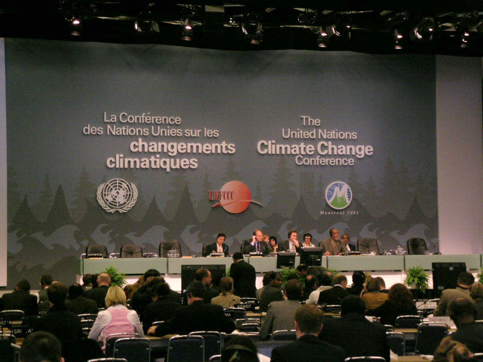
This month's successful conclusion to the United Nations Climate Change Conference in Montreal means the Kyoto Protocol now has a future, with international agreement to begin negotiating a fresh round of greenhouse gas emission reduction targets and develop new mechanisms to combat global warming. Satellite technology could be set to play an increasing role in these efforts.
By adopting the so-called 'Marrakesh accords', the Conference – formally known as the 11th Conference of the Parties (COP 11) to the UN Framework Convention on Climate Change (UNFCCC) and the first Conference of the Parties serving as the Meeting of the Parties to the Kyoto Protocol (COP11/MOP 1) - accepted the Kyoto rulebook, while the process for future carbon reduction commitments beyond 2012 – when the original Kyoto Protocol's remit runs out – with a new working group established to discuss future commitments for developed countries.
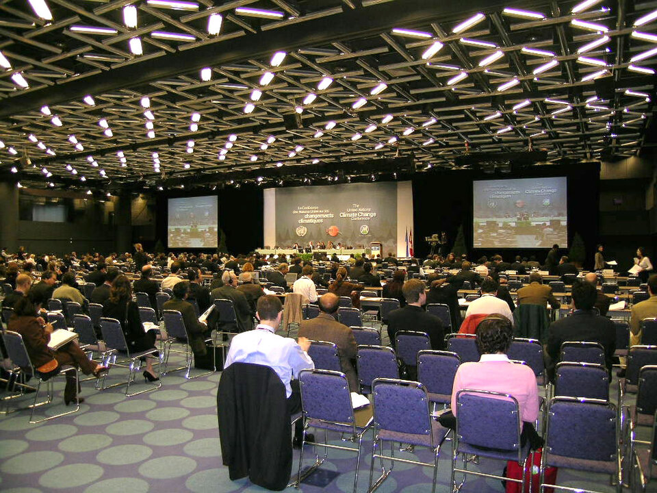
Overall the two-week Conference, attended by more than 9500 participants including 190 national delegations plus intergovernmental organisations and non-governmental organisations, closed on 9 December with the adoption of more than 40 decisions to strengthen global efforts to fight climate change.
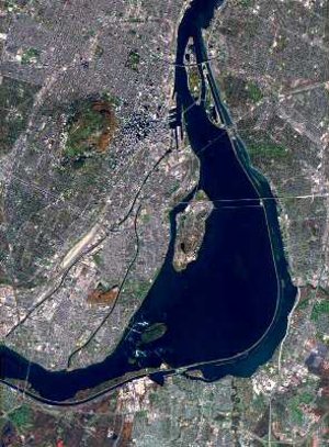
For ESA - which has been in the forefront of developing operational satellite-based systems to monitor the retreat or expansion of forests - one of the most significant outcomes was the decision to consider strategies to reduce emissions from deforestation in developing countries, an issue currently not addressed by the Kyoto protocol.

Up to 25% of human-induced greenhouse gas emissions are due to deforestation, mainly occurring in tropical countries. UN Food and Agriculture Organisation (FAO) figures indicate the world's forests store 283 gigatonnes (or thousand million tonnes) of carbon in their biomass alone, with the total carbon stored in biomass plus deadwood, litter and soil collectively equalling 50% more than all that found in the atmosphere, adding up to one trillion (or thousand thousand million) tonnes.
However two thousand million tonnes of extra carbon are entering the atmosphere each year due to forest loss, and carbon stocks in forest biomass decreased by at least 1.1 gigatonnes per year from 2000-2005 due to deforestation and degradation, with the greatest losses occurring in Africa, Asia and South America.
The governments of Papua New Guinea and Costa Rica – supported by fellow members of the Coalition for Rainforest Nations - proposed to the Conference that the COP consider methods of reducing deforestation-related emissions in developing countries, and received overwhelming support.
The COP invited signatory parties and accredited observes to submit views and recommendations on the issue by 31 March 2006, and for the COP's supporting Subsidiary Body for Scientific and Technological Advice (SBSTA) to consider the information in these submissions.
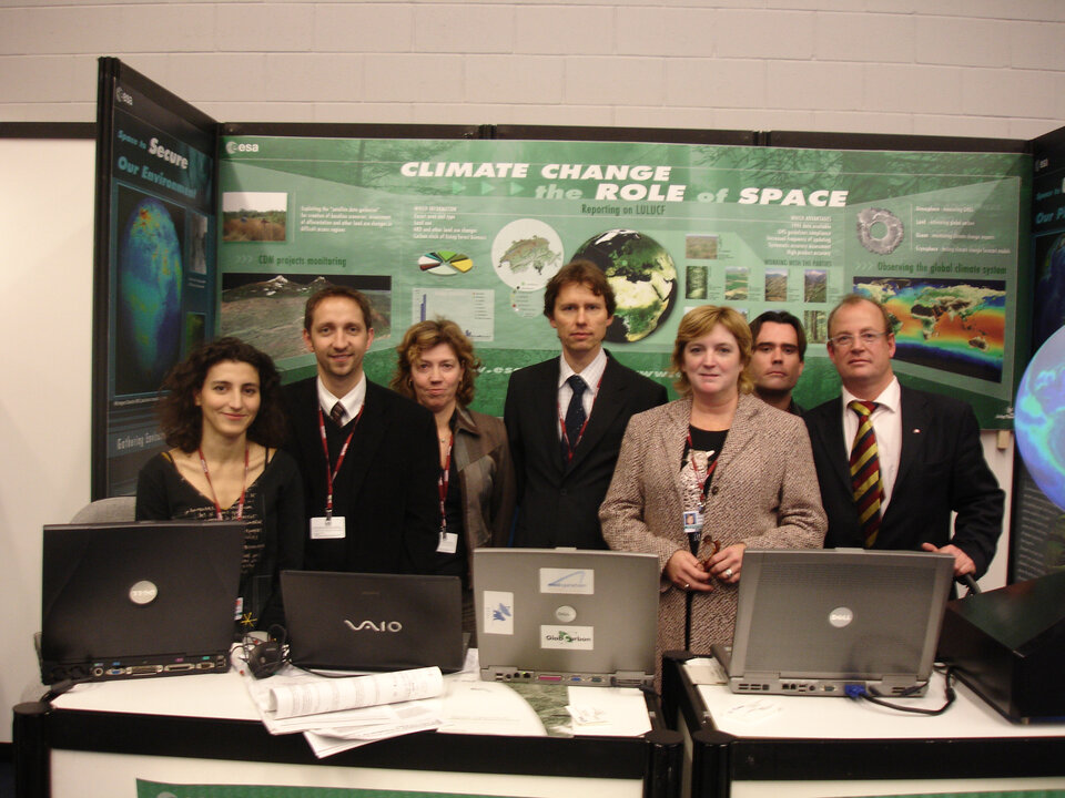
The point was raised repeatedly during the Conference that Earth Observation would need to be part of such a mechanism to provide cost-effective wide-area forest monitoring. ESA presented results from its own efforts in this field at a dedicated exhibit, as well as a 30 November side event and a special space day at 8 December at the Canadian Pavilion, hosted by the Canadian Space Agency.
Four years before the Kyoto Protocol was ratified, ESA began working on ways to apply satellite technology for land cover mapping in support of the Protocol, which awards emissions credits to so-called 'Annex 1' developed countries based on their national carbon 'sinks'. A project called Kyoto-Inventory developed prototype satellite-based services in cooperation with agencies responsible for national Kyoto reporting in Italy, the Netherlands, Spain and Switzerland.
Results from the project have been sufficiently promising that the effort is continuing on a wider scale through a project called GSE Forest Monitoring, which is extending coverage to other European countries and to nations of the developing world, including Indonesia and South Africa.
Another significant decision taken by the Conference was the strengthening of the Clean Development Mechanism (CDM), enabling developed countries to invest in sustainable development projects in developing countries, improving developing nations' quality of life at the same time as gaining emissions allowances.
At Montreal developed nations committed themselves to fund the operation of the CDM with 13 million US dollars for 2006-2007. In addition the working of the CDM was streamlined and its governing body strengthened. Richard Kinley, acting head of the UNFCCC Secretariat stated that 41 CDM projects have so far been registered, with more than 500 in the pipeline.

Afforestation and reforestation projects are set to form a significant part of the CDM, and the portfolio of products and services offered by ESA's GSE Forest Monitoring includes the provision of baseline land cover maps for tracking of subsequent CDM project forest growth. Target groups for the CDM services include a diversity of groups involved in CDM projects - private and non governmental entities as well as the public sector.
GSE Forest Monitoring is being run as part of ESA's initial contribution to Global Monitoring to Environment and Security (GMES), a joint initiative by ESA and the European Union to integrate all available Earth- and space-based information sources to develop a planetary monitoring capability in support of Europe's environment and security goals.
During ESA's own side event on 30 November, Stephen Briggs, Head of ESA's Earth Observation Science and Applications Department, joined national representatives from Greece, Italy, Spain, South Africa and Switzerland. Briggs explained that ESA had been flying environmental monitoring satellites for the last 14 years.
Satellite images and data are routinely exploited for scientific research, but now these results are also forming the basis of operational information products aimed at governmental and institutional users.
"These data have been used to develop a set of services within the GMES initiative," Briggs stated. "This is an initiative to put in space and the ground an entire system of measurements to allow Europe to manage its territories and interact with the rest of the world more effectively. The intention here is not just to deliver datasets but provide full-blown services to the user providing them the sort of information they need."
GMES services so far range from polar ice monitoring to tracking coastal subsidence and chemical changes in the atmosphere. The initiative's global reach is likely to be useful for another decision agreed at Montreal, to commence a five-year work programme to identify impacts of climate change and measures needed for adaptation.

Olivier Arino, Head of the ESA Earth Observation Projects Section, speaking in a UNFCCC webcast, explained that a new generation of operational 'Sentinel' spacecraft are planned as part of GMES. Their payload should include atmospheric sensors capable of direct measurements of some greenhouse gas emissions. Both this speech and the ESA side event are viewable on the UNFCCC website.
Other notable events during COP 11/MOP 1 were the presentations of the Global Climate Observing System (GCOS) and the Global Terrestrial Observing System (GTOS) activities supporting the implementation of the UNFCCC.
These are comprehensive programmes set up by the United Nations to acquire observations, modelling and analysis of climate systems and terrestrial ecosystems respectively, both of them having a satellite component. The UNFCCC SBSTA took note on the progress made, in particular concerning the GCOS implementation plan. The presentations were welcomed by many delegates and received strong encouragement.
The SBSTA also welcomed and accepted an offer from the Committee on Earth Observations (CEOS), on behalf of the Parties supporting space agencies involved in global observations, to provide a detailed report on a coordinated response to the needs expressed in the GCOS implementation plan at the 25th SBSTA session, due in November 2006.
In addition the SBSTA welcomed the efforts by the GTOS secretariat to develop a framework for the preparation of guidance materials, standards and reporting guidelines for terrestrial observing systems and encourage GTOS to continue this work. It also called on the GTOS secretariat to assess the status of the development of standards for each of the essential climate variables in the terrestrial domain - inviting a progress report by the 26th SBSTA session in May 2007.
Satellite monitoring cited as part of the climate solution

There were also more than 140 other side events held during the Conference. During several of these the particular usefulness of satellites for land cover mapping and forest monitoring was repeatedly emphasised.
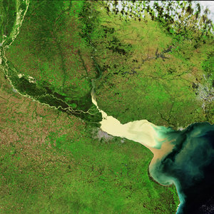
On 29 November the European Commission's Joint Research Centre (EC-JRC) jointly presented an event with the NGO Global Forest Watch Russia, to recount its own activity in this area. Alan Belward of JRC explained that the regular information provided by Earth Observation served to reduce uncertainties in global forest cover change and related carbon emissions.
His colleague Frédéric Archard explained that medium-resolution imagery could be used for large-scale surveys of forested areas, with higher-resolution views acquired for closer study of particular deforestation 'hotspots'. He also introduced results from Global Forest Watch, noting that the availability medium resolution satellite data meant a team of only ten people have essentially been able to map intact forest cover across the globe.
At a side event on 1 December presented by the Amazon Institute for Environmental Research the importance of reducing tropical deforestation was stressed by Robert Aisi, Ambassador of Papua New Guinea to the United Nations. He said that meaningful incentives and access to the world's carbon markets must be provided to developing countries for progress to be made.
Virgílio Viana, Secretary of Environment and Sustainable Development for the Brazilian province of Amazonas, outlined deforestation reduction opportunities taking place in his province, and presented authoritative deforestation maps based on satellite data prepared by Brazil's National Institute of Space Research. He noted that under 'business as usual' conditions, only a small core of the Amazon is projected to remain intact by 2030.
Greg Asner of the Carnegie Institution stated that using Earth Observation to monitor deforestation was a mature, "wall-to-wall objective approach" upon which a transparent and credible system of accurate forest accounting acceptable to the world community had the potential to be constructed. To further develop technical guidance on monitoring tropical deforestation for compensated reductions, an expert workshop in March 2006 will be organised by ESA’s Land Cover Office of the panel Global Observations Forest and Land Cover Dynamics (GOFC-GOLD).
Satellites in support of biodiversity

Discussion on Earth Observation applications also extended to a side event of the 11th Meeting of the Subsidiary Body on Scientific, Technical and Technological Advice (SBSTTA 11) of the United Nations Convention on Biological Diversity (CBD), taking place in Montreal at the same time as the UNFCCC/Kyoto COP.
The title of the side event organized by GTOS was 'Making progress towards 2010', which is the target date by which the CBD aims to significantly reduce the current rate of biodiversity loss. Neville Ash of the United Nations Environment Programme World Conservation Monitoring Centre (UNEP WCMC) stated that to meet this goal, indicators needed to be developed to track changes in the extent of selected biomes, ecosystems and habitats, including forests, grasslands, coral reefs and wetlands.
John Latham, Head of the GTOS – assigned the task by the UN of acquiring observations, modelling and analysis of terrestrial ecosystems to help identify and manage environmental change – stressed that the Earth is currently undergoing an unprecedented transformation, with 60% of land ecosystems being degraded or utilised unsustainably, and between 10 and 30% of species threatened with extinction.
"Land cover is a key variable in global change," Latham stated, with fragmentation of ecosystems representing a particular problem for biodiversity. He argued that a more systematic approach to land cover mapping would help support both the UNFCCC and CBD, ensuring greater conservation and more sustainable use of land resources. He added that with the CBD's 2010 target only five years away, Earth Observation was the only way to satisfactorily track all relevant land changes, and that a significant amount of work still needed to be done to meet it.
Latham gave the example of FAO's 'Africover' project, which is a land cover database covering a third of Africa so far, intended to support sustainable development in African countries where natural resources are under strain.
Martin Herold of the ESA-funded Global Office of Forest and Land Cover Dynamics (GOFC-GOLD) recounted the activities of this panel of GTOS, aimed at promoting globally harmonised space- and ground-based standards for forestry and land cover mapping. GOFC-GOLD activities include working with ESA on GSE Forest Monitoring and the satellite-based GLOBCOVER project, intended to be the highest-ever-resolution global land cover map.