
Passing its global sight test leaves MERIS ready for work
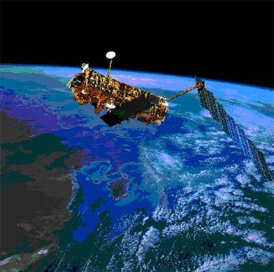
The MERIS sensor on ESA's Envisat environmental satellite is ready for operational use by science and industry. A lengthy test campaign spanning the globe has validated the complex software systems that convert top-of-atmosphere radiation readings into useful measurements of ocean colour, atmospheric water vapour and land cover.
The Medium Resolution Imaging Spectrometer (MERIS) was launched along with nine other instruments aboard Envisat in March last year. It measures the solar radiation reflected off the Earth in 15 separate bands of visible and near-infrared light.
Initial MERIS data are error-corrected and georeferenced to a quality called 'Level 1'. Then software packages called 'processors' making use of algorithms - mathematical instructions based on physics models – tailor this basic data into what are known as 'Level 2' products.
These are specific measurements of geophysical parameters such as oceanic phytoplankton chlorophyll concentration, cloud-top pressure or terrestrial vegetation cover, to a maximum resolution of 300 metres from 800 km away in space.
Immediately Envisat was launched ESA began a calibration campaign to make sure all instruments, including MERIS, were working optimally. But the processor algorithms applied to MERIS data also needed validation, to see how much they needed 'tuning up' for maximum accuracy.
What this came down to was checking if what the processors reported was really there. Some of this job could be done by cross-checking data with similar spacecraft instruments like CNES's POLDER or NASA's SeaWiFs, but independent verification of ground conditions was also required.
This entailed international efforts to mount a worldwide 'sight test' that ranged from the Greenland ice cap to African deserts, aircraft flights above Europe, buoys in coastal zones and research vessels out in the open ocean.
To ensure overall accuracy all the radiometer instruments used to gather local measurements across the world were first inter-calibrated by the UK Plymouth Marine Laboratory, one of the leading partners in validation efforts.
Checking results on land was the simplest part of the validation campaign, as many cross-comparisons could be done with a European Commission land cover database. Stable desert sites in Africa that are usually cloud-free and have not changed their surface character in many years were also used.
MERIS was built primarily to chart ocean colour – a task involving a quite different set of algorithms - so gathering in-situ data on this and other local variables was crucial, both inside coastal zones and out in the open ocean.
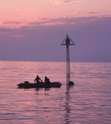
Close to land, specially equipped buoys were deployed close to Envisat orbit times in the Baltic, North Sea, the Skagerrak and the Mediterranean. Readings were also taken from whatever ships that were available.
Journey to a cold ocean current teeming with life
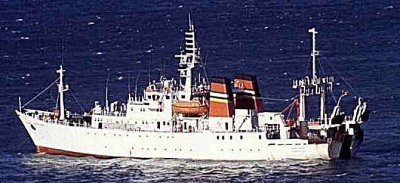
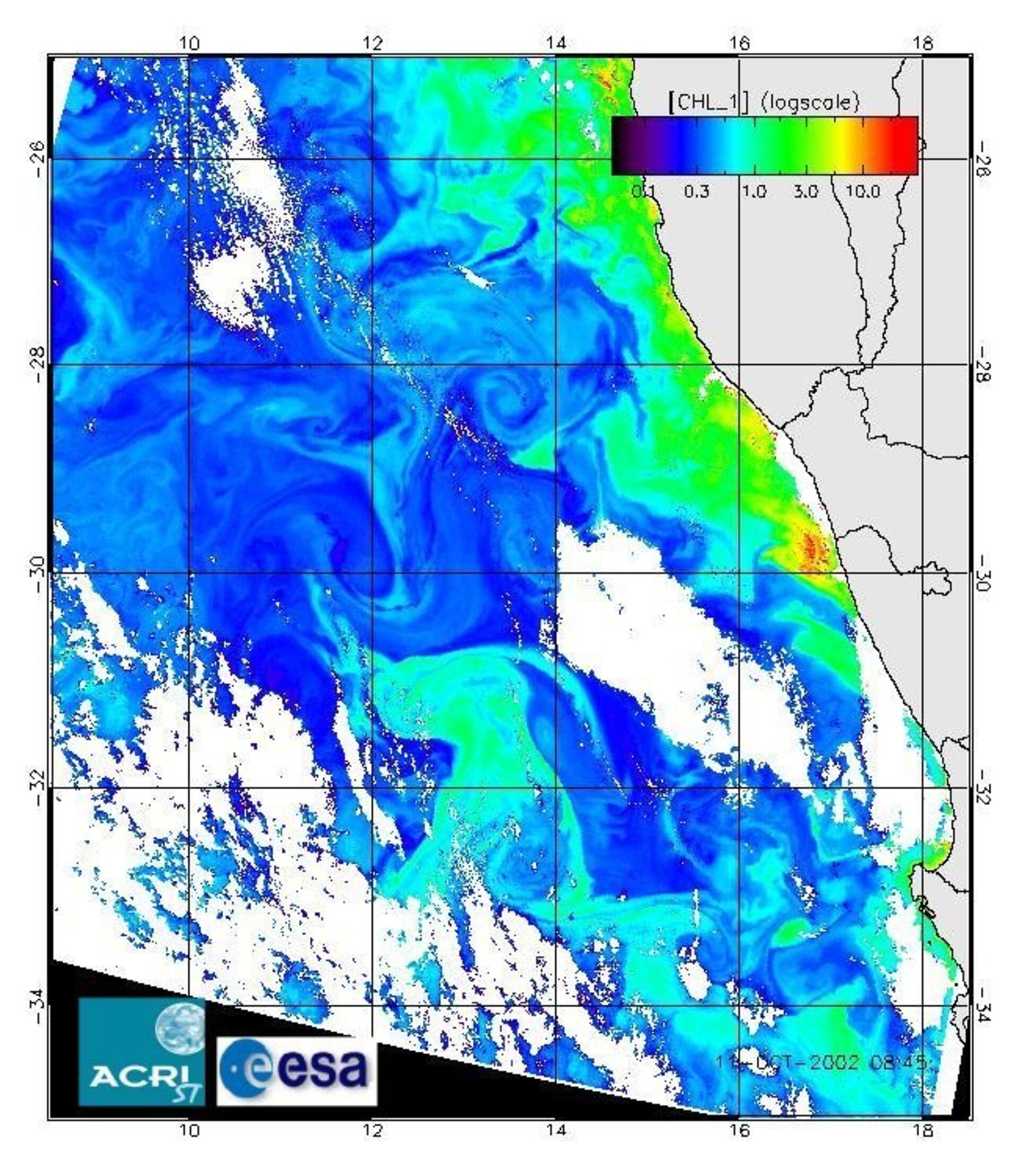
For open ocean data, in October 2002 ESA helped fund the South African Fisheries Research Ship Africana for a two-week cruise along the Benguela Current off the west coast of South Africa, an upwelling of cold nutrient-rich water. Exposed to the hot sun, the waters are able to support an abundant population of individually-microscopic phytoplankton, whose chlorophyll pigments MERIS was designed to see from space.
"The phytoplankton blooms were indirectly visible to us," explained Andre Morel of the French Observatoire Océanolgique de Villefranche, who took part in the validation cruise. "With a high phytoplankton chlorophyll content, oceanic waters are very dark, greenish-brown in colour, whereas they are deep blue when chlorophyll is very low."
"Accurately measuring phytoplankton is important because it determines the primary production of the sea, and all the food chain up to fisheries, and it also regulates the fixation of carbon dioxide by photosynthesis." The latter is a key variable in global warming.
The optical properties of the ocean and phytoplankton populations were measured with surface and submersible instruments. And as with all readings carried out – on sea and land - atmospheric data were also recorded, including surface pressure, local aerosol properties and how light scatters in the air.
Raw MERIS results represent light recorded shining through the top of the atmosphere, but typically what is being sought after is located down at the base of the atmosphere. Indeed the signal received by the sensor when aiming at the ocean is more than 90 per cent derived from the atmosphere, rather than the ocean itself. So the algorithm-based process known as atmospheric correction is crucial to ensure reliable data.
Another algorithm is used to derive atmospheric water vapour content from MERIS data over both land and ocean. To validate this data, tracking GPS signals and other radio-based methods were used – the way radio waves propagate through air changes in the presence of water vapour in such a way it can be used for estimating its amount.
Cloud reflectivity and cloud-top pressure are two more atmospheric products derived from MERIS data. And to validate this, the Freie Universität Berlin (FUB) flew survey planes through clouds in Northern Germany.
MERIS calibration and validation activities will continue throughout the active life of the instrument, but the data already gathered have enabled the validation of the MERIS Level 2 products – announced by ESA last week. To find out more about how to acquire and make use of MERIS and other Envisat data, go to http://envisat.esa.int
