
Proof of a warming world is written on water
The world is heating up and scientists are turning to the Earth's oceans for answers on the magnitude of the temperature increases.
A new ESA-funded office in the UK is co-ordinating international efforts to map global sea surface temperature in unprecedented detail.
The oceans function as vast reservoirs of heat: the top two metres of ocean alone store all the equivalent energy contained in the atmosphere, while the whole of their waters store more than a thousand times this same value.
Because they cover 71% of the Earth's surface the oceans directly absorb the majority of solar heat, storing it for long periods of time by comparison to either the land or atmosphere. In effect, the oceans act as a giant rechargeable battery for the Earth.
It takes a lot of energy and time to shift sea temperature: it is for this reason that oceans can also be termed the 'memory' of the Earth's climate system, and it means that tracking sea surface temperature (SST) over a long period is arguably the most reliable way researchers know of measuring the precise rate at which global temperatures are increasing.
Besides answering this fundamental question, measuring the SST value also improves the accuracy of our climate change models and weather forecasts. Heat energy slowly released from the sea is the dominant driver of atmospheric circulation and weather patterns. SST influences the rate of energy transfer to the atmosphere, as evaporation increases with temperature.
An international endeavour called the Global Ocean Data Assimilation Experiment (GODAE) is intended to develop a range of operational ocean analysis and prediction systems for the world's oceans.
Among the most ambitious is known as the GODAE High Resolution Sea Surface Temperature Pilot Project (GHRSST-PP) and aims to deliver to the user community a new generation of highly accurate worldwide SST products with a space resolution of less than 10 km every six hours.
As an important step towards achieving this goal, ESA has funded a GHRSST International Project Office, located at the Hadley Centre for Climate Prediction and Research, part of the UK Met Office located in new purpose-built offices in Exeter.
Formally inaugurated in March 2004, the GHRSST Project Office is headed by Dr. Craig Donlon.

Achieving a reliable operational system requires the integration of near real time SST data gathered from a variety of different satellites as well as in-situ sources. The two types of data complement one another: a single spacecraft provides wide-area sea views, but its resolution may be limited and the time it takes to revisit the same stretch of ocean is too high.
Instruments aboard ships, drifting buoys and fixed moorings provide continuous data but only across limited areas but all importantly, these data provide a reference to long term climate measurements of SST. The GHRSST-PP will also make good use of the one thousand plus floats that make up the global Argo system, which periodically surface to supply temperature and salinity profiles via telecommunication satellite links. ARGO data will be used to obtain a picture of the top 100-metre temperature structure of the ocean and to compare to GHRSST-PP estimates of the sub-surface water temperature.
Satellite derived SST measurements must be reconciled with the in situ sources in order for them to make a valid contribution to the climate data record and to account for diurnal variability – a particular problem when merging satellite observations obtained at different times within a diurnal period. The GHRSST-PP will integrate these data sets together using the in situ data to derive sensor specific error estimates (SSES) comprising a bias and standard deviation error that are assigned to every satellite measurement.
In addition, each satellite measurement will be accompanied with an estimate of the surface wind speed, aerosol optical depth and time-averaged solar flux data that will provide additional knowledge on the state of the air-sea interface and the reliability of SSES estimates. These combined data sets, called L2P data, will be produced operationally and in near real time to serve the needs of the operational ocean/atmosphere modelling communities.
Every 24 hours, all available L2P satellite data will be analysed together to provide a best estimate of the sub-surface water temperature free of diurnal variability accompanied by estimates of the skin-SST at 2-hourly intervals (important for air-sea interactions).
Under the GHRSST-PP framework, satellite and in-situ data streams will be converted into common international format products on a regional basis by Regional Data Assembly Centres (RDACs). A Global Data Analysis Centre (GDAC) will then analyse these data and produce global coverage products.
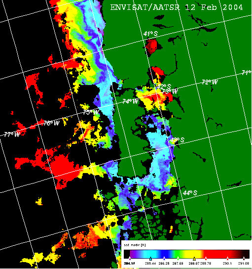
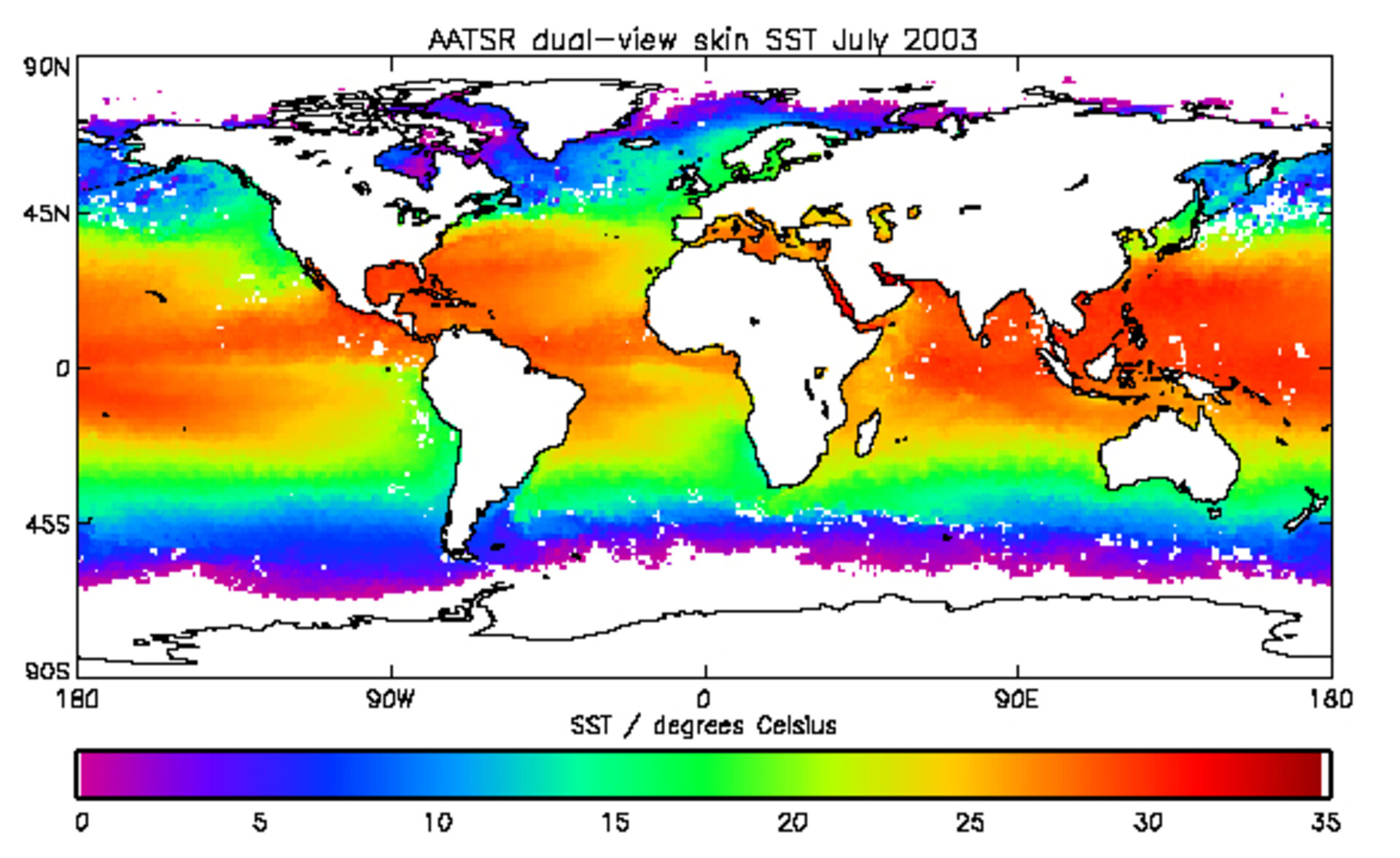
Available space-based sensors include meteorological satellites measuring solar irradiance as well as instruments that directly record SST such as the Advanced Along Track Scanning Radiometer (AATSR) aboard ESA's Envisat, which provides extremely accurate skin-SST measurements. Numerous RDACs are already in existence including an ESA-sponsored project called Medspiration, providing SST data for European waters and the Atlantic.
The GHRSST-PP International Project Office is based at the Hadley Centre for climate prediction and research - part of the UK Met Office - which provides a unique blend of operational ocean and weather prediction and world class research.
The Hadley Centre's climate research programme is funded by the UK Department for Environment, Food and Rural Affairs (Defra), who also funded the development of AATSR in collaboration with the Commonwealth of Australia. In addition Defra funds the AATSR science and validation programmes, in collaboration with ESA.
Over the next three years, the Project Office will coordinate GHRSST-PP activities in the USA, Japan, Australia and Europe including close collaboration with the user operational and scientific user community driving the project forwards.
During the coming months, the GHRSST-PP will start to provide a new vision for a new generation of global coverage high resolution SST data sets designed to capitalise on the enhanced satellite and in situ data available.
