

Roundtable: New radar imaging technologies for Earth observation
The European Space Agency (ESA) is bringing together scientists and researchers from around the world to assess the latest techniques in synthetic aperture radar imaging. They will meet at the ESA POLinSAR 2003 workshop on applications of SAR Polarimetry and Polarimetric Interferometry, which will be held at ESA’s ESRIN facility in Frascati, Italy, 14-16 January 2003.
In advance of that meeting, the ESA Web portal asked two leading radar-imaging specialists to offer their insights on the subject in a roundtable discussion. The two scientists – Dr Shane Cloude of AEL Consultants in the UK and Prof Eric Pottier of the University of Rennes in France -- offered an in-depth look into what promises to be a breakthrough technology in using radar to explore the Earth’s environment.
A brief introduction
Since 1996 Dr Cloude has been director and senior scientist with AEL Consultants, undertaking contract research on a range of problems associated with radar and electromagnetic scattering. He received his BSc degree from the University of Dundee, Scotland, in 1981 and his PhD from the University of Birmingham, England, in 1987.
His main research interests lie in polarisation effects in electromagnetic scattering and their applications in radar and optical remote sensing. He is a Fellow of the IEEE Geoscience and Remote Sensing Society, a Fellow of the Alexander von Humboldt Society in Germany and Honorary Professor at the University of Dundee. He is the author of a book on time domain antennas, 10 contributed book chapters, 20 journal publications and over 75 international conference and workshop papers.
Prof. Eric Pottier is presently the head of the Radar Polarimetry Group of the Antenna, Radar and Telecommunication Laboratory at the University of Rennes 1, France, where he has been a full professor since 1999 and received his MSc in 1987 and PhD in 1990 in signal processing and telecommunications.
His current research and education activities centre on analog electronics, microwave theory and radar imaging with emphasis in radar polarimetry, including radar image processing, polarimetric scattering modelling, supervised/unsupervised polarimetric segmentation and basic theory. He is the coordinator of the research group’s Quantitative Data Inversion of the European Project TMR Radar Polarimetry, and a member of the U.S. Navy Research Interaction program on Wideband Interferometric and Polarimetric Surveillance and Sensing. He has authored five book, 19 papers in refereed journals and more than 120 papers in conference and symposium proceedings.
The two scientists covered a wide variety of topics in the discussion, included what they saw as the general benefits of satellite imagery and the specific impact of synthetic aperture radar polarimetry and polarimetric interferometry techniques, the technology’s potential to improve environmental management, and what they hoped to see come out of the upcoming ESA POLinSAR workshop.

Prof. Pottier, Dr Shane, thank you for agreeing to participate in this. First question: how do you define synthetic-aperture radar polarimetry and polarimetric SAR interferometry?
Dr Cloude: I would say that the development of SAR Polarimetry is as important to radar imaging as colour was to television.
SAR Polarimetry provides three channels of information, which can be used to dramatically improve the quality of images of the Earth’s surface from space.
Polarimetric Interferometric SAR adds 3-D information to this “colour” imaging process, allowing us to view the Earth’s surface in three dimensions with colour relief.
The impact of this on earth observation can best be appreciated by first noting that radar operates day and night and in all types of weather. By then collecting multiple signal returns as the radar platform is in motion, a large equivalent antenna size or aperture can be synthesised using computer-processing techniques and the resulting synthetic aperture radar (SAR) image used to provide high-resolution spatial information. By combining these features we obtain a unique capability to provide images under very difficult circumstances, such as through volcanic clouds or in remote parts of the world, such as the rain forests of South America and Africa.
Prof. Pottier: SAR remote sensing allows us to extract biophysical and geophysical parameters about the Earth's surface without being in contact with it. This is done by sensing scattered electromagnetic fields reflected from Earth surface from an electromagnetic energy source located on either an aircraft or a spacecraft outside of the Earth's atmosphere.
The development of Radar Polarimetry and Radar Interferometry is advancing rapidly, and these novel radar technologies are revamping Synthetic Aperture Radar Imaging decisively.
Radar Polarimetry (a combination of polar, for polarization, and metry, for measure) is the science of acquiring, processing and analysing the polarization state of an electromagnetic field. The polarization information contained in the waves backscattered from a given medium is highly related to its geometrical structure and orientation, as well as to its geophysical properties such as humidity.
Polarimetric interferometry is performed using two polarimetric SAR images acquired from slightly different directions. The study of these data sets permits us to retrieve parts of information related to the 3-D structure of the observed scene, such as topography or a forest biomass.
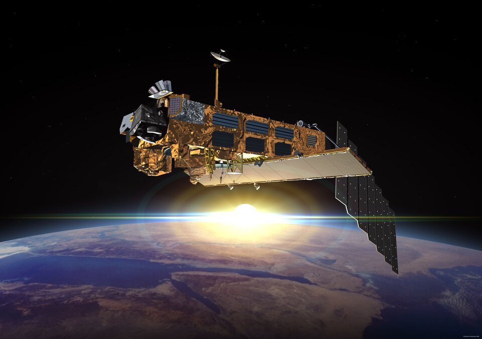
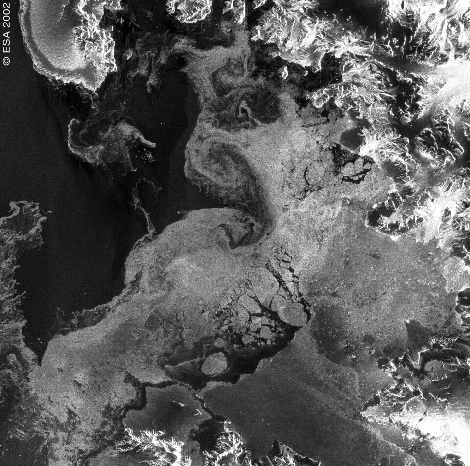
The joint use of polarimetric and interferometric techniques permits us to characterize accurately the different kinds of natural media. New polarimetric radar sensors, such as RADARSAT-2 and ALOS-PALSAR, will provide such information. The recently launched ENVISAT ASAR is providing simultaneous dual polaristion capability as a forerunner of fully polarimetric radars.
What are the benefits to the public of these technologies?
Prof. Pottier: The accelerated advancement of POLinSAR techniques is directly relevant to, and a priority for, local-to-global environmental ground-truth measurement and validation, stress assessment, and stress-change monitoring of the terrestrial and planetary covers. POLinSAR remote sensing offers an efficient and reliable means of collecting the information required to extract biophysical and geophysical parameters about the Earth's surface. It has found successful application in crop monitoring and damage assessment, in forest maps of clear-cut areas, deforestation and burn mapping, in land surface structure (geology) land cover (biomass) and land use, in hydrology (soil moisture, flood delineation), in sea ice monitoring, and for oceans and coastal monitoring (oil spills).
Dr Cloude: I think there are two key levels of impact of this new technology: short and long term. In the short term for example, improved disaster relief will be provided through more complete imaging of both natural and man-made catastrophes, such as flooding, mudslides and volcanic activity. Optical technologies are limited in their ability to provide such information, as they are often hindered by bad weather and clouds around the disaster zone.
In the long term, this technology has the potential to provide, for the first time, global 3-D vegetation maps of our planet, including the vast hitherto unmapped regions of tropical and boreal forests. This information will be vital in the on-going climate change debate and assist politicians and NGOs in planning strategies for combating global warming through international monitoring and carbon sequestration.
What are the potential benefits of the POLinSAR workshop and related research to the scientific and technical communities? Why is this workshop important?
Dr Cloude: This is the first time that experts in both Polarimetry and Interferometry will be together to discuss the latest developments and to highlight future strategy for research in what is a totally new subject, formed as a synthesis of the other two, and called POLinSAR or Polarimetric Interferometric SAR.
Prof. Pottier: The POLinSAR workshop will be a unique occasion to evaluate the actual advances in POLinSAR remote sensing. It will bring together people who have developed different POLinSAR approaches and techniques. The discussions will permit us to synthesize the potential usefulness of polarimetric and interferometric measurements for many kinds of applications.
In what ways could this workshop, along with the subjects that will be discussed, help deliver the message that Earth observation programmes are worthwhile and deliver tangible benefits?
Prof. Pottier: The potential benefits of this research mainly concern Earth environmental applications. The type of data acquisition from a POLinSAR sensor permits large-scale observations of geo and biophysical properties of natural environment.
Radar images are still difficult to analyse compared to optical images or photography. However, the workshop will provide a forum to present POLinSAR remote sensing techniques that complement classic remote sensing techniques used in previous Earth observation programmes. These include optical, infrared or ultraviolet, spectrometer, scanner, radiometer, spectrometer, thermometer, altimeter, laser and profilometer.
Dr Cloude: This workshop will largely be concerned with the development of new methods for estimating the vertical structure and properties of vegetated surfaces on local and global scales. This in itself is a key ecosystem factor that reflects biomass, growth dynamics and biodiversity. Parameters such as tree height, crown width, canopy density and the underlying ground topography are direct inputs into biomass determination models that enable the modelling of ecological processes, forest inventories and predictive modelling in hydrology.
Further, global forest inventory and forest (above ground) biomass are critical missing parts in the current global debate on climate change. There is a need for a reliable remote-sensing technique to provide such information.
POLinSAR is well suited to tackle this problem since it provides sensitivity to both volume and surface effects. With its 3-D imaging capabilities, it also can provide high-resolution spatial maps of vegetation cover.
What are the implications of this research on environmental management?
Dr Cloude: The conventional approach to biomass estimation with single-channel radar has been based on empirical regression relationships between radar backscatter amplitude and biomass. In general backscatter amplitude increases as biomass increases.
Unfortunately this relationship fails at the so-called saturation point, when further increase in biomass causes no change in the signal level. Importantly, this saturation occurs at levels well below those required for global monitoring. Although the saturation point increases with decreasing radar frequency, the range of biomass levels accessible at commonly used radar frequencies is limited. At C-band for example, the saturation occurs around 20 tons/hectare and even at the much lower frequency of P-band saturation occurs at around 120 tons/ha. It is estimated that approximately 40% of the world’s vegetated surface containing nearly 80% of the above ground biomass are therefore above the saturation level, even of P-band.
On the other hand, initial studies of POLinSAR have shown that reliable estimates of biomass up to 250 tons/ha become feasible. If species information is added to this, the saturation point rises to around 400 tons/ha. Even at the lower limit, this would then enable mapping of 70% of the world’s vegetated surface, containing 80% of the total biomass.
For this reason, POLinSAR offers great potential in global biomass applications. It can therefore play a vital role in the development, monitoring and enforcement of environmental management policies.
Prof. Pottier: Polarimetry deals with the full vector nature of polarized electromagnetic waves -- when the wave passes through a medium of changing index of refraction, or when it strikes an object or a scattering surface and it is reflected. Then, characteristic information about the reflectivity, shape and orientation of the reflecting body can be obtained by polarization processing.
There is currently a great deal of growing interest in the use of polarimetry for radar remote sensing and wave polarization. It is of fundamental importance in the information retrieval problem of microwave imaging and inverse scattering.
Radar polarimetry offers considerable improvements over standard, amplitude-only polarization radar, including better and more detailed information about the texture, structure, shape, symmetries and constituent materials of the Earth’s surface. With radar interferometry, the spatial structure of the Earth’s surface can be explored as well.
Combining polarimetric and interferometric SAR techniques (POLinSAR) it is now possible to recover such co-registered textural plus spatial properties simultaneously.
The POLinSAR workshop is devoted to showing how, and why, it is very important to be concerned with the exploitation of electromagnetic wave polarization for the enhanced detection, classification and imaging of structures and natural environments.
Again, thank you both for agreeing to share your thoughts in this discussion. See you at the workshop.
For more information on the ESA POLinSAR 2003 workshop on applications of SAR Polarimetry and Polarimetric Interferometry, ESA’s ESRIN facility, Frascati, Italy, 14-16 January 2003, contact:
Yves-Louis Desnos
Workshop Organiser
ESA/ESRIN, Directorate of Earth Observation Programmes
E-mail: Yves-Louis.Desnos@esa.int
Veronica Arpaia
Workshop Coordinator
ESA/ESRIN
E-mail: envmail@esa.int
Tel: +39-06-180 605
Fax: +39-06-94 180 552
