Data products
The following SMOS data product definitions are based on the CEOS (Committee on Earth Observation Satellites) conventions and have been specifically tailored to the SMOS mission.
Raw data
These are SMOS data in their original format (CCSDS packets) comprised of instrument observation data and housekeeping telemetry, as received from the satellite.
Level-0
These are SMOS data in source packets with added Earth Explorer product headers. They are chronologically sorted by source packet type: observation data and housekeeping telemetry.
Level-1A
These are the SMOS reformatted and calibrated observation and housekeeping data in engineering units. Level-1A products are physically consolidated in pole-to-pole time-based segments. Scientific SMOS Level-1A products are 'calibrated visibilities'.
Level-1B
These products are the output of the image reconstruction from SMOS observations and consist of Fourier components of brightness temperatures in the antenna polarisation reference frame.
Level-1C
Since Level-1B products are arranged as snapshots and not geographically sorted, SMOS Level-1C products constitute reprocessed Level-1B, which are geographically sorted, that is swath-based maps of brightness Temperature.
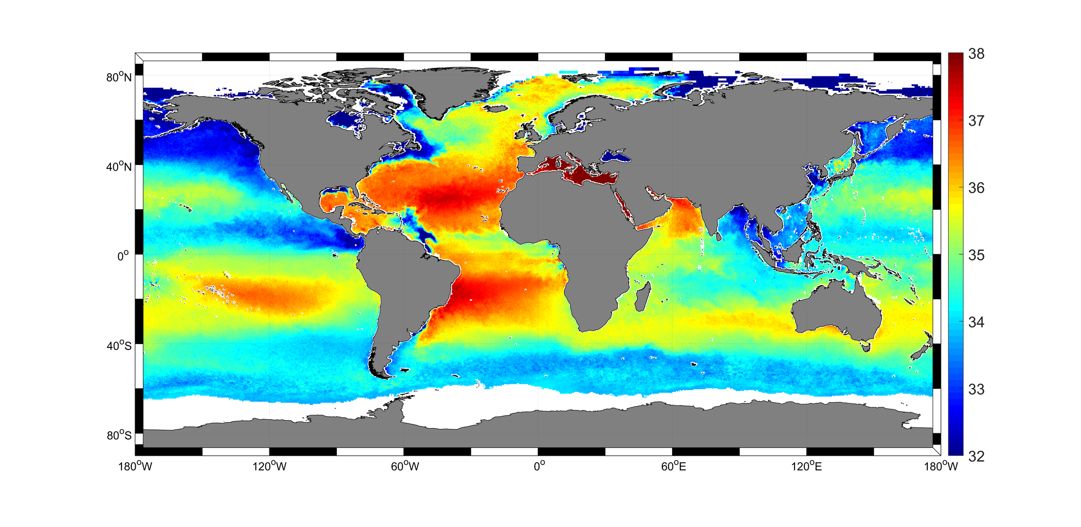
Level-2
There are two types of Level-2 products:
- Soil moisture swath-based maps
- Ocean salinity swath-based maps
Global maps using Level-3 data are produced in the next processing step.
More information about accessing data from the SMOS mission is available on ESA’s Earth online website.