SMOS offers new perspective on hurricanes
With recent stories in the news about the devastation brought by hurricanes and typhoons to the US and Asia, we are reminded of how important it is to predict the paths of these mighty storms and also learn more about how they develop. Many satellites have eyes on storms, but ESA’s SMOS mission can offer an entirely new perspective.
Tracking and forecasting hurricanes across the ocean brings obvious benefits to those at sea and to those who live in places where they make landfall. While forecasters have excellent tools to hand to make these predictions, ESA’s Soil Moisture and Ocean Salinity (SMOS) mission is now ready to add valuable information to help make these predictions even more accurate.
SMOS was built for scientific research, mainly into Earth’s water cycle. The satellite carries a novel microwave sensor to capture images of ‘brightness temperature’. These images correspond to radiation emitted from Earth’s surface, which are then used to collect information on soil moisture and ocean salinity.
Strong winds over oceans whip up waves and whitecaps, which in turn affect the microwave radiation from the surface. This means that although strong storms make it difficult to measure salinity, the changes in radiation can, however, be linked directly to the strength of the wind over the sea.

The mission has a real advantage over satellites that carry optical images, which cannot see though the thick cloud of a hurricane, for example. Effectively, seeing through the storm, SMOS can deliver unique information on the speed of the wind near the sea surface at the base of the storm.
While scientists have known how SMOS can do this for a few years now, the mission is now being tested to see if it can supply this information for operational hurricane services.
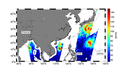
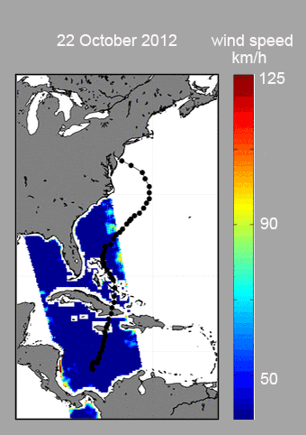
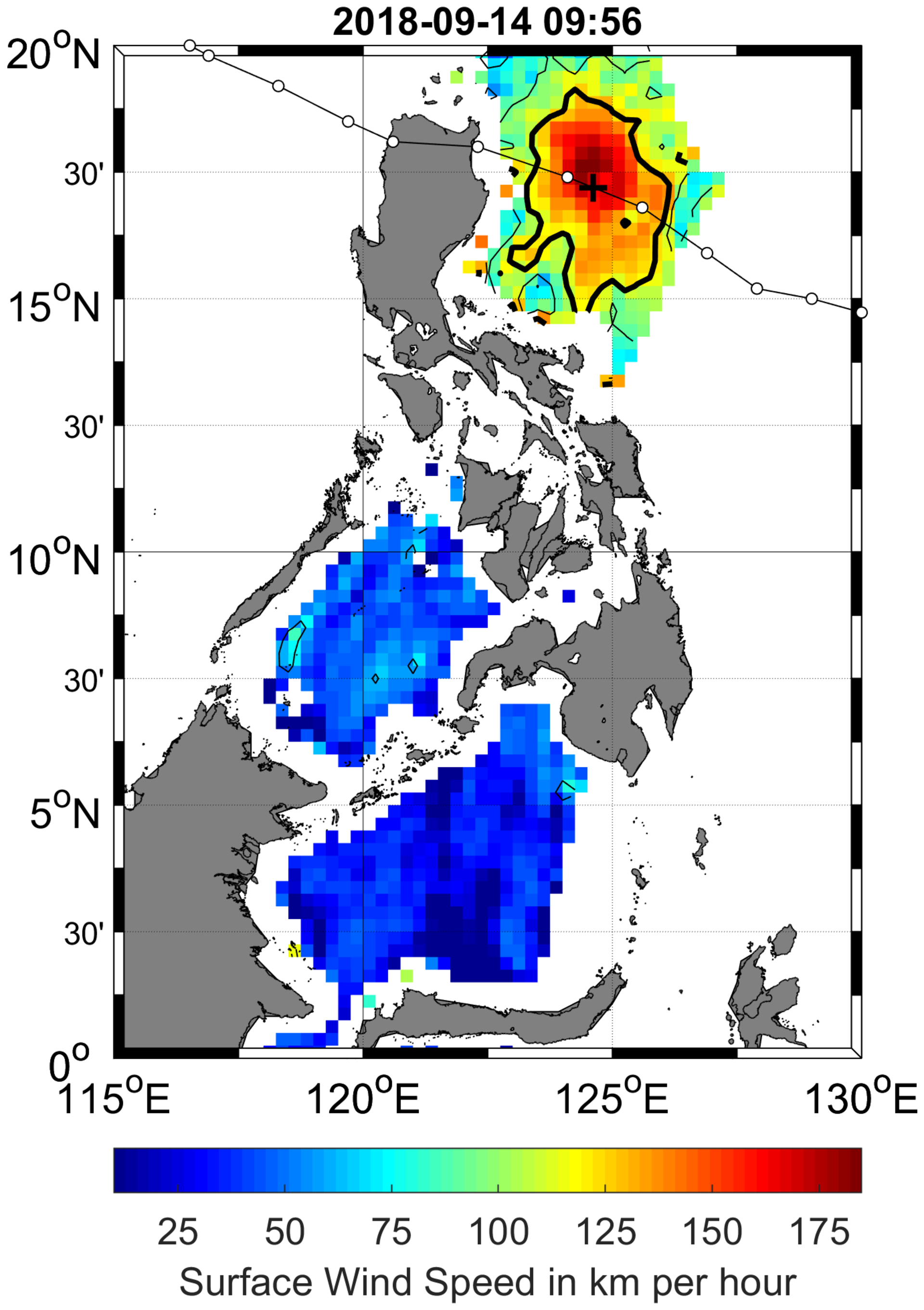
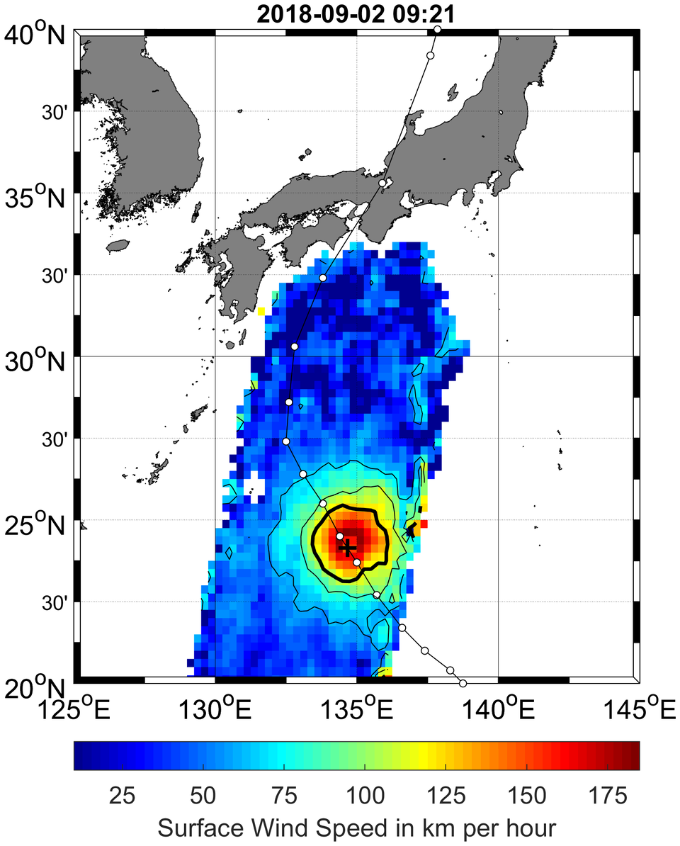
Recently, SMOS has been used to image and track the wind under Hurricane Florence, Typhoon Mangkhut and Typhoon Jebi.
Buck Sampson from the US Naval Research Laboratory said, “ESA’s SMOS mission can give us really interesting new information for operational storm forecasting, which we hope to use along with our traditional sources of data.
“SMOS measurements can help us keep track of the structure of a dangerous storm. Combining SMOS data with that from its US counterpart SMAP mission, will give us more timely information which is essential for monitoring major storms.”
Susanne Mecklenburg, ESA’s SMOS mission manager, added, “While SMOS is still delivering important information to further our scientific understanding of Earth, it will be really exciting to see it being used for practical applications once this testing phase finishes at the end of the year.
“Every year, hurricanes bring misery to many people around the world, so the hope is that SMOS will be useful to make better predictions, and ultimately help decision-makers with their damage mitigation strategies.”