
Scatterometers, sea ice and climate change
Whether our climate is changing quicker than expected and if so why, are two of the most important and controversial questions facing environmental experts. The use of scatterometers to monitor sea ice may provide some of the evidence needed to resolve these problems.
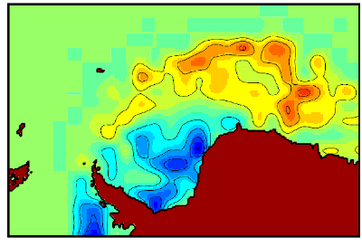
Scatterometers measure the reflection or scattering effect produced by scanning the surface of the Earth with specially designed microwave radars. As the energy pulses hit the surface of the ocean a scattering effect occurs, known as backscatter, with rough surfaces producing stronger signals than smooth surfaces. Measuring the amount of backscatter provides data on wind speed and direction.
Data provided by scatterometers has been used for many years for weather and wave forecasting. More recently it has been used to study unusual weather phenomena such as El Niño, the long-term effects of deforestation and changes in sea-ice masses around the poles. All of which play a central role in regulating global climate.
Mark Drinkwater, Head of ESA’s Oceans/Sea-Ice Unit, is now working on the use of scatterometers to understand the connection between changes in polar sea ice and climate changes at the equator. Scatterometers are proving to be an extremely useful tool in this research.

Sea ice forms when temperatures of below -2°C cause surface water to freeze. Wind and currents then break the pack ice up into individual ice floes separated by narrow strips of open water. Although sea ice is relatively thin - in general less than 5 m thick - it is a good isolator for heat loss from the ocean. As such it plays a central role in polar climate as its thickness determines the degree to which the winter polar atmosphere will benefit from heat stored in the ocean the previous summer.
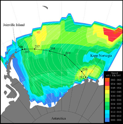
Data from scatterometers and other instruments aboard ESA’s Earth remote sensing satellite, ERS-2, as well as from NASA satellites, allow scientists to calculate the size, thickness and flow of sea ice, and to monitor its movement towards the equator.
Ice increases or decreases in thickness as a result of stronger or weaker winds blowing towards the equator. As the ice is drawn away from the coast of Antarctica by wind and currents, more vigorous ice growth occurs in the areas of open water left behind.
The flow of sea ice determines the amount of salt and heat in the polar oceans, which in turn effects global thermohaline circulation, that is, the ‘conveyor belt’ effect which, in the southern hemisphere, carries cold water northwards to the equator and warm water southwards towards the Antarctic. As the warm water cools, large quantities of heat are released to the atmosphere and this has an effect on climate.
Findings to date show that the transport of sea ice by gyres - the pattern of rings of current circulating in the open oceans - speeds up or slows down in response to climate variations in equatorial regions. Also that abnormalities in the flow and ice thickness correspond with the effect that El Niño has on the atmosphere and the oceans.
The role of El Niño in polar atmospheric circulation patterns is well known, as is the fact that surface currents play an important role in moderating our climate by warming cool regions and cooling hot ones. Therefore, the use of scatterometers to comprehend the connection between sea-ice variability and changes in equatorial climate can help to increase understanding of the reasons for climate change and the extent to which these are affected by man.
New developments at ESA should further increase understanding of this phenomenon. CryoSat, the first Earth Explorer Opportunity Mission in ESA’s Living Planet Programme, will come into operation within the next decade. One of CryoSat’s main priorities is to measure ice thickness in the polar oceans using an altimeter technique, developed on the basis of results obtained from ERS-1 and ERS-2.
The data that CryoSat will make available, together with continuing scatterometer data from ERS-2 and later Metop, offer exciting prospects for research into the role of sea ice in global climate changes. Mark Drinkwater explains, “With Earth Explorer missions on their way, such as CryoSat, we will find other sensors directed specifically at polar regions over the course of the years to address the impact of climate change in polar regions.”

