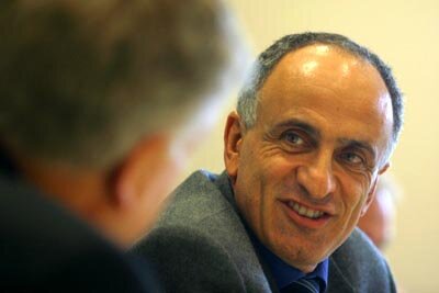
Space can help Europe go a long way: interview with José Achache
In an interview adapted from ESA Today, a staff publication for the European Space Agency, José Achache, Director of Earth Observation Programmes for the European Space Agency, discusses developments in his Directorate and explains how society can further benefit from EO services.
What were the main changes in your Directorate in 2002?
José Achache: The changes are the adoption of a new strategy giving greater recognition to the needs of Earth Observation users and a new organisation that will enable us to offer better services to our various partners.
All of this had a single goal: to increase the number, size and satisfaction level of our beneficiary communities in the space sector.
What has been the impact of the reorganisation of the Directorate?
JA: Regarding our new organisation, we were seeking improvement in four areas: cooperation and coordination between departments, preparation for missions, post-mission analysis and coherence between analysis of current missions and definition of future missions.
Overall, the new organisation is user-oriented. It aims to guarantee maximum coherence and provide for efficient coordination between teams. We have put considerable effort and care into identifying the interfaces and the sharing of responsibilities between the various departments.
The keywords that sum up this organisation are: 'coordination, coherence, complementarity and customer service.' The sharing of work seems to be bearing fruit already. I believe our teams are now working more coherently than they could in the past.
What do you expect from the latest Earth observation missions and what are your plans for later on?
JA: We’ll be concentrating on two main areas – science and services. We must continue to push ahead with our knowledge of the Earth with the aid of ERS-2 and Envisat, and the Explorer missions included in the Programme Envelope.
At the moment our activities cover five main disciplines:
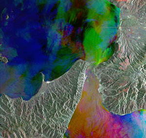
Internal geophysics: studies of the gravitational field, initiated by DLR’s Champ mission and the Grace mission (DLR/NASA), will be complemented from 2006 by the GOCE Mission (Gravity and Ocean Circulation Explorer); study of tectonic deformations with SAR (Synthetic Aperture Radar) interferometry using ESA’s ERS-2 and Envisat, and Canada’s Radarsat.
Oceanography: studies of the dynamic topography of the oceans with the radar altimeters of ERS-2 and Envisat, in cooperation with the CNES/NASA Topex-Poseidon and Jason missions; study of chlorophylien activity with Envisat’s MERIS (MEdium Resolution Imaging Spectrometer) with its water colour component; and finally studies of surface temperatures with the AATSR (Advanced Along Track Scanning Radiometer), also on Envisat.
Atmospheric chemistry: Envisat carries three instruments for this: Global Ozone Monitoring by Occultation of Stars (GOMOS), Michelson Interferometer for Passive Atmospheric Sounding (MIPAS) and Scanning Imaging Absorption Spectrometer for Atmospheric CHartographY (SCIAMACHY). We also have the GOME instrument (Global Ozone Monitoring Experiment) on ERS-2. Europe has gained a significant technical advantage in this area that we must exploit and preserve.
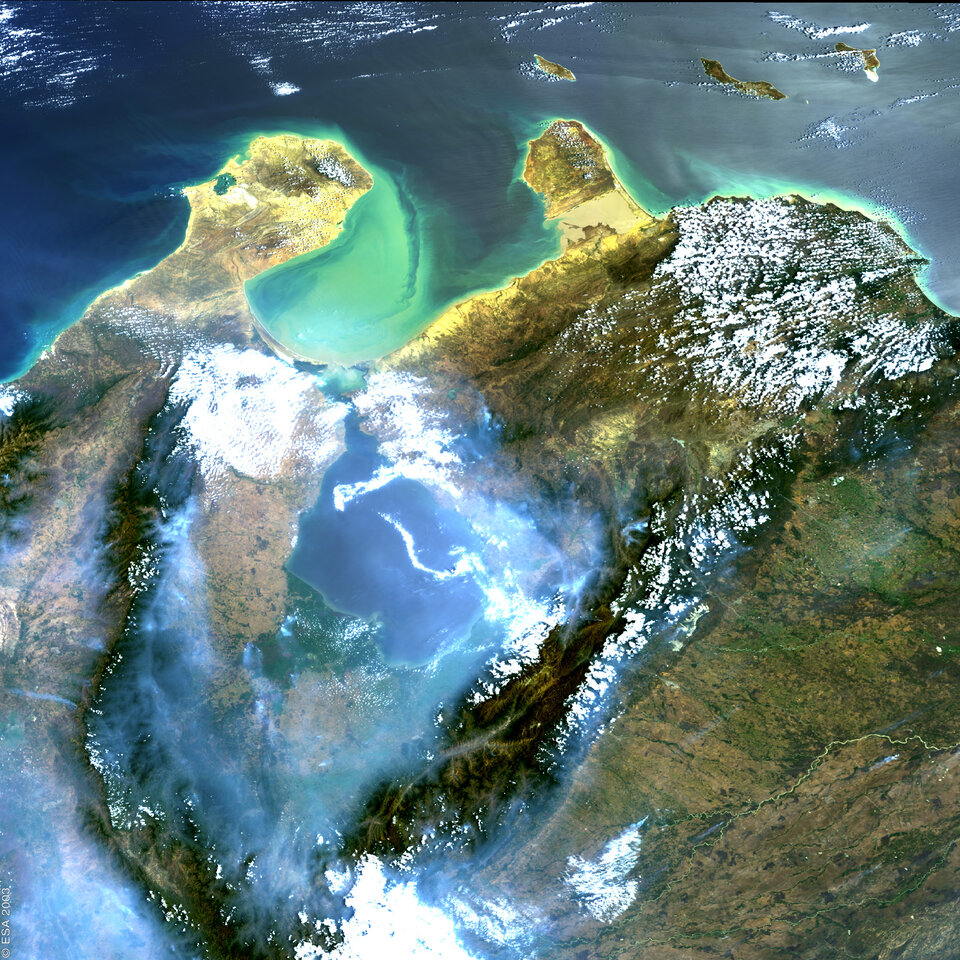
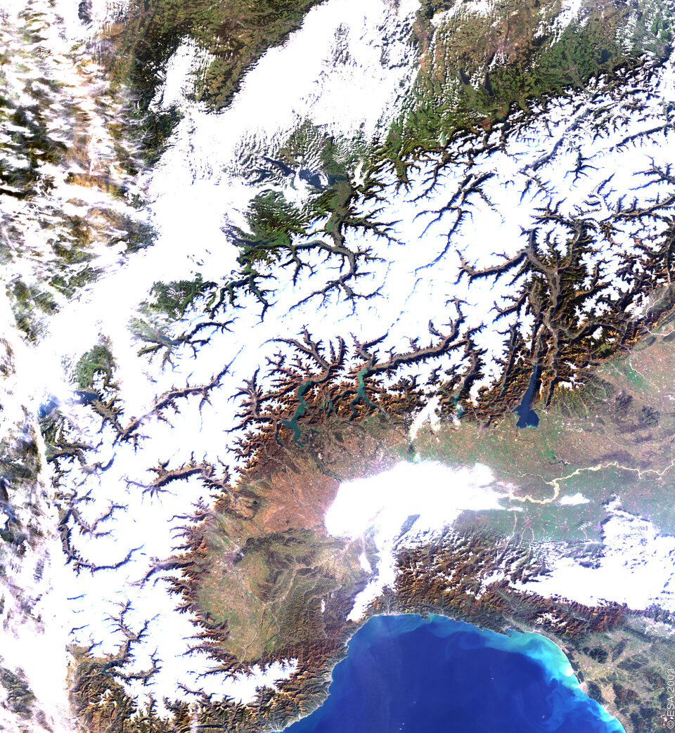
Study of polar ice deposits: the Synthetic Aperture Radars (SAR) and the altimeters of ERS and Envisat, and the CryoSat mission scheduled for launch in 2004, are the strengths which will enable Europe to hold a strong position in this field, essential for understanding the dynamics of our climate.
- Study of continental surfaces and the water cycle: the use of radar altimeter to study river water levels and hence continental hydrographic networks will be used in conjunction with the Grace mission (DLR/NASA). The SMOS (Soil Moisture and Ocean Salinity) mission on soil humidity will also be absolutely essential, as will the Digital Terrain Models calculated by interferometry.
In all these five fields, Europe has an extremely strong scientific community and has succeeded in structuring a balanced observation programme.
How will Earth Observation be affected by the next Ministerial Council (the meeting of ministerial-level representatives from ESA’s member states)?
JA: The subject that touches Earth Observation most closely is the coordination of ESA with the European Union and the joint European Strategy for Space, especially regarding GMES (the Global Monitoring for Environment and Security programme).
The aim of GMES is to set up infrastructures and services for governments, administrations and municipal authorities. Specifically, it will cover the forecasting and management of natural risks, management of resources, monitoring and implementing major international agreements (Montreal for ozone, Kyoto for greenhouse gases), biodiversity, management of humid zones and rural areas, conservation of the national heritage, humanitarian aid and external relations. In short, everything that relates to Europe’s major political initiatives or the management of European administrative bodies. This programme will therefore require a significant involvement of several DGs of the European Commission.
We are working just as energetically to develop services for civilians and commercial activities associated with space and Earth Observation. The development of services for the general public, the main concern of GMES, and the development of commercial services must be conducted in parallel. Since the same mechanisms, methods and developmental steps are needed for both, what we do in one area will benefit the other.
We definitely need to demonstrate the kind of services that space can offer society. It will be on the basis of these services that Ministers will be willing to give political support to the space sector. But to reach this point, we believe that changes will be necessary in the current policy regarding data distribution and in the technical means of access to space information. That’s the objective of the Oxygen(O2) project which was presented at the last Council.
What changes are you talking about?
JA: We are currently analysing the factors that are holding back the development of services. One of the main reasons is the policy regarding access to data. Many space-related data are only available at a very high price, which obviously puts a brake on development of both market and applications. Besides, for technical reasons, it is not easy to obtain images and processing is complex. We are trying to introduce changes in data commercialisation policy and improve distribution mechanisms and image processing tools. These are all essential conditions for the development of commercial applications.
You are clearly committed to the idea that ESA should contribute to initiatives for sustainable development in developing countries: what concrete progress can we expect?
JA: To improve water management, we are currently preparing a vast programme in Africa – the Tiger Programme. To improve the monitoring of desertification and agricultural resources management, we are working with China on a programme covering rice, forests and water – the Dragon Programme. Finally, space could have an important role in tele-epidemiology, that is, the monitoring and forecasting of epidemics.
We can see that there’s a strong link between environmental changes and the reappearance of certain diseases transmitted by carriers: haemorrhagic fevers, malaria, meningitis, and cholera. One consequence of climatic warming is a redistribution of the ecological development zones for these carriers. The re-emergence of malaria, transmitted by the mosquito, is associated with changes in the distribution of humid zones. As for the increase in meningitis epidemics, this is linked to aerosols which, in turn, are linked to desertification and wind patterns.
In the case of cholera, the cholera vibrio develops extensively in coastal phytoplankton which is monitored by the MERIS instrument on Envisat.
Space will enable us to go a long way in health monitoring and predicting epidemics and I believe this to be a priority area that is essential to develop.
How do you see the future in terms of coordination with the network of technical centres and cooperation with industry?
JA: Very busy, extremely dynamic! We have plenty of work to do! Developing all this represents an enormous workload. We need to increase efficiency and aim for greater coordination between national and European expertise.
We need to introduce better coordination between national Earth Observation programmes and our own programmes. France with Pléiades, Italy with Cosmo-Skymed, Germany with TerraSAR, along with France’s Spot and Canada’s Radarsat, are currently involved in programmes that are in competition with each other. Taken individually, it is difficult to demonstrate their viability, but if we are capable of creating a greater synergy between all these systems and can make them interoperable, they could certainly provide important services and lead to major advances.
We must create greater transparency for all these systems. The user wants information and services. He is not in the least concerned about the satellite that acquired the images. We need to move towards a sort of space systems cooperative.
As for industry, we can’t get anywhere without it. Naturally, we must continue to cooperate. The sector that has been pushed aside for the moment is services. ESA should aim to achieve with the service industry what it has achieved over the past 20 years with the space manufacturing industry.
We’d like to thank you for your very interesting comments. We will be following the progress of the Earth Observation Directorate teams very closely.