Tackling drought issues for food security
This summer’s drought is a harsh reminder of how unusual weather can cause havoc for farmers – even in a rich part of the world like Western Europe. While there is a wealth of satellite data available to help predict the risk of drought, it can be daunting for a non-expert to handle. ESA’s Food Security Thematic Exploitation Platform makes this task much easier.
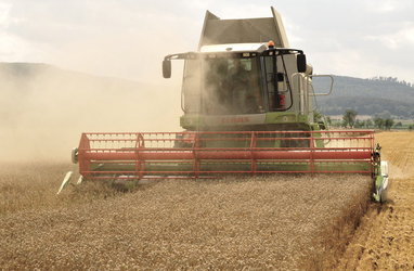
‘German grain yield tumbles in the heat’ and ‘Record drought grips Germany’s breadbasket’ were just a couple of the headlines to hit the news in the summer. Now, the first assessments for Germany’s winter wheat reveal that yield is down by 35%, making this year’s harvest the lowest in 15 years.
As climate change takes a grip, extreme weather events – not just heatwaves, but also storms and cold – are likely to become more frequent and more severe.
There are already several initiatives, such as Europe’s Monitoring Agricultural Resources, that use Earth observation satellite data to monitor crops over large areas and serve as good indicators for governments to predict when drought-stricken regions may need help.

These initiatives use medium-resolution data that are averaged over large regions, and are usually intended for governments to use.
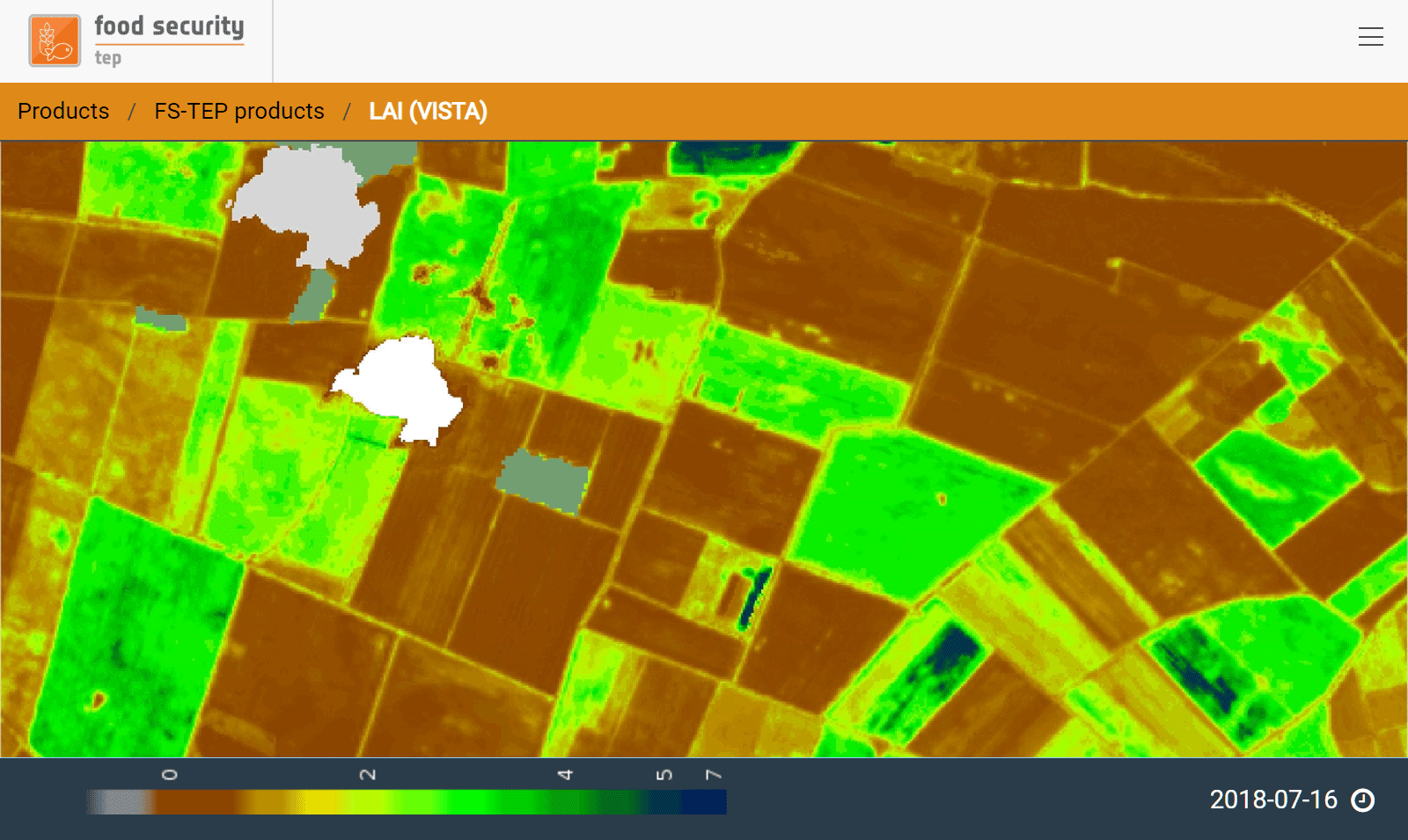
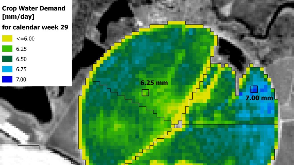
Thanks to the EC’s Copernicus programme and the Copernicus Sentinel-2 satellites, a continuous stream of high-resolution data to monitor individual fields and even to show differences within one field. The mission delivers new data over the same place every three to five days, this short revisit time is essential for monitoring change in the growing season.
Nevertheless, a delivery of over 1 TB of data a day gives rise to some significant challenges as the data have to be downloaded, stored and processed with specialised software.
This is where ESA’s Food Security Thematic Exploitation Platform (TEP) comes in.
It puts the relevant satellite data, tools, algorithms and other information in one place so that individual users – be that farmers, agricultural advisors and others involved in agricultural business – can see exactly how their crops are doing.
So far, farmers in Germany, Belgium, Netherlands and Zambia use Food Security TEP services to monitor plant growth.
The VISTA and VITO service providers calculate several different crop variables that indicate current growth and ‘greenness’ of plants. Platform users can view this information on the platform as well as use further calculations to understand crop biomass and ripeness.
In turn, this information can help to take appropriate action to mitigate drought-related issues.
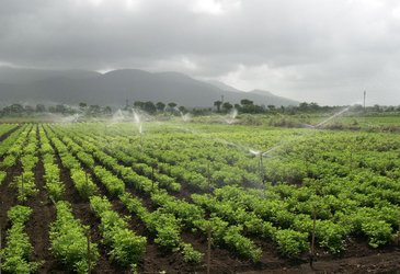
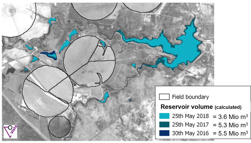
In Zambia, for example, the platform has helped farmers in a drought-prone part of the country. Here, during the dry season, a surface reservoir is used for much-needed irrigation. The last few years, however, have been exceptionally dry and water levels have fallen.
The Zambian farmers along with their agricultural advisor BayWa and the VISTA remote-sensing service provider have started to use Copernicus Sentinel-2 data to work out how much irrigation is needed.
This has saved them up to 1750 cubic metres of water for one pivot and in one day of irrigation alone, helping to stabilise the vulnerable water resource.
With food security a major concern around the world, this one example shows how managing irrigation through ESA’s Food Security TEP is not only saves valuable water but also helps optimise crop yield and, importantly, helping local food production in Africa – all this without the farmer having to download any satellite data at all.