Envisat data validation set to continue
Since its launch in 2002, Envisat has been delivering a wealth of information about how our Earth system works, as well as insights into factors contributing to climate change. To ensure that the data from the ten sophisticated radar and optical instruments on board are correct, the launch was followed by an intense period of activities relating to validation. This phase of validation is now slowly coming to an end. However, this year ESA initiated several new projects in order to secure the more long-term validation of Envisat's instruments.
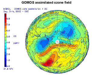
The Envisat Quality Assessment with Lidar (EQUAL) project is one such enterprise, and focuses on one of the main products - the measurements of ozone profiles - from all three atmospheric chemistry instruments called GOMOS (Global ozone monitoring by occultation of stars), MIPAS (Michelson interferometer for passive atmospheric sounding) and SCIAMACHY Scanning Imaging Absorption Spectrometer for Atmospheric Cartography). In addition, this project will incorporate the analysis of temperature profiles from the same instruments.

Correlative observations for this project will come from lidar systems. A lidar is similar to the more familiar radar but transmits and receives light instead of radio waves. A lidar works by emitting powerful light pulses from a laser through the atmosphere. As the light pulse travels through the air it interacts with molecules of gas, particles of dust and droplets of water. Lasers operating in the ultraviolet are used to emit light at two different wavelengths (usually around 308 and 353 nm). The differential absorption effects of ozone gas at these two wavelengths can be exploited to derive ozone profiles between altitudes of 10-50 km and with a vertical resolution of 1-4 km. Some of the light travelling through the atmosphere encounters different molecules and particles and is 'scattered' in all directions, some of which is scattered back towards the lidar – so-called 'backscattered light'. Since the backscattered light is proportional to the density of the air, these observations can also be used to derive temperature profiles.

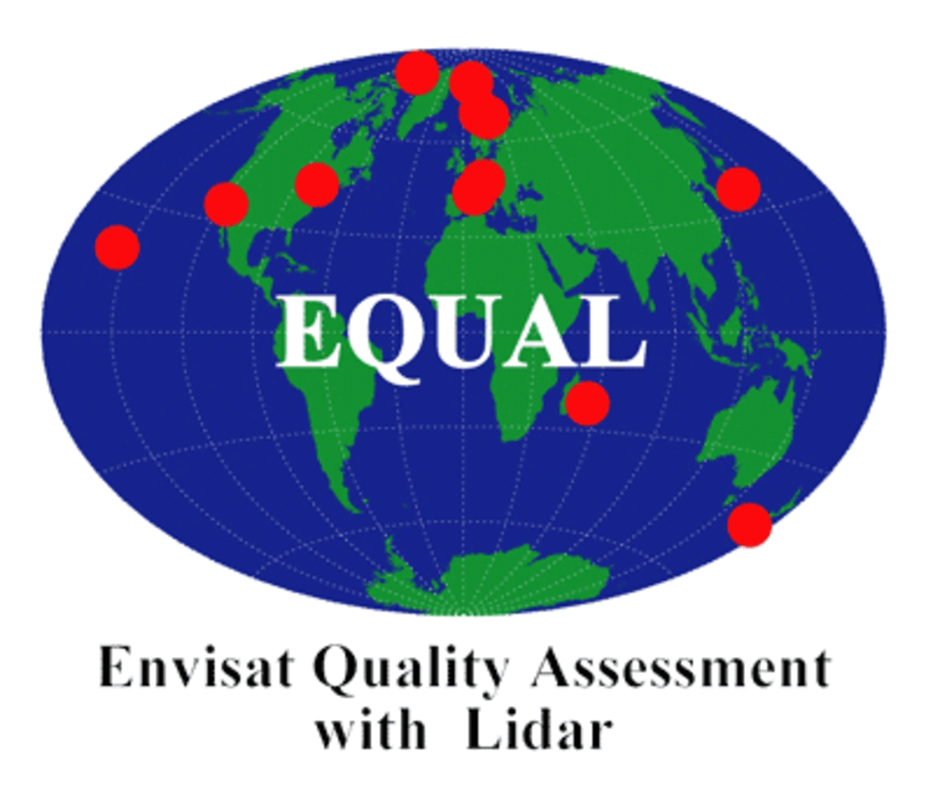
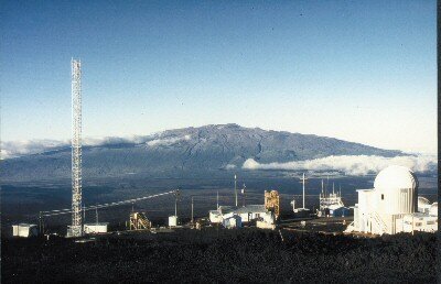
Around the world eleven Differential Absorption Lidar (DIAL) systems currently sample the vertical distribution of ozone with high-energy optical pulses. In addition to these DIAL systems, dedicated temperature (and aerosol) lidars operating at 532 (and 355) nm contribute to the EQUAL project. Most of these systems are operated manually and generally during the night. They and are located far afield such as in the snow- and ice-covered Arctic, on the top of a volcano in Hawaii and as far south as New Zealand.
A dedicated validation database, maintained by the Norwegian Institute for Air Research NILU, is the central archive to which these correlative measurements are uploaded. In 2003, over 800 profiles were added to the central database and it is expected that more data will still become available for that year. From the profiles measured in 2004, over 600 files have already been processed and made available to a wider group of validation scientists.
Assessment studies are also being carried out within the EQUAL project. Initially, the focus has been on the quality of the ozone profiles obtained from the GOMOS instrument. These data have been subjected to extensive analysis and recently led to a publication in the Journal of Geophysical Research. Shortly the ozone and temperature data from the other two instruments will also be incorporated in the study. These studies are performed in close interaction with ESA's dedicated Quality Working Groups. The direct interaction with the scientists specialising in the instruments, together with the continuous quality of relatively high-resolution reference data are some of the main strengths of this project.
In addition to the EQUAL project, another activity called TASTE (Technical Assistance to Envisat Validation by Soundings, Spectrometers and Radiometers) is also being carried out to further meet long-term validation objectives for the three atmospheric instruments carried on Envisat. This involves making correlative measurements of ozone as well as other atmospheric gases using spectrometers, radiometers and ozone-sondes from ground-based and balloon-borne instruments.
The EQUAL and TASTE projects mark an important step in confirming that the data on atmospheric chemistry we receive from Envisat is as accurate as possible so that we can significantly further our understanding of the Earth's atmosphere.