MERIS chlorophyll data proves positive
Scientists have, for the first time, devised and tested a method for correlating spaceborne data derived from Envisat's MERIS instrument on the amount of chlorophyll present in terrestrial vegetation with actual chlorophyll measured in field experiments. Positive correlations further confirm that MERIS is providing an accurate picture of the health our planet.
Chlorophyll is the green photosynthetic compound in plants that captures energy from sunlight necessary for photosynthesis. The amount of chlorophyll present in plants plays an important role in determining how healthy they are. Accurately monitoring chlorophyll from space, therefore, provides a valuable tool for modelling terrestrial productivity and support for the managements of vegetated environments.

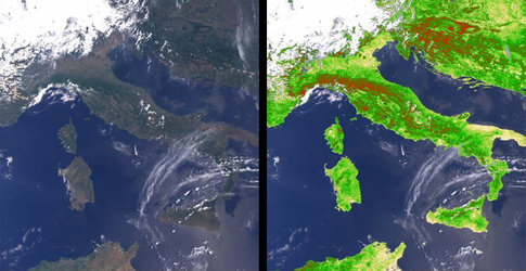
Although primarily used for the measurement of ocean colour, Envisat's Medium Resolution Imaging Spectrometer (MERIS) has also been monitoring the state and evolution of the Earth's vegetation cover since its launch in 2002. The MERIS Terrestrial Chlorophyll Index (MTCI) combines information on the extent of the planet's green areas along with an assessment of the amount of chlorophyll in the leaves to produce detailed images of chlorophyll per unit area of ground.
However, because of the logistical difficulties on the ground of determining the chlorophyll content of the area covered by a MERIS pixel (9 x 10⁴ m2), the derived values of chlorophyll have, up until recently, only been correlated with surrogate chlorophyll content data. In essence, the MTCI had never been correlated with actual field-measured data.
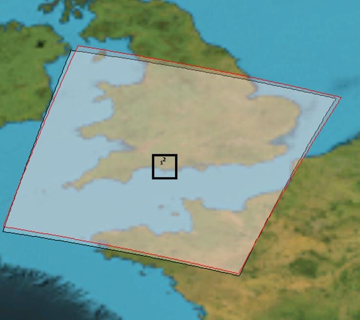
In a first attempt to confirm the relationship between the MTCI and chlorophyll content using actual MERIS data and actual chlorophyll content data scientists from the University of Southampton (UK) recently carried out a series of field experiments in southern England.
During the summer of 2006, Leaf Area Index (LAI) and chlorophyll concentration data were collected for eight large (more than 25 hectares) fields. The fields contained six different crops (oats, winter wheat, beans, linseed, maize and grass) at different stages of maturity and with different canopy structures, LAIs and chlorophyll concentrations. A modified random sampling method was used in which each field contained a sampling unit in proportion to the spatial variability of the crop. Within each unit 25 random points were sampled. At each random point the LAI was estimated with a planet canopy analyser and chlorophyll concentration estimated using a Minolta-SPAD chlorophyll meter.
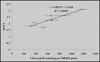
When the data collected during the field experiments was compared with that of cloud-free MTCI data, the correlation proved positive. Although further confidence on these correlations could be improved further by similar field experiments in the future, this first attempt to validate MERIS-derived chlorophyll data is another important step in proving the excellence of the instrument and its usefulness at monitoring the state of our changing Earth.