Eva Oriol-Pibernat - ESA MetOp Mission Manager
In the first in a series of interviews with key members of the MetOp team, we spoke with ESA's MetOp Mission Manager, Eva Oriol-Pibernat. Check back for further interviews, as well as updates on the MetOp mission.
How did you begin working for ESA?
I started to work at ESA (ESRIN) in 1983, after spending over 5 years as a scientist at the European Centre for Medium Range Weather Forecasts (ECMWF) in the UK. I was first involved in the preparation for the first ESA Remote Sensing satellite. Then, I moved to ESA’s Paris headquarters in 1994 as MSG and MetOp Mission Manager. Due to an internal re-organisation, I moved back to Frascati in 2000, keeping the same post.
What does being ESA MetOp Mission Manager involve?
The Earth Observation (EO) Mission Management Office was originally created at headquarters. My work included all the preparations for the MetOp satellites, starting with the establishment of the mission objectives and the negotiations with the European Organisation for the Exploitation of Meteorological Satellites (EUMETSAT) regarding the role of each organisation, which concluded with the co-operation agreement.
After successful completion of this, the project at ESTEC started the Phases C/D. I was involved then in the various reviews of the development of the project, including contacts with the scientific advisory committees for the ESA instruments on board MetOp.
Meanwhile, I organised a joint ESA/EUMETSAT Research Announcement of Opportunity for the scientific exploitation of MetOp data in synergy with ERS and Envisat data. The 50 selected projects will carry leading research during the exploitation phase of the satellites.
How many people are working on the project?
This is difficult to estimate, as many people are also indirectly working on MetOp-A, at ESA, EUMETSAT and industry.
The MetOp series of satellites has come together as a result of international contribution. What role have the different space and industrial agencies played in this process?
The United States’ National Oceanic and Atmospheric Administration (NOAA) has been flying meteorological polar orbiting satellites for a long time. In order to assure the continuity of such data, NOAA is supplying some of the instruments on board MetOp-A, which also carries innovative European instruments. MetOp-A will substitute the NOAA satellite flying now in the so-called morning orbit.
Who will be the main users of MetOp-A data?
MetOp-A is an operational satellite. The main users will be the meteorological offices in charge of supplying weather forecasts. However, MetOp-A will also be contributing to climate monitoring, and it is expected that the growing user community in this area will also be a main user. Finally, the innovation of some of the instruments will be also well exploited by the scientific users.
How will MetOp-A data be delivered to end users?
The MetOp-A data will be directly disseminated in near-real time to operational users, either globally or regionally. However, data will also be archived for later use.
What is your involvement over the lifetime of the satellite?
Once the satellite is launched, EUMETSAT becomes the owner of the satellite and its data. My role continues by interfacing with the scientists who have been selected through the Research Announcement of Opportunity. On the other hand, the co-operation agreement with EUMETSAT guarantees free access to MetOp-A data for ESA’s own purposes, and I will be assuring that such possibility is fully exploited.
How will MetOp-A’s vast array of instruments compliment each other?
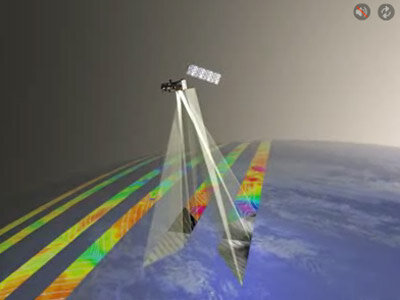
The main objective of MetOp-A is to supply accurate information about the atmosphere in order to be assimilated in Numerical Weather Prediction models. Such models ‘integrate’ in a physically consistent manner data from all relevant MetOp-A instruments, but also from many other sources.
Why are so many instruments needed to measure temperature and humidity?
Temperature and humidity are two key variables to describe the atmosphere. Each instrument is based in a different technology and therefore supplies its measurement in different conditions, complementing each other.
Will the combination of MetOp-A’s onboard instrumentation offer new data not previously available on the NOAA satellite it is replacing?
The European supplied instruments, with one exception, MHS, are not flying onboard the NOAA satellites. The IASI and GRAS instruments are completely new and will provide a huge improvement with respect to the humidity and temperature profiles supplied by the NOAA satellites. The ASCAT and GOME-2 instruments, which are improvements of the ones already flying in ERS-2, provide information brand new for an operational context.
The MSG series are also European weather satellites, how do the MSG and MetOp programmes complement each other?
The MSG series are the continuation of the Meteosat series, flying since 1977. These satellites have geo-stationary orbits, at 36 000 km of altitude, and supply almost ’continuous’ data over the same part of the Earth, covering Europe and Africa. MetOp-A will fly at a lower altitude of around 800 km, over the Poles, and will provide data with better spatial resolution than MSG, and will need about one day to get a global coverage. They are therefore highly complementary.
What have you enjoyed most about working on the MetOp-A series of satellites so far?
I have enjoyed every bit of it. The highlight is still to come: the launch!
Where will you be for the launch?
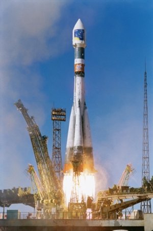
I will be at the launch site in Baikonur. Having already been at the launch of MSG-1 in Kourou, I am looking forward to such new experience!