First Level-1 HIRS and AVHRR (IR) products
After the nominal two-week out-gassing period, the High Resolution Infrared Radiation Sounder (HIRS/4) and the channels 3B, 4, and 5 of the Advanced Very High Resolution Radiometer (AVHRR/3) carried on MetOp-A, were switched-on on 21 November at 13:00 UTC.
With 19 infrared channels and one visible channel, HIRS/4 measurements provide the most important information out of the Advanced TIROS Operational Vertical Sounder (ATOVS) instruments on the spatial distribution of atmospheric temperature and water vapour - especially over land surfaces. The ATOVS ensemble comprises the European MHS (Microwave Humidity Sounder), and four of the US instruments provided by the National Oceanic and Atmospheric Administration (NOAA) - the Advanced Microwave Sounding Units–A1 and –A2 (AMSU), AVHRR and HIRS.
Since the HIRS temperature and humidity retrieval is very sensitive to the occurrence of clouds, it relies on the cloud information gained through the evaluation of the collocated AVHRR measurements.
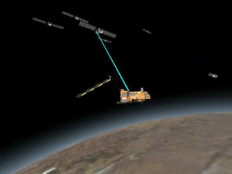
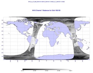
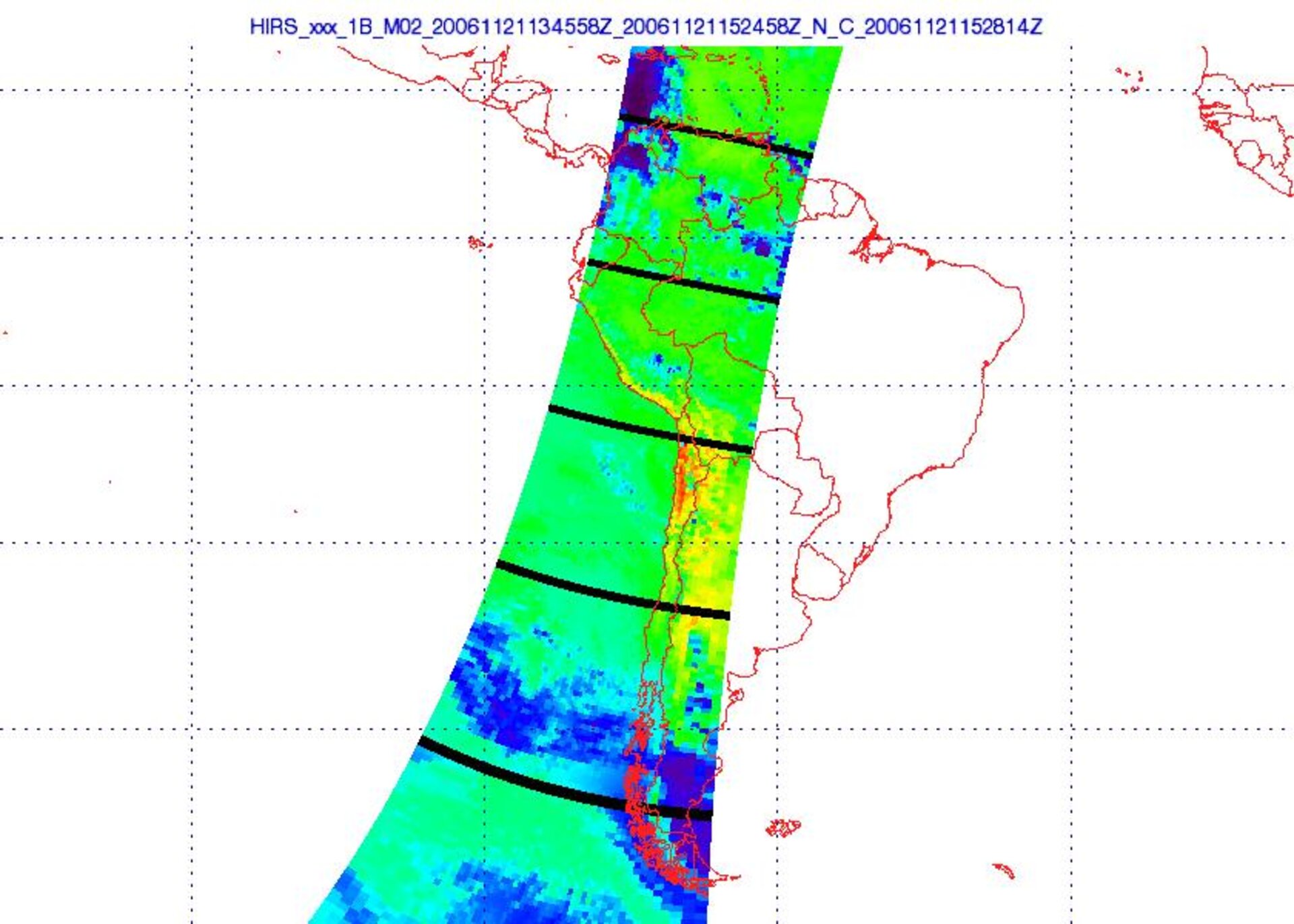
The first three images shown in this article were received and processed to Level 1B in near real-time on the operational processor and subsequently displayed in the Calibration Validation Facility of EPS. They display about 20 minutes of data, which were recorded one hour after the instruments were switched on. During this pass over South America, the flight direction of the satellite is southwards, i.e. from the top to the bottom of each figure.
The first image (above) shows calibrated geo-located HIRS Channel 8 radiances. High radiance values are related to the red and the yellow coloured pixels, and low values are marked by magenta. HIRS channel 8 is a window channel with a maximum sensitivity of 11.1 microns. Hence, it provides information on the surface temperature, cloud top temperature when clouds are optically thick. Between 15°S and 30°S, the sharp radiance contrast between land and water surfaces is evident, whereas major parts of Patagonia are covered by clouds. The black stripes, which occur at regular intervals across the flight direction, mark the calibration lines. During this time, the instrument looks into space or at the internal warm target and so can not generate Earth-view data.
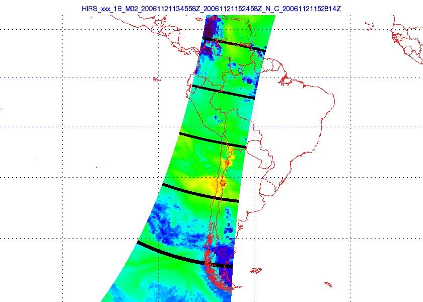
The second image shows calibrated geo-located HIRS Channel 11 radiances. High radiance values are related to the red and the yellow coloured pixels, and low values are marked by magenta. HIRS channel 11 is sensitive to atmospheric water vapour (7.3 microns) in the mid-troposphere (roughly 700 hPa, corresponding to about 3 km). Thus, for low surface altitudes, the main contributors to the radiance signal are clouds and atmospheric humidity.
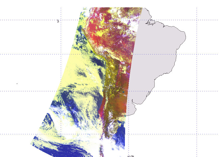
The third image shows an AVHRR image composed of radiances from channels 1, 2 and 4. This combination of shortwave channels with an infrared channel is often used because it allows the discrimination between different cloud and surface types. In cloud-free areas, land surfaces appear brown, red or slightly green and water is marked by deep blue. The colour of optically thick clouds depends on the cloud-top height and varies between yellow for relatively low clouds and white for high cloud-tops. In addition, thin cirrus clouds can be detected mainly over water surfaces when no other cloud type is present. This is in the contrast to surrounding cloud-free areas, where the signature of cirrus clouds is a faint bluish colour.
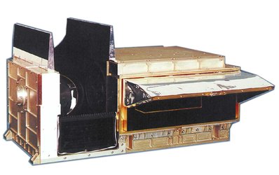
The HIRS instrument detects radiated thermal energy emitted by the air at different levels in the atmosphere. The primary purpose of HIRS is to provide high resolution global temperature sounding data in cloud-free conditions, which is of great importance to meteorology and climatology. The HIRS instrument is provided to EUMETSAT by NOAA, and was manufactured by ITT Industries of Fort Wayne, Indiana, (USA), under contract to NASA.
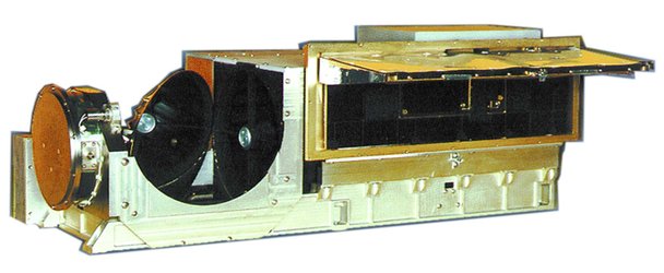
The AVHRR instrument detects reflected solar energy and radiated thermal energy from land, sea, clouds and the atmosphere. The primary purpose of AVHRR is to provide global cloud imagery for meteorological purposes, although many other applications have developed around the use of this versatile instrument previously flown on NOAA satellites, such as the mapping of sea ice and sea surface temperatures, vegetation mapping and land-surface analysis. The AVHRR instrument is provided to EUMETSAT by NOAA, and is manufactured by ITT Industries of Fort Wayne, Indiana, (USA), under contract to NASA.