

New ESA sounder sees through ice to unveil Greenland bedrock
An airborne campaign carried out over Greenland has demonstrated that a new ESA instrument, called Polaris, can see through the ice sheet to reveal how snow has accumulated, the structure of the ice layers and the underlying bedrock. This dataset is now available online.
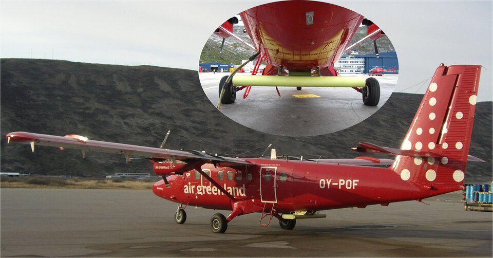
The Polaris instrument, which stands for Polarimetric Airborne Radar Ice Sounder, was developed for ESA by the Technical University of Denmark. Development included the design, implementation, installation of the instrument on a Twin Otter aircraft, as well as the field campaign over the Greenland ice sheet that took place last year.
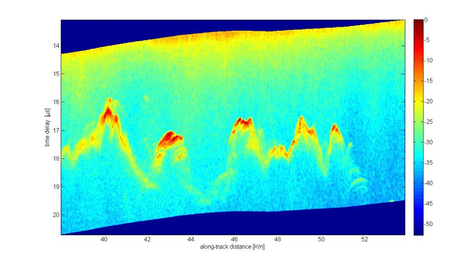
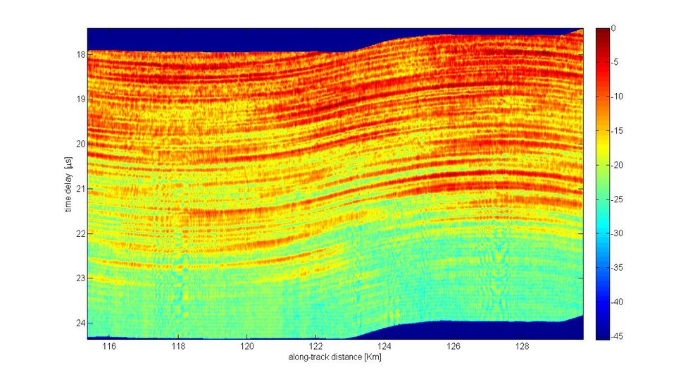
The test campaign in Greenland has shown that the sophisticated instrument, which operates at the unusual frequency of 435 MHz (P-band), along with new data-processing techniques, can offer a different way of characterising snow and ice layers in thick polar ice sheets. ESA initiated the development of Polaris to provide a better understanding of how P-band scatters and propagates through the ice, and to validate new methods of processing data.
Indeed, the success of the campaign, and specialised data handling by ESA has shown that Polaris can provide a new opportunity for glaciologists to learn more about ice sheet dynamics and how climate change may be affecting the cryosphere.
The campaign to test Polaris was carried out last year while the International Polar Year (IPY) was in full swing. The two-year IPY programme was an internationally coordinated effort in which more than 5000 scientists from 60 countries conducted research in the Arctic and Antarctic to increase our knowledge of the polar regions, how they are changing and how those changes impact the health of our planet.
It is known that the polar regions will be the first areas to suffer the consequences of climate change, so the careful monitoring of Earth's ice cover is essential. The new dataset from the Polaris campaign, which is available through ESA, and future use of the instrument will make a contribution to the endeavour to learn more about the state of the cryosphere.
The sounder includes a multi-aperture antenna, mounted on a Twin Otter aircraft, and is characterised by a large dynamic range. The radar bandwidth can be selected between 6 and 85 MHz, corresponding to a vertical resolution of 14 to 1 m in pure ice.
The design of Polaris is classical for such instrument, with a central transmitter and receiver unit mounted inside the aircraft. The flexibility of the electronics offers the capability to register two received channels at the same time. So various modes of operation are available, including polarimetric operation, clutter suppression, shallow and deep sounding.
Both engineering and science data were delivered to ESA. On the basis of existing knowledge of the subject, a synthetic aperture filter, tailored to the specific sounder geometry, was designed. Software tools interfaced to pre-processed data were also included in the development. Those tools together with part of the data are now available through the ESA Earth Observation Campaigns Data website linked on the right-hand bar.
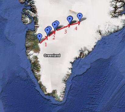
Several datasets, covering four flights and including both shallow- and deep-sounding data, are available. Thanks to the processing technique, it is possible to retrieve the bedrock topography through 3 km of ice.

