
Observing land surface temperatures from the AATSR
Imagine being at a height of 800 km above the surface of the Earth and yet able to measure the temperature of the land surface to an accuracy of one degree or better. Carried on Envisat, the Advanced Along-Track Scanning Radiometer is doing just that. However, to ensure that atmospheric and surface effects are being correctly accounted for, long-term work on the ground is also required.
The temperature of the surface of the Earth can help scientists monitor the health of our changing planet and provided a great deal of information about physical processes that are occurring. Observations of land surface temperature can be used to improve Earth-system models for weather, pollution and the water cycle. In addition, these data are useful for some agricultural applications, such as monitoring the water requirements of crops and desertification.
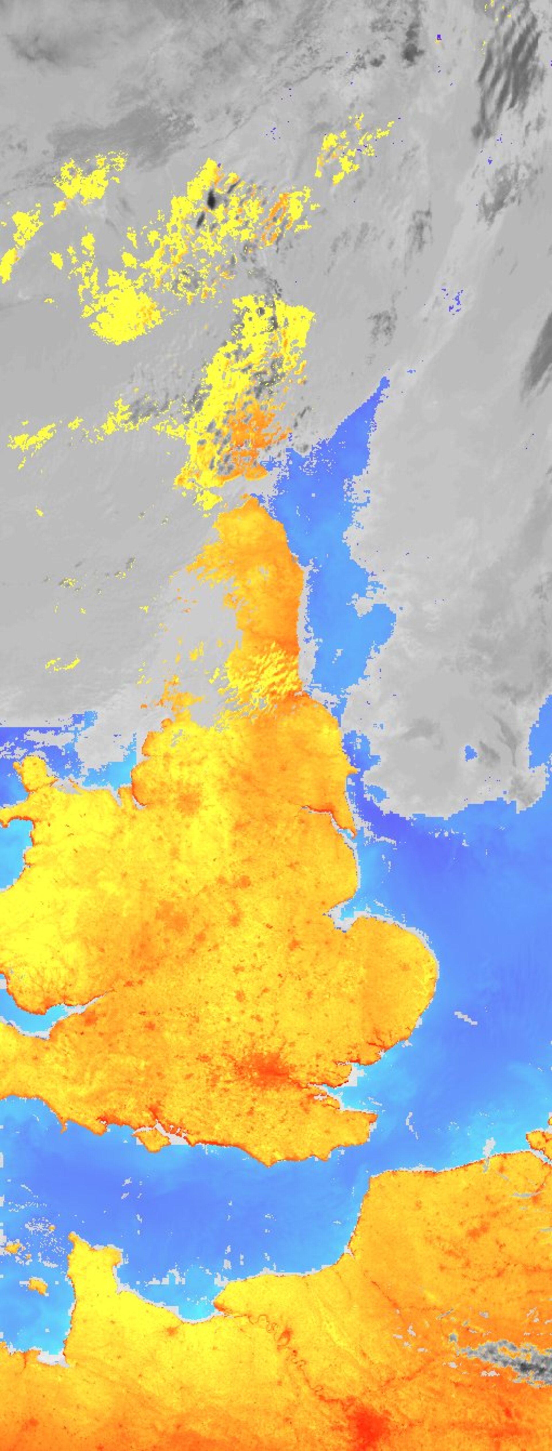
Land surface temperature data from the ATSR series, the third of which is the AATSR, is a relatively new concept. First launched in 1991 on the ERS-1 satellite, the ATSR-1 was originally designed to provide accurate global sea surface temperature data. However, the benefits of extending the mission objectives to include observations over land soon became clear, as the capability of this instrument was realised. Due to the innovative design of these instruments, the ATSRs are the most accurate temperature-sensing instruments ever to have flown in space. Now with almost fifteen years in operation, the data recorded by these instruments offer one of the most consistent and long-term global land surface temperature data sets available for climate studies.
However, observing the surface of the Earth from space is not an easy job. To ‘see’ the surface, the AATSR has to look down through the atmosphere from its position high up in space. This is a bit like using our eyes to make out the features at the bottom of a muddy river – the atmosphere distorts what we are trying to measure. To complicate matters further, the temperature signal from the Earth’s surface is also distorted by the nature of the surface itself: mountains, vegetation and buildings are just some examples of what affect the temperature that the AATSR observes. To remove these effects, scientists must have some knowledge of the atmospheric and surface conditions at the time when the AATSR passes overhead. This is often a very difficult process as both the land and atmosphere vary enormously around the globe and with time. The AATSR manages to achieve the correction for the surface conditions by using ground and different satellite observations made over many years (a climatology data set). The correction for the atmosphere is estimated by using a combination of measurements made over different wavelength bands (channels), which respond differently to the properties of the atmosphere and thus provide information about its state.
To check the accuracy of the correction for the atmospheric and surface effects, the AATSR land surface temperature data are compared with land surface temperature data recorded on the ground at the same time as the AATSR makes its measurements. This process is known as ‘validation’. As these ground data are collected at the surface, where the effects of the atmosphere are not a problem and the land surface type is well known, these data should be more representative of the true surface temperature. Therefore, the difference between the ground and AATSR land surface temperature can tell scientists the accuracy of the satellite data.
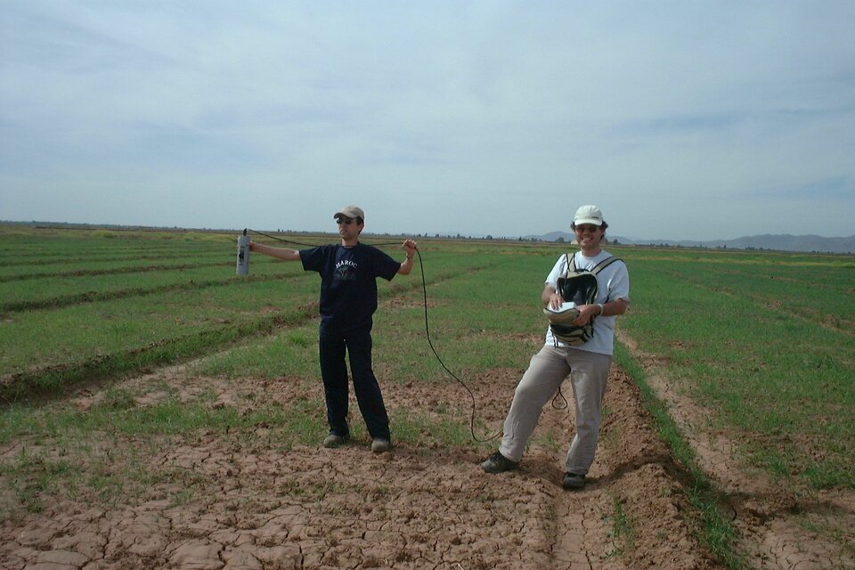
As conditions on Earth are so variable, it is very important that the validation experiments are performed in as many places as possible. If the data are found to be accurate in the Australian outback, this does not mean that we will obtain the same accuracies over the Amazon rainforest. Furthermore, it is also important that ground validation data are collected over long periods of time to determine the accuracy of the data through each season, as the atmospheric and surface conditions vary throughout the year. Although immensely useful, specific validation experiments typically yield only a few data points and a ‘snapshot’ of the accuracy of the AATSR land surface temperature data. The longer-term validation experiments provide a more complete picture and more data points, which give increased confidence in the results. The results of these validation experiments also help scientists improve the atmospheric and surface corrections, and thus the quality of the final data.
For the AATSR, a number of these LST validation experiments have taken place since the launch of Envisat. Campaigns to date include some exotic locations that include Morocco, Australia and Spain. Luckily for the scientists involved in these campaigns, the data must be collected in cloud-free conditions, as the AATSR cannot ‘see through’ clouds and so cannot measure land surface temperature when it’s raining! In general, the results of these experiments are extremely encouraging and demonstrate that, in most cloud-free cases, the AATSR land surface temperature measurements are accurate to within 1-3 K. Further improvements are also possible and efforts are ongoing to obtain the best possible performance.
