Forests
Forests serve as habitats for two thirds of terrestrial animal and plant species, prevent soil erosion and water run-off, and play a major role in regulating our climate. But forested zones are shrinking. Worldwide it is estimated that a fifth of all forest coverage was lost between the 1960s and the 1990s.
Vanishing woodland
In Europe less than half of the continent's original forested areas remain, and deforestation is accelerating across the developing world. The major pressure on forests comes from human population growth. The growing numbers of mouths to feed means that almost 40% of the world's land surface has been converted to cropland and permanent pasture, supplanting forests and grasslands.
Even forests spared from clearing are subject to acid rain caused by industrial pollution, and climate change threatens to shift temperature zones across a continent faster than slow-growing trees can follow.
Storing carbon
Yet forests also work to moderate climate change: a single hectare of pine forest takes an annual 7.5 tonnes of carbon out of the air every year. Because they extract carbon dioxide from the atmosphere, replacing it with oxygen, forests serve as 'sinks' within the carbon cycle. It is only if they are burnt down or rot that this carbon gets released again.
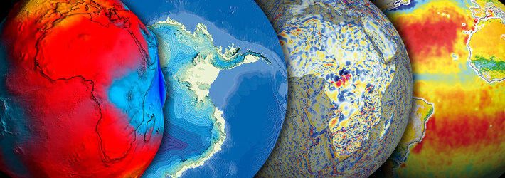
Satellites are increasingly being used to assist national forest inventories so countries can fulfil their obligations to the 1997 Kyoto Protocol, and gain 'carbon credits' for wooded areas. Optical or radar instruments can quantify forest biomass, leaf size, water content and overall health, and even differentiate individual species. And better-quantified forests can then be better factored into climate prediction models.
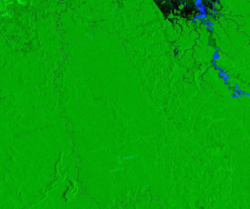
Russia is the nation with the largest forest area and its extent has been recorded using Earth Observation. Radar instruments on ERS as well as Japan's JERS-1 have been used to map 1.2 million sq km of forest across central Siberia, the largest project of its kind Forest authorities used the land cover maps to update obsolete inventories and monitor reforestation efforts.
Forests and sustainable development
Forests represent an economic as well as an ecological resource, and satellite data enables woodland to be logged in a sustainable manner. In areas such as Sarawak in Indonesia, Earth observation has been used to provide data on the quality and quantity of forest resources and enables accurate advance estimates of production yields. Illegal forest clearing can potentially be highlighted and brought to the attention of the authorities.
Combating fires
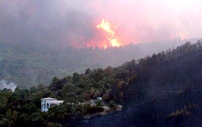
Forests are always vulnerable to fire, and this risk may be further exacerbated by climate change. Europe had a summer of forest fires in 2003, losing more than 700 000 hectares. The European Commission estimates that every hectare of forest burnt by fire costs the economy between a thousand and 5000 Euros.
Satellites can provide speedy surveys of forest burn scars to help with damage assessment and assessing the likely risk of future blazes. As fires occur, radar instruments such as Envisat's Advanced Along Track Scanning Radiometer (AATSR) can peer through the pall of smoke to show high-temperature 'hotspots' where the fire is centred.