
Learning about Arctic Ocean circulation & ice thickness by gravity
A combination of new satellite-derived datasets is providing an exciting opportunity to peer through the sea-ice cover to study circulation patterns in the Arctic Ocean (Forsberg et al., 2006). A better understanding of what's going on beneath the ice will, in turn, lead to a more accurate interpretation of sea-ice thickness data from CryoSat-2.
The new estimates of Arctic Ocean mean dynamic topography have been compiled through a combination of satellite altimetry data from ERS, Envisat and ICESat, and a revised geoid model based on surface, submarine, airborne and satellite gravity field data from the US-German GRACE mission.
With the forthcoming launch of ESA's gravity mission GOCE (Gravity Field and Steady-State Ocean Circulation Explorer) next year, the current estimates of ocean dynamic topography are likely to improve since GOCE will address a completely new range of spatial scales. Its data will provide a model of the Earth's gravity field with unprecedented accuracy and resolution.
Satellite radar altimetry data has been used for more than a decade to map the height of the sea surface, which is not actually as flat as one might think. Although invisible to the eye, the sea surface has ridges and valleys that echo the topography of the ocean floor combined with mass anomalies of the Earth interior, in several places of the order of tens of metres. For example, the effect of the slight increase in gravity caused by the mass of an undersea mountain attracts extra water over it, causing a 'bulge' in the sea surface. Similarly, the reduced gravity over trenches in the sea floor means there is less water held over these regions, so the height of the sea-surface is depressed.

Therefore, in the absence of winds, tides and currents, the sea-surface would follow this surface of equal gravitational potential, known as the geoid. A precise model of the Earth's geoid – using GOCE data - is crucial in deriving accurate measurements of ocean circulation and sea-level change, both of which are affected by climate change However, there will be a hole in the data coverage that GOCE will provide since GOCE will not fly directly over the poles. In order to create a truly global geoid, gravity information near to and over the poles must be provided by other means.
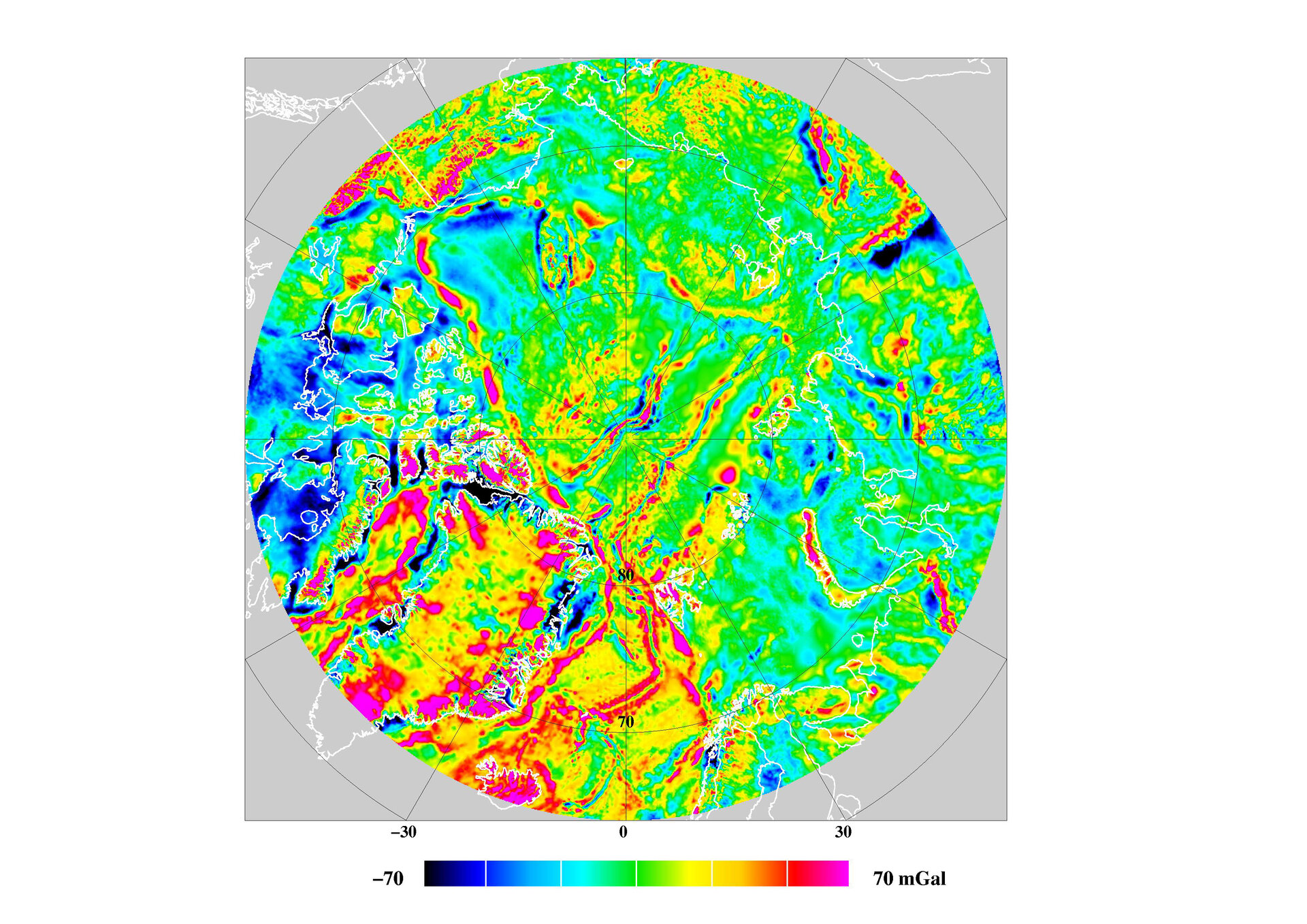
Since 1998, the Arctic Gravity Project (ArcGP), which has been supported by organisations from ten different countries, has been collecting data to compile a gravity grid of the Arctic region. These data have been acquired through surface, airborne and submarine data. Supplemented with some ERS and ICESat altimetry data, the most recent gridded gravity data set resulting from the Arctic Gravity Project has just been released.
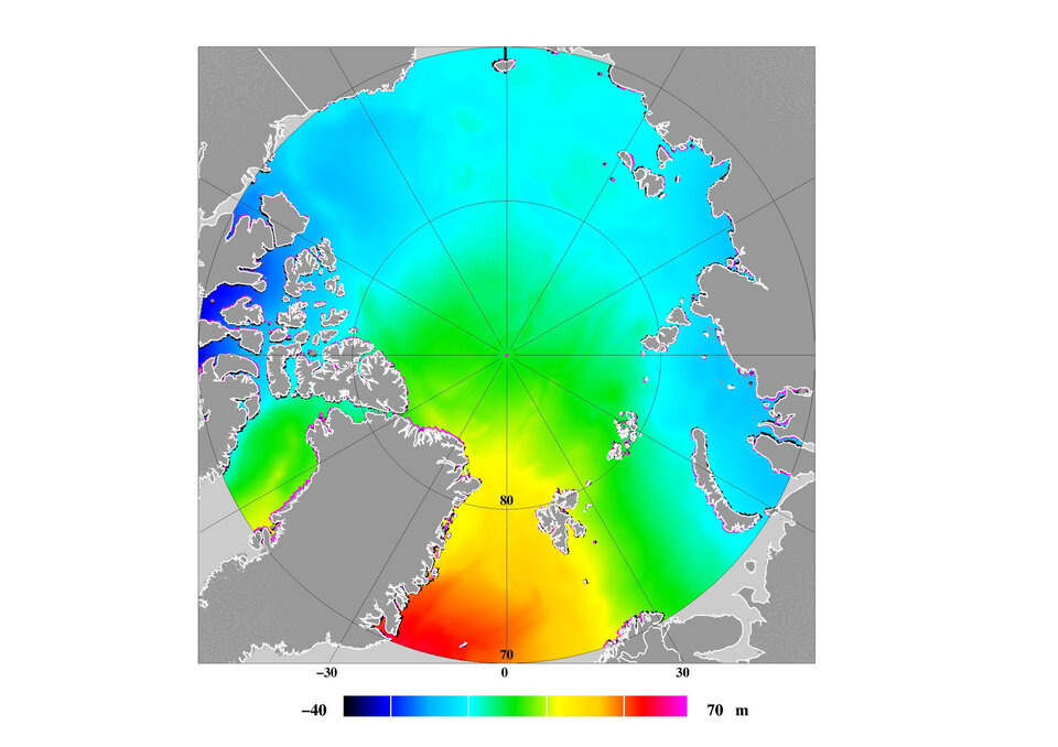
Altimetry data from the Arctic region has been accumulated since the launch of ERS-1 in 1991. These data are used to derive the average Arctic Ocean surface topography, known as the mean sea surface (MSS). Currently this serves as the basis for deriving important geophysical information from the altimetry data. For instance, the mean dynamic topography (MDT) of the Arctic Ocean may be calculated from the difference between the mean sea surface and the geoid.
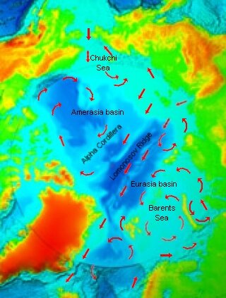
Mark Drinkwater, ESA's GOCE and CryoSat-2 mission scientist explains, “The MDT is the direct consequence of the ocean circulation in the Arctic basin. For the first time we are able to see through the ice to understand the details of the dynamics within the ocean beneath. Features observed in the MDT highlight the inflow of warm Atlantic waters into the Arctic, together with the location of the Beaufort gyre and details of bathymetrically-steered circulation patterns. Since the Earth’s gravity field and geoid are ever changing, the forthcoming GOCE mission will allow us to obtain an improved and more detailed quantitative knowledge of the geoid, and corresponding MDT. Moreover, the details of the shape of the ocean surface are required in order to effectively retrieve sea-ice thickness from future CryoSat data."
The results of the ArcGICE study (Forsberg et al., 2006) show how data from different space missions can work together to improve our knowledge of the Earth system and climate change connected with the cryosphere at high latitudes. The important synergy between GOCE and CryoSat-2 missions is also highlighted in this context.
