HFR
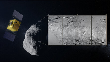
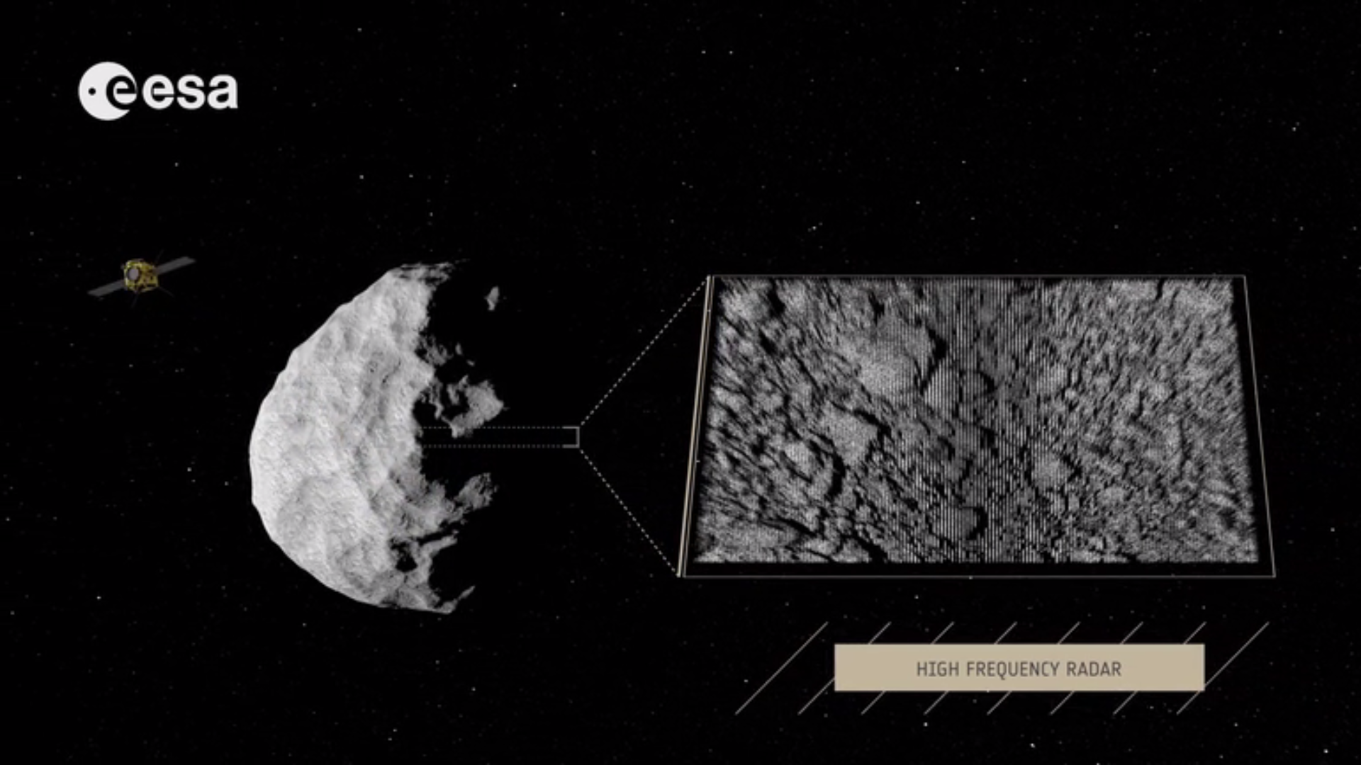
The main objective of AIM’s monostatic High-Frequency Radar (HFR) is to obtain information on the structure of the asteroid´s outermost surface and sub-surface layers, up to a depth of 10 m with a resolution of maximum 1 m (goal would be 0.2 m). Scanning Didymoon with an HFR instrument would enable the scientists to study the layering of the sub-surface and the 2D distribution of “rocks” on the surface.
The HFR operation requires a shape, motion and orbitography model. The accuracy should be 10 m for the shape and 100 m for the orbit of Didymoon.
In general, the HFR operation would improve with closer proximity to the surface and with higher angular aperture. Therefore, an operating distance of around 10 km is foreseen.
| Primary objectives (to be achieved with a frequency range of 300-800 MHz) | |
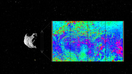
| P1 | To determine the structure and layering of Didymoon's shallow sub-surface down to a few metres with a vertical and horizontal resolution of approx. 1 m (goal 20 cm). The horizontal position will depend on the spacecraft's speed relative to the asteroid surface. The spatial variation of the regolith texture will also be mapped at the same resolution, which will give more insight into the size and mineralogy of the consituting grains and macro-porosity. |
| P2 | To study the two-dimsensional distribution of geomorphical elements (e.g. rocks, boulders, etc.) that are embedded in the subsurface with a resolution of approx. 1 m |
| P3 | To derive an estimate of the dielectric permittivity of the sub-surface material and the horizontal and vertical variations thereof. The dielectric permittivity gives insight into the surface composition and content of volatile compounds. The measurements are carried out by analysing the spatial signature from individual reflectors and/or by analysing the surface echo amplitude. |
| Secondary objectives | |
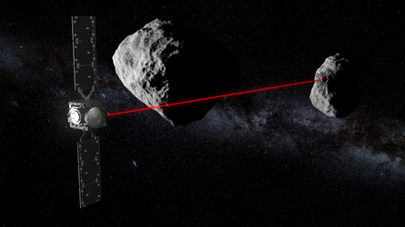
| S1 | To support asteroid mass determination, shape modelling and orbit characterisation with range measurements (resolution 10 cm or better) |
| S2 | To support ground-based bistatic radar measurements with a high-frequency channel that is compatible with Arecibo and Goldstone to offer better resolution and sensitivity |
| S3 | To observe the ejecta cloud in the vicinity of Didymoon after impact by DART, the size of the particles that can be detected would depend on the chosen frequency range of the instrument |
| S4 | To search for the possible presence of particles in the vicinity of Didymoon (also before DART impact), the size range of the particles being detected would depend on the frequency range of the chosen instrument |
| S5 | To determine the structure and layering of Didymain with the same resolution as for Didymoon, as well as map the regolith structure, scan the geomorphological elements and derive the dielectric permittivity for Didymain |
| S6 | To determine the structure and layering of Didymoon's shallow sub-surface after DART impact with the same vertical and horizontal resolution as before impact, as well as further mapping of the regolith structure |
| S7 | To support asteroid mass determination, shape modelling and orbit characterisation with range measurements (resolution = 10 cm or better) after DART impact |