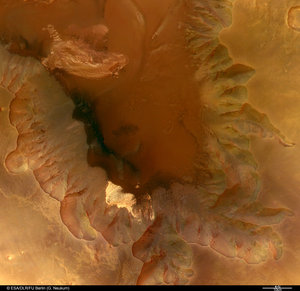
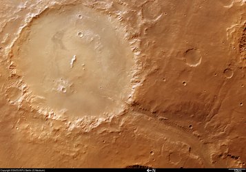
Crater Holden and Uzboi Vallis
These images, taken by the High Resolution Stereo Camera (HRSC) on board ESA’s Mars Express spacecraft, show the outlet channel of the Uzboi Vallis system into Crater Holden on Mars.
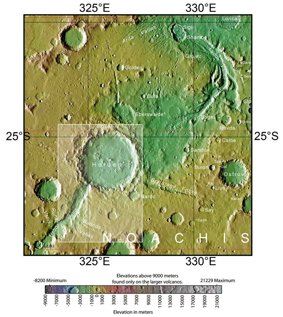
The HRSC obtained these images during orbit 511 with a ground resolution of approximately 45 metres per pixel. The scenes show the region of Noachis Terra, over an area centred at about 26º South and 325º East.
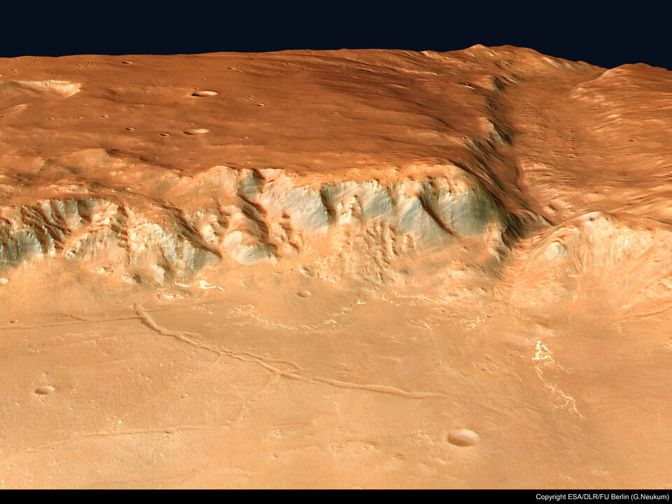
The valley of Uzboi Vallis begins in the region of Argyre Planitia and crosses the southern highlands in the direction of the northern lowlands. It connects several large impact craters, such as the 140 kilometre-wide Crater Holden seen in the main image.
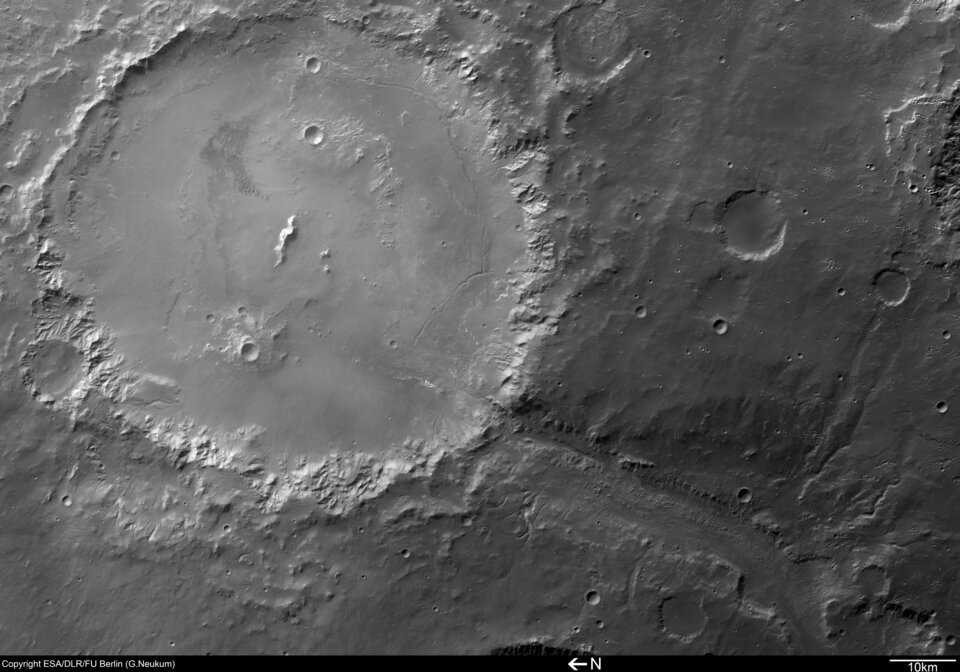
Due to a layer of haze close to the base of Holden, the area within the crater appears lighter coloured and slightly less detailed than the surrounding area.
A small, dark dune-field can be seen in the eastern half of the crater floor. It indicates the role of wind in the morphological evolution of Crater Holden.
The terrain within Crater Holden is the result of a long and varied evolution. The numerous smaller craters inside Holden indicate that the crater is old.
Many smaller craters on the floor of Holden are covered with sediments, which were deposited after the formation of these craters and indicate that they are older than the unfilled small craters.
The central mount of Holden is partly hidden, because it has also been covered by sediments. The rim of the crater has been cut by gullies, which sometimes form small valley networks.
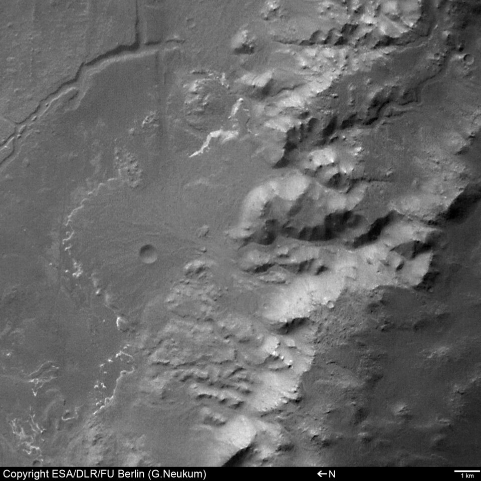
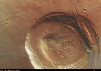
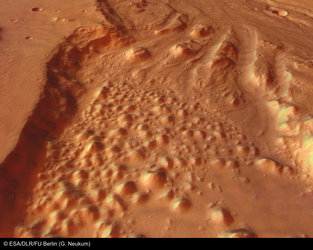
In the southern part of Crater Holden, well-preserved ‘alluvial fans’ (fan-shaped deposits of water-transported material) are visible at the end of some gullies (see close-up left).
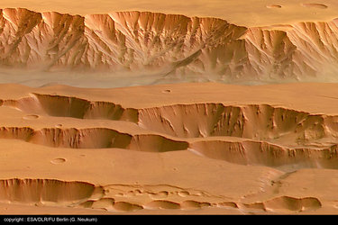
In other parts of the crater rim, the alluvial fans are less distinct and partly covered by younger ‘talus’ cones (cone-shaped piles of debris from rock falls at the base of slopes).

Uzboi Vallis enters Crater Holden from the south-west. Two distinct phases of its development can be seen. In the first phase, a valley was formed up to 20 kilometres wide.
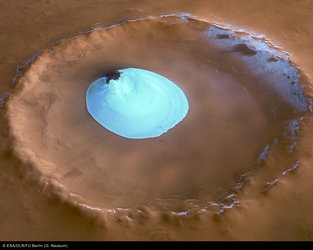
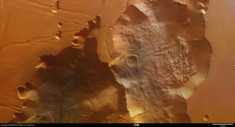
Later, a smaller channel was cut into the valley floor. The end of the small channel has been blocked by a landslide from the crater rim (see close-up 2).

The deepest parts of the valley floor are more than 1600 metres below the surrounding area. The numerous valleys at the flanks of Uzboi Vallis indicate that water probably played a major role in the formation and evolution of this region. Most of the valleys have been covered by younger sediments, indicating they have been inactive in recent geological time.
The colour images were processed using the HRSC nadir (vertical view) and three colour channels. The perspective views were calculated from the digital terrain model derived from the stereo channels.
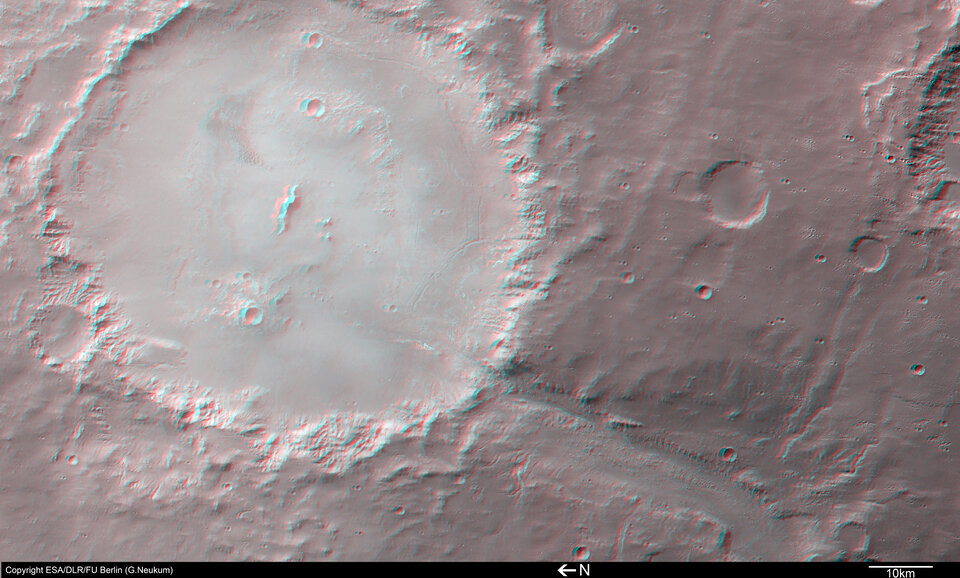
The 3D anaglyph image was created from the nadir channel and one of the stereo channels. Stereoscopic glasses are needed to view the 3D image. Image resolution has been decreased for use on the internet.
For more information on Mars Express HRSC images, you might like to read our updated 'Frequently Asked Questions'.