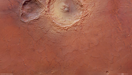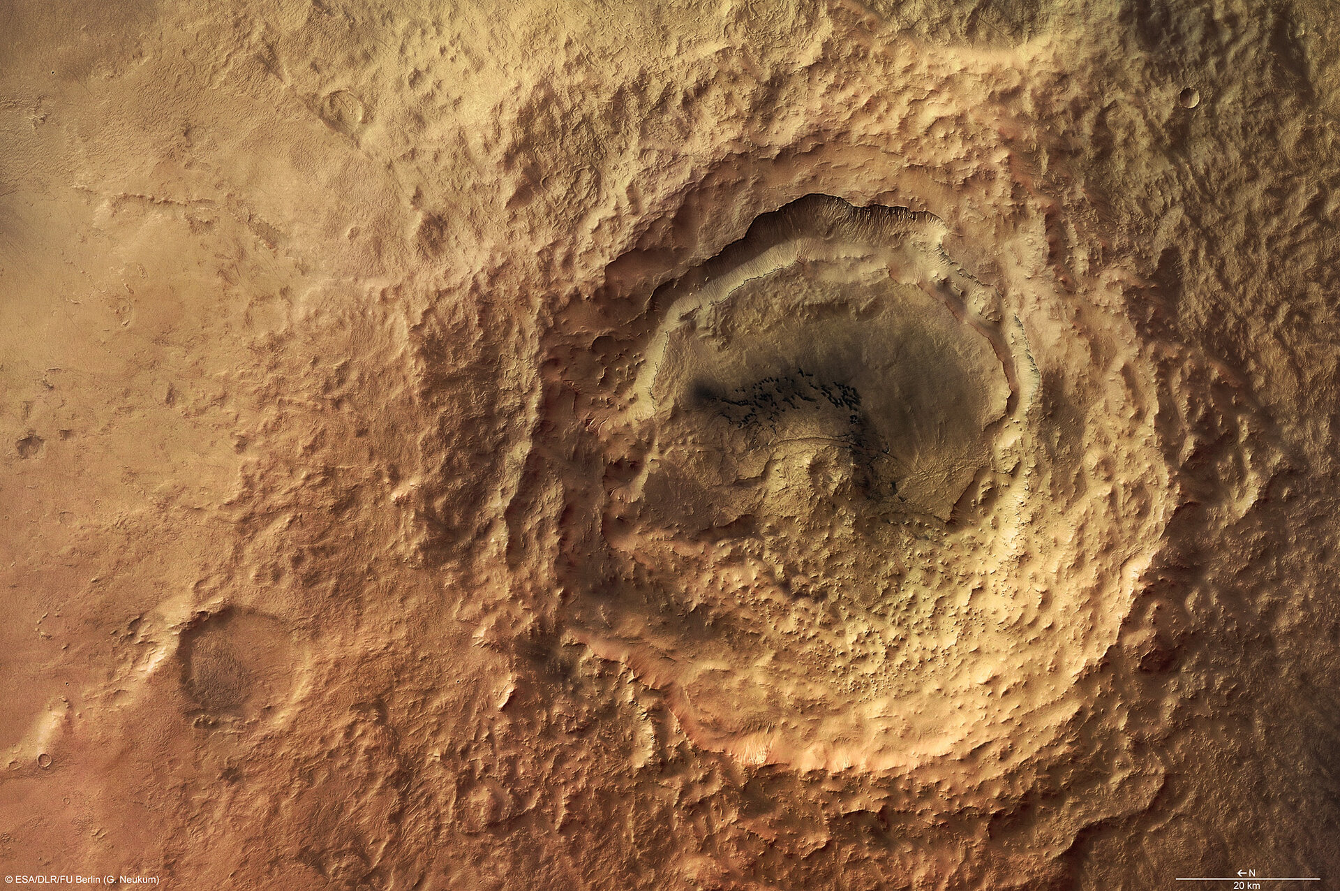
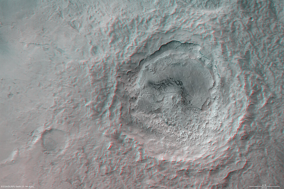
Hummocky and shallow Maunder crater
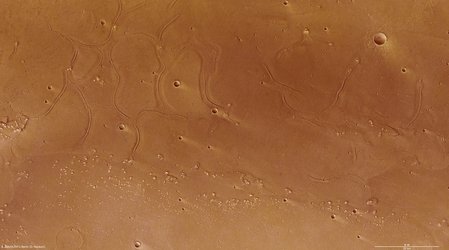
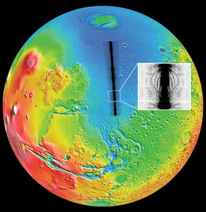
The High Resolution Stereo Camera (HRSC) on ESA’s Mars Express orbiter has obtained pictures of the Noachis Terra region on Mars, in particular, the striking Maunder crater.
The images were taken in orbits 2412 and 2467 on 29 November and 14 December 2005 respectively, with a ground resolution of approximately 15 metres per pixel.
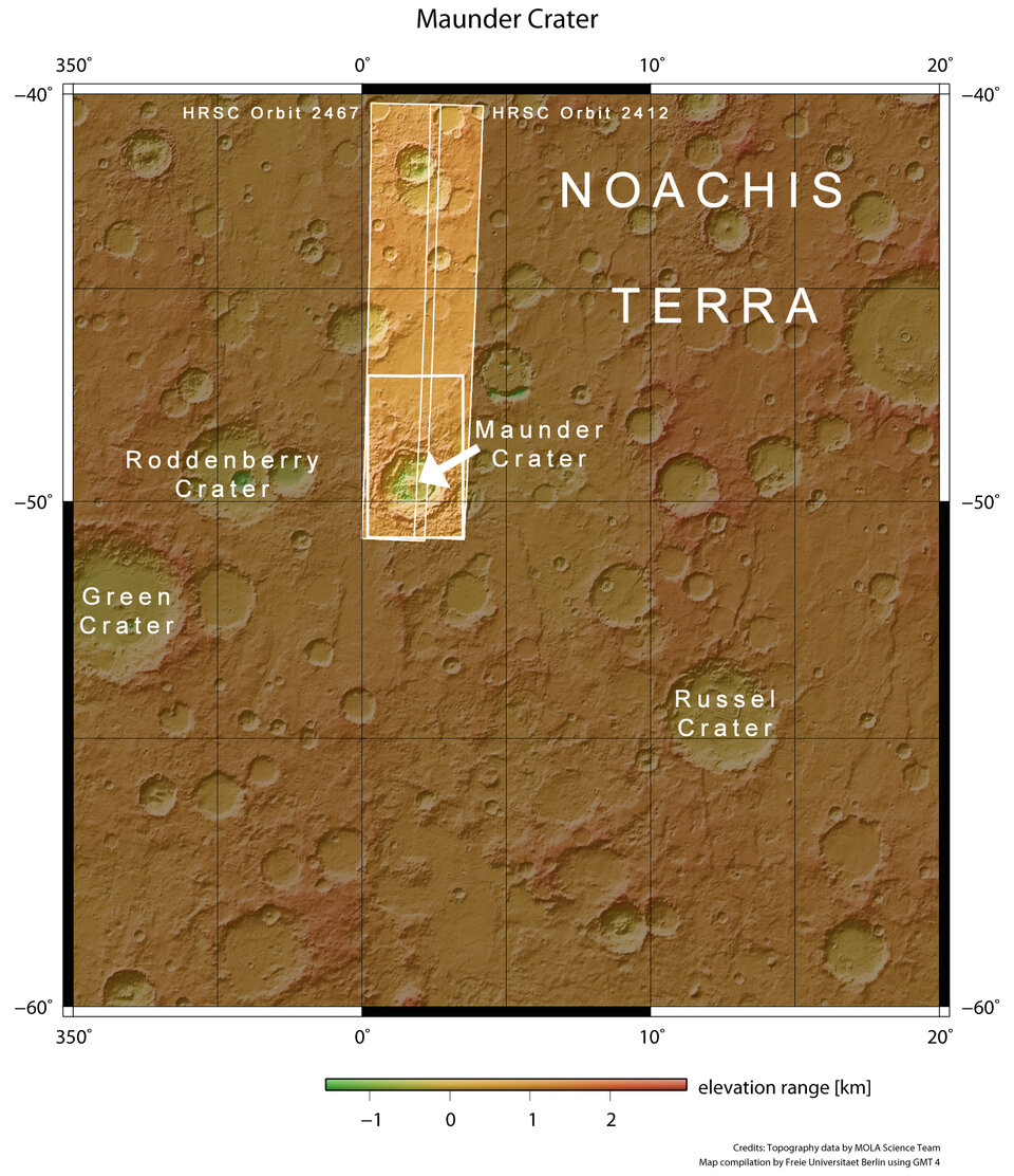
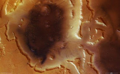
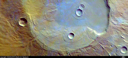
Maunder crater lies at 50° South and 2° East, approximately in the center of Noachis Terra. The sun illuminates the scene from the north-east (top left in the image).
The impact crater, named after the british astronomer Edward W. Maunder (1851-1928), is located halfway between Argyre Planitia and Hellas Planitia on the southern Highlands of Mars.
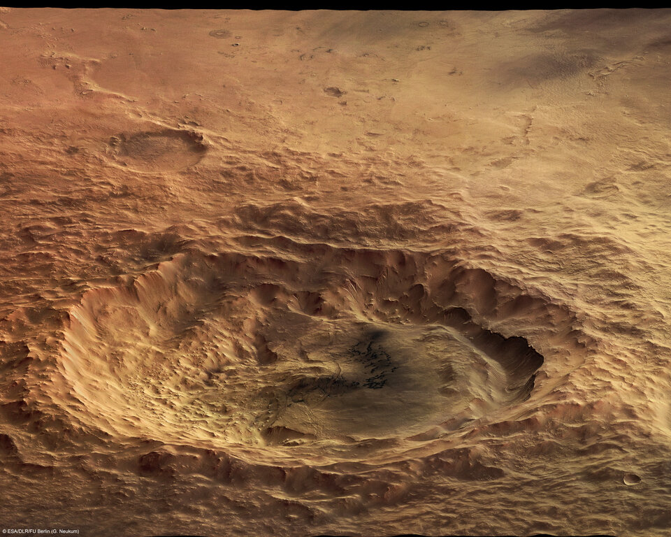
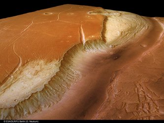
With a diameter of 90 kilometres and a depth of barely 900 metres, the crater is not one of the largest impact craters on Mars at present, but it used to be much deeper. It has since been filled partially with large amounts of material.
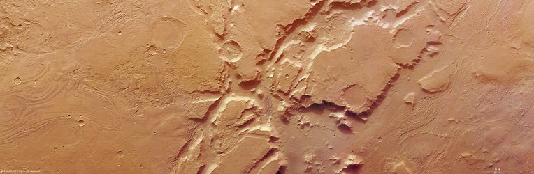
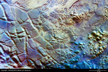
The west of the crater experienced a major slope failure, during which a large landslide transported loose material eastward, to the inner parts of the crater. The edges of the crater rim that collapsed exhibit gullies which might be associated with the mass transport of the material.
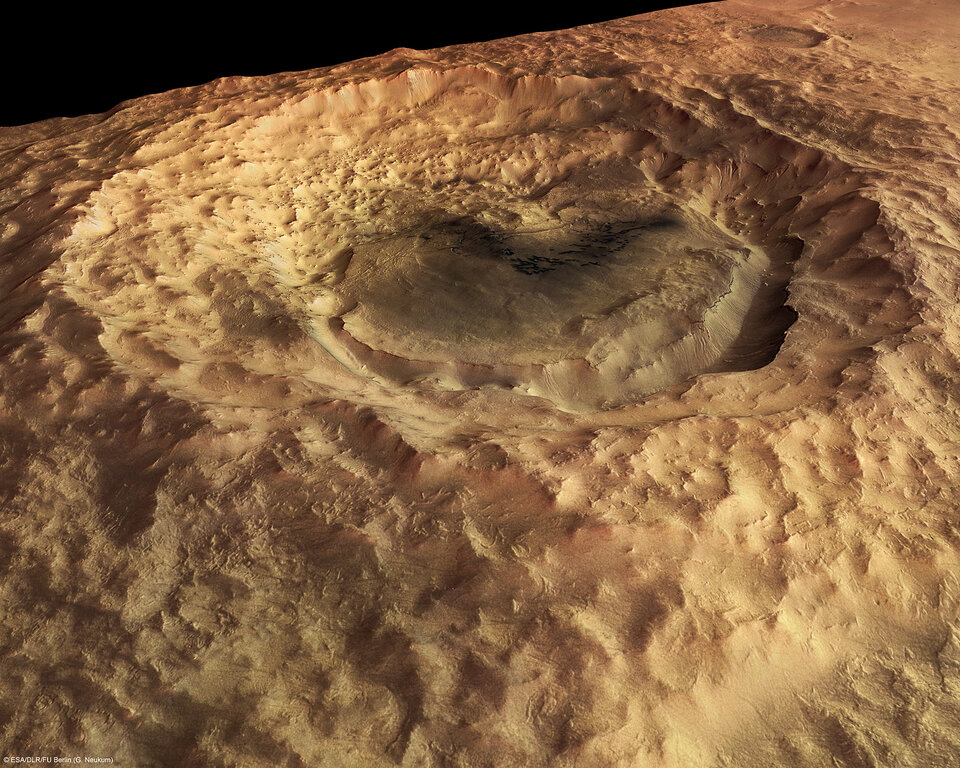
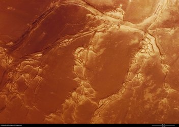
The transition zone from the western rim of the crater to the rather smooth crater floor on the eastern edge shows hummocky terrain. Such terrain exhibits small, irregularly-shaped hills and valleys. The hummocky terrain in the Maunder crater was formed by deposition of landslide debris.
In the east, the crater floor is bounded by a trough, approximately 700 metres deep. The trough may be associated with a landslide on the western edge of the crater. Some gullies can be seen on the upper edge of the trough which is possible evidence for water seepage.

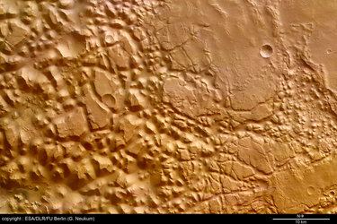
The small, 500 to 2500-metre long, dark features on the crater floor are eye-catching. These features are called Barchan dunes, one of the most abundant dune forms in arid environments. Dunes of this kind are also found on Earth, for example in the West-African Namib desert.
The colour scenes have been derived from the three HRSC-colour channels and the nadir channels. The perspective views have been calculated from the digital terrain model derived from the HRSC stereo channels. The anaglyph image was calculated from the nadir channels and two stereo channels, stereoscopic glasses are required for viewing. The 3-D (anaglyph) picture has been put together from several individual 3-D images of different scenes, enhancing the view over larger areas.
For more information on Mars Express HRSC images, please read our updated FAQ (frequently asked questions).