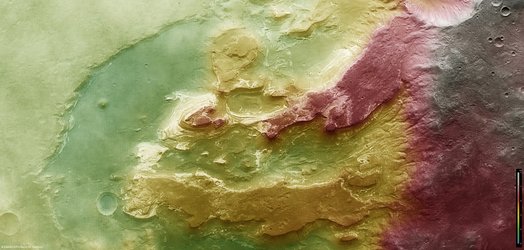
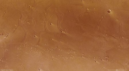
River delta in Nepenthes Mensae
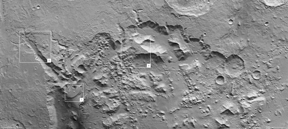
The High Resolution Stereo Camera on board ESA’s Mars Express orbiter imaged the region of Nepenthes Mensae, a river delta on Mars, on 22 January 2008. The region is located in the eastern hemisphere of Mars, close to the boundary between the northern lowlands and the southern highlands.
The data was acquired in the region lying at approximately 3° north and 121° east with a ground resolution of 15 m/pixel.

The southern part of the image shows a structure reminiscent of a river delta on Earth whose material was eroded from a valley, about 30 km long and up to 1000 m deep. This formed a fan-shaped deposit at the mouth of the valley. The rim of the deposit stands roughly 300 m above the floor of the depression.

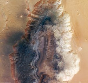
The resemblance of the structure to river deltas on Earth suggests that it was formed by a similar mechanism. Scientists believe that sediment transported by water was deposited as the flow of the water slowed down where the channel widened and met the mouth of the river.

The pictures show that the region was affected by two episodes of flooding. The first episode left behind a cone-shaped deposit, reaching far out into the lowlands. The second episode formed the fan with the distinct margin. This margin could indicate the location where sediments flowed into a standing body of water or ice.

Numerous hills and flat-topped mountains visible in the central part of the depression are remnants of the material that was present in the area. The material was then eroded forming the depression, leaving behind the elevations visible today.

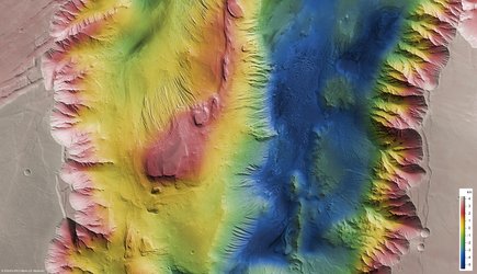
The colour scenes have been derived from the three HRSC-colour channels and the nadir channel. The perspective views have been calculated from the digital terrain model derived from the stereo channels.

The anaglyph (3D) image was calculated from the nadir and one stereo channel.

The black and white high-resolution images were derived from the nadir channel which provides the highest detail of all channels.
For more information on Mars Express HRSC images, please read our updated FAQ (frequently asked questions).