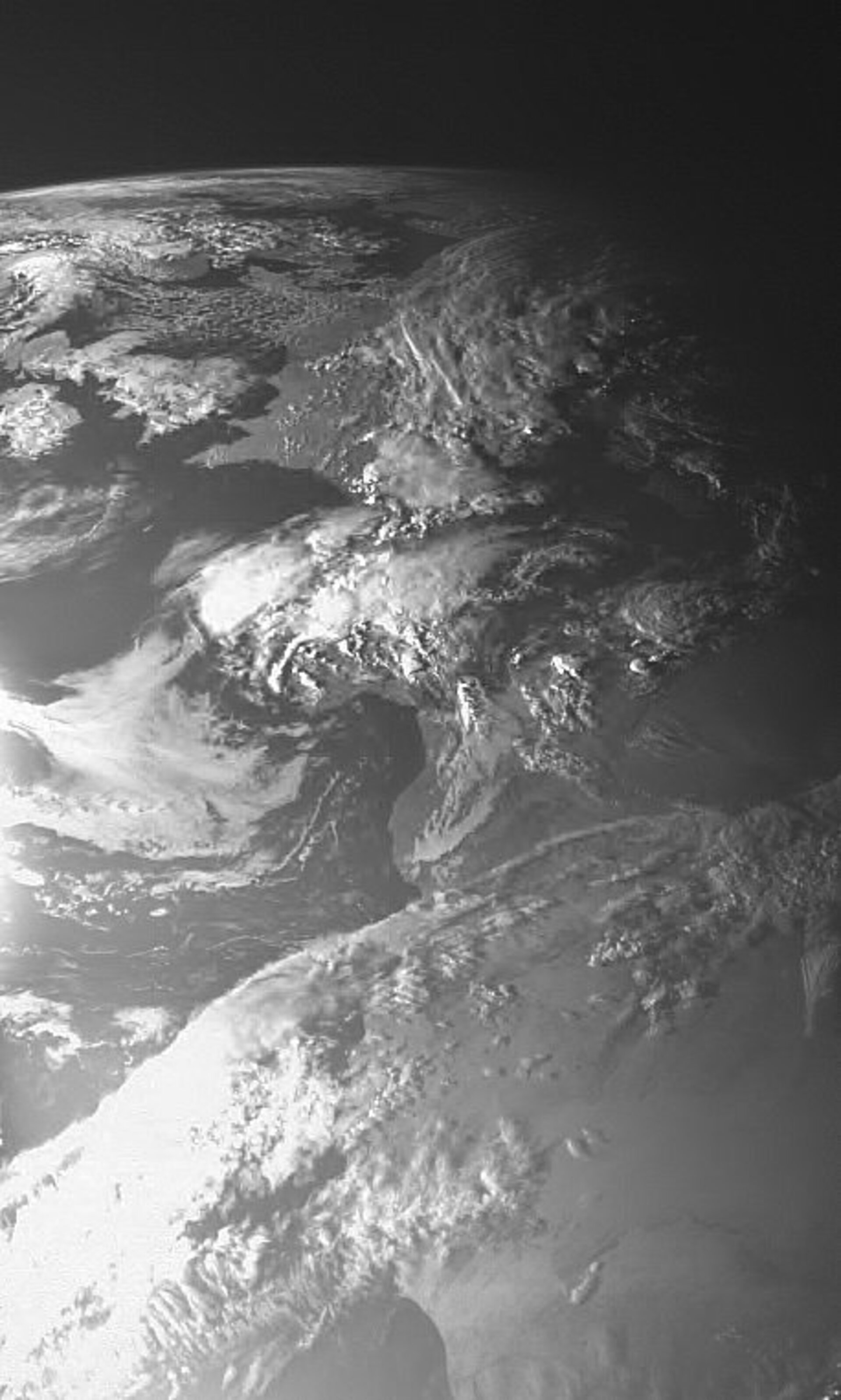
SMART-1 views Europe
The first picture of Earth taken by the SMART-1 spacecraft on 21 May 2004 from a distance of 70 000 kilometres.
The image shows from top left, Scandinavia, Denmark, United Kingdom and clear west and northern France. Southern France and Spain are at the centre under cloud cover. North Africa is bottom right.
The image was taken by the Advanced Moon Micro-Imager Experiment (AMIE) camera. This imaging system has been developed by Space-X, space exploration, in Neuchatel, Switzerland.
The AMIE camera is a remarkably compact design, a package of dedicated optics, electronics and mechanical interfaces that weighs only 450 grams.
Once in orbit around the Moon, AMIE will survey the lunar terrain using visible and near-infrared light, providing clues about its chemical composition and geological history.
"The image shows clearly that the AMIE camera works well, and that we are really in space," says Principal Investigator Jean Luc Josset, Space-X.
"This picture is a great view of Earth seen as a planet," says ESA Project Scientist Bernard Foing. "Further synoptic images of Earth obtained during the cruise phase will be used to compare the signature of geophysical processes with what we shall measure on the Moon."