
|
Simulazione di una valutazione di danni da terremoto 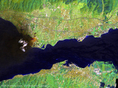 Landsat 7 15 m panchromatic multitemporal image. The image was obtained by superimposing the acquisition of 10 August (before the earthquake) onto the one of 17 August. The large area in blue, to the left of the image, is the smoke plume. In the lower right corner of the image, along the coastline, changes are indicated by two other areas in blue, probably due to a bradyseism phenomenon. 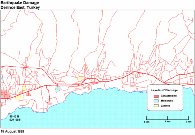 Earthquake damage, 18 August 1999. Derince East, Turkey . 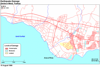 Earthquake damage, 18 August 1999. Derince West, Turkey . |