| |
Earth observation satellites
|
| • | Introduction (http://www.esa.int/SPECIALS/Eduspace_EN/SEM7YN6SXIG_0.html) |
|
| • | Landsat (http://www.esa.int/SPECIALS/Eduspace_EN/SEMHB04Z2OF_0.html) |
|
| • | ERS (http://www.esa.int/SPECIALS/Eduspace_EN/SEMFZ04Z2OF_0.html) |
|
| • | RESURS (http://www.esa.int/SPECIALS/Eduspace_EN/SEMQ614Z2OF_0.html) |
|
| • | Envisat (http://www.esa.int/SPECIALS/Eduspace_EN/SEMR314Z2OF_0.html) |
|
| • | SPOT (http://www.esa.int/SPECIALS/Eduspace_EN/SEMIW04Z2OF_0.html) |
|
Meteorological satellites
|
| • | Meteosat (http://www.esa.int/SPECIALS/Eduspace_EN/SEM6BY3Z2OF_0.html) |
|
| • | Meteosat Second Generation (http://www.esa.int/SPECIALS/Eduspace_EN/SEMTNY3Z2OF_0.html) |
|
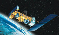
| • | MetOp (http://www.esa.int/SPECIALS/Eduspace_EN/SEMS1O6SXIG_0.html) |
|
Earth Explorer satellites
|
| • | Introduction (http://www.esa.int/SPECIALS/Eduspace_EN/SEMUYN6SXIG_0.html) |
|
| • | GOCE (http://www.esa.int/esaLP/LPgoce.html) |
|
| • | SMOS (http://www.esa.int/esaLP/LPsmos.html) |
|
| • | CryoSat-2 (http://www.esa.int/esaLP/LPcryosat.html) |
|
Commercial high resolution optical satellites
|
| • | IKONOS (http://www.esa.int/SPECIALS/Eduspace_EN/SEMI714Z2OF_0.html) |
|
| • | QuickBird (http://www.esa.int/SPECIALS/Eduspace_EN/SEMZ814Z2OF_0.html) |
|
| • | WorldView (http://www.esa.int/SPECIALS/Eduspace_EN/SEM43O6SXIG_0.html) |
|
Related links
|
| • | NOAA (http://www.noaa.gov/) |
|
| • | NOAA AVHRR (http://noaasis.noaa.gov/NOAASIS/ml/avhrr.html) |
|