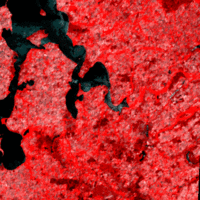
The Soviet Union and later Russia developed the RESURS satellites, which have been in orbit since 1985. They are equipped with scanners that have four channels in the visible and near infrared ranges, and one thermal infrared channel.
Since the RESURS satellites have a large coverage area of 600 km wide, the same areas are scanned at brief intervals. For example, the Equator is scanned every 4 days, while Europe is scanned every 2 or 3 days.
The sensor on these satellites has a spatial resolution of 160 m, and can therefore be used in the detailed mapping of large areas. RESURS fills a gap in the capabilities of similar sensors - those of the NOAA satellite, which cover large areas, but have a limited range of detail (a resolution of 1 km) and the Landsat and SPOT satellites, which both have limited
area coverage, but a high spatial resolution (10, 20, 30 m resolution).
RESURS is therefore very important in creating regional surveys, with Landsat and SPOT data providing high detail over smaller key areas, and NOAA providing an overview of larger areas which helps in the mapping of forest clearance, desertification, agricultural growth, snow and ice extent, floods, and forest fires at scales of 1:500,000 and 1:1.000,000.
 | |
Earth observation satellites
|
| • | Introduction (http://www.esa.int/SPECIALS/Eduspace_EN/SEM7YN6SXIG_0.html) |
|
| • | Landsat (http://www.esa.int/SPECIALS/Eduspace_EN/SEMHB04Z2OF_0.html) |
|
| • | ERS (http://www.esa.int/SPECIALS/Eduspace_EN/SEMFZ04Z2OF_0.html) |
|
| • | Envisat (http://www.esa.int/SPECIALS/Eduspace_EN/SEMR314Z2OF_0.html) |
|
| • | SPOT (http://www.esa.int/SPECIALS/Eduspace_EN/SEMIW04Z2OF_0.html) |
|
Meteorological satellites
|
| • | Meteosat (http://www.esa.int/SPECIALS/Eduspace_EN/SEM6BY3Z2OF_0.html) |
|
| • | Meteosat Second Generation (http://www.esa.int/SPECIALS/Eduspace_EN/SEMTNY3Z2OF_0.html) |
|
| • | MetOp (http://www.esa.int/SPECIALS/Eduspace_EN/SEMS1O6SXIG_0.html) |
|
| • | NOAA (http://www.esa.int/SPECIALS/Eduspace_EN/SEMDQY3Z2OF_0.html) |
|
Earth Explorer satellites
|
| • | Introduction (http://www.esa.int/SPECIALS/Eduspace_EN/SEMUYN6SXIG_0.html) |
|
| • | GOCE (http://www.esa.int/esaLP/LPgoce.html) |
|
| • | SMOS (http://www.esa.int/esaLP/LPsmos.html) |
|
| • | CryoSat-2 (http://www.esa.int/esaLP/LPcryosat.html) |
|
Commercial high resolution optical satellites
|
| • | IKONOS (http://www.esa.int/SPECIALS/Eduspace_EN/SEMI714Z2OF_0.html) |
|
| • | QuickBird (http://www.esa.int/SPECIALS/Eduspace_EN/SEMZ814Z2OF_0.html) |
|
| • | WorldView (http://www.esa.int/SPECIALS/Eduspace_EN/SEM43O6SXIG_0.html) |
|