|
Main Ecosystems
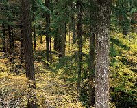
Tropical forests make up about 40% of the world’s forested area and contain about 60% of global forest biomass. South American tropical forests represent around 22% of global forest coverage. They are economically very important for trading and subsistence. There is only 4% pristine forest left of the original 100 million hectares of the Atlantic Brasilian forest. High deforestation rates are also a problem in Argentina. The subtropical Parana and Gran Chaco regions, as well as the Andean Patagonian and Austral forests are particularly affected.
The conversion of tropical forest into pasture has consequences on climate, increasing surface and soil temperatures, creating diurnal temperature fluctuations and reducing evapotranspiration. Large scale forest clearing could have negative consequences, such as the reduction in runoff of the Amazon River system.
Rangelands are made up of grasslands, shrublands, savannahs and hot and cold deserts. They cover 33% of the South American continent. Rangeland productivity and species composition are both related to a highly variable amount of seasonal distribution of precipitation.
Rangelands sustain pastoralist activities, subsistence farming and commercial ranching. Any alteration of the standing capacity of grasslands will have a huge economic impact, given the scale of livestock production in tropical and temperate grasslands.
Deserts Extremely arid deserts are those that get less than 100 mm in annual precipitation. These deserts make up a large proportion of the Peruvian, Atacama, and Patagonian regions. They are home to a significant amount of species and have a high degree of endemism. Mountain ecosystems and cryosphere Mountain chains in South America influence climate, hydrological cycles and biodiversity. Mountainous areas are exposed to extreme weather and climate phenomena, such as high or low temperatures and precipitations. The cryosphere region is composed of the Andes glaciers, Patagonia’s ice fields (47°-52°S) and the Darwin ice field in Tierra del Fuego (54°S). Seasonal snowfall on the high Andes is critical for the subsistence of communities in central Chile and large piedmont communities in Argentina, where water supply depends almost entirely on snowmelt. Hydrology, water resources and freshwater fisheries About 35% of the world’s continental waters are found in South America, but the distribution within and among countries is highly variable. Many areas like north-eastern Brasil, coastal Peru, and northern Chile have difficulty meeting their water needs. About two thirds of South America is arid or semi-arid, including large areas of Argentina, Bolivia, Chile, Peru, north-eastern Brasil, Ecuador and Colombia. Wetlands are distributed throughout the region but are more extensive in the tropical and subtropical areas. Agriculture South America has about 23% of the world’s potential arable land, but the total cropland, excluding pastures, represents less that 10% of the total area. Human settlements South America has the highest urbanisation rate in the world. Urban settlements have established themselves from sea level to mountain ranges exceeding 3,000 metres. These locations have a wide variety of geographic and topographic conditions. Migration movements are significant in some countries. Migrants usually leave rural, drought-prone areas or poverty stricken communities to go to the modern, well-developed cities. Cities offer better opportunity for employment, although a poverty belt is often built around the cities.
In mountain regions, hundreds of thousands of people live in precarious settlements on potentially unstable hillsides (e.g. Rio de Janeiro, Medellin, Sao Paulo). Favelas, barriadas and villas miseria are present in the drainage valleys of rivers and streams. Flooding and landslides have adverse effects on the welfare and health conditions of poorer communities.
Last update: 16 April 2013
| ||||||||||||||||||||||||||||||||||||||||||||