| |
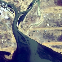
Niger Inland Delta
|
| • | Introduction (http://www.esa.int/SPECIALS/Eduspace_Global_EN/SEM4ZI05VQF_0.html) |
|
| • | Background (http://www.esa.int/SPECIALS/Eduspace_Global_EN/SEMWCK05VQF_0.html) |
|
Exercises
|
| • | Exercises using Landsat ETM data (http://www.esa.int/SPECIALS/Eduspace_Global_EN/SEMYPK05VQF_0.html) |
|
| • | Exercises using Landsat MSS data (http://www.esa.int/SPECIALS/Eduspace_Global_EN/SEMVWK05VQF_0.html) |
|
Links
|
| • | Monitoring Landcover Changes of the Niger Inland Delta (Mali) by Means of Envisat-Meris Data (pdf) (http://envisat.esa.int/workshops/meris03/participants/112/paper_meris-workshop_2003_finalversion.pdf) |
|
Eduspace - Software
|
| • | LEOWorks 3 (http://esamultimedia.esa.int/multimedia/LEOWorks3.exe) |
|
Eduspace - Download
|
| • | niger_inlanddelta.zip (http://esamultimedia.esa.int/multimedia/eduspace/niger_inlanddelta.zip) |
|
| • | landsat_mss.zip (http://esamultimedia.esa.int/docs/eduspace/landsat_mss.zip) |
|