| |
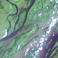
Congo River Basin
|
| • | Introduction (http://www.esa.int/SPECIALS/Eduspace_Global_EN/SEMUE0WX3RF_0.html) |
|
| • | Background (http://www.esa.int/SPECIALS/Eduspace_Global_EN/SEMYF0WX3RF_0.html) |
|
Exercises
|
| • | Exercises using Landsat ETM data (http://www.esa.int/SPECIALS/Eduspace_Global_EN/SEMZK0WX3RF_0.html) |
|
Links
|
| • | Landsat satellite program (NASA) (http://landsat.gsfc.nasa.gov) |
|
Eduspace - Software
|
| • | LEOWorks 3 (http://esamultimedia.esa.int/multimedia/LEOWorks3.exe) |
|
Eduspace - Download
|
| • | congo_riverbasin.zip (http://esamultimedia.esa.int/multimedia/eduspace/congo_riverbasin.zip) |
|
| • | Technical information about Landsat bands (PDF) (http://esamultimedia.esa.int/docs/eduspace/Technical_data_LANDSAT_bands.pdf) |
|