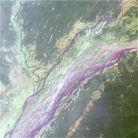
The Congo Basin is known for both its enormous diversity of unique flora and fauna and its deposits of rare mineral resources such as coltan, which is used, for example, in mobile phone batteries. Unfortunately, decades of political instability have left their mark on the whole region.
The exploitation of these natural resources is a threat to the Congo's entire natural environment. Illegal deforestation is a particularly serious problem. Felling harms the rainforest, not just because of the logging itself, but also because the building of roads necessary for the removal of the timber destroys large parts of the unique forest and gives poachers an easy entrance into the dense bush.
Satellite images can help in the observation of the process of sustainable cultivation and in the identification of illegal land use, deforestation, and slash and burn methods. Furthermore, the satellite images can be used for locating environmentally acceptable routes for the transport of legal logging, or areas suitable for afforestation or cultivation.
 | |
Congo River Basin
|
| • | Background (http://www.esa.int/SPECIALS/Eduspace_Global_EN/SEMYF0WX3RF_0.html) |
|
Exercises
|
| • | Worksheet introduction (http://www.esa.int/SPECIALS/Eduspace_Global_EN/SEMKH0WX3RF_0.html) |
|
| • | Exercises using Landsat ETM data (http://www.esa.int/SPECIALS/Eduspace_Global_EN/SEMZK0WX3RF_0.html) |
|
Links
|
| • | Landsat satellite program (NASA) (http://landsat.gsfc.nasa.gov) |
|
Eduspace - Software
|
| • | LEOWorks 3 (http://esamultimedia.esa.int/multimedia/LEOWorks3.exe) |
|
Eduspace - Download
|
| • | congo_riverbasin.zip (http://esamultimedia.esa.int/multimedia/eduspace/congo_riverbasin.zip) |
|
| • | Technical information about Landsat bands (PDF) (http://esamultimedia.esa.int/docs/eduspace/Technical_data_LANDSAT_bands.pdf) |
|