
|
Exploradores da Terra da ESA GOCE 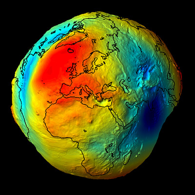 The GOCE (Gravity field and steady-state Ocean Circulation Explorer) mission will measure high-accuracy gravity gradients and provide a global model of the Earth's gravity field and of the geoid. The geoid (the surface of equal gravitational potential of a hypothetical ocean at rest) serves as the classical reference for all topographical features. The accuracy of its determination is important for surveying and geodesy, and in studies of Earth interior processes, ocean circulation, ice motion and sea-level change. SMOS 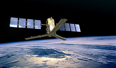 SMOS (Soil Moisture and Ocean Salinity), an ESA Earth Explorer satellite, was launched into orbit from the Plesetsk Cosmodrome in northern Russia on Monday 2 November 2009. CryoSat-2 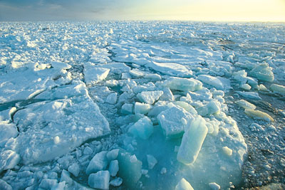 The polar oceans each year experience the formation and then melting of vast amounts of sea ice. At the North Pole, an area the size of Europe melts every summer and then freezes again the following winter. The thickness of this sea ice plays a central role in polar climate because it moderates heat transport by insulating the ocean from the cold polar atmosphere. |