
|
Exercise 1: Sea Level Height 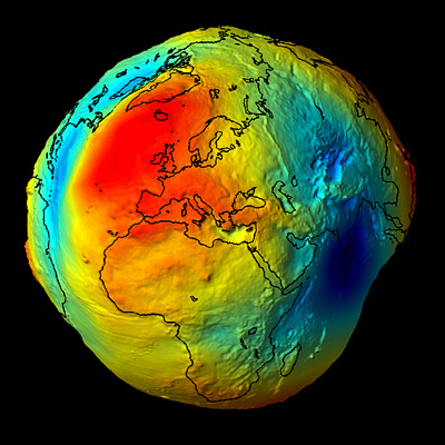 The Gravity field and steady-state Ocean Circulation Explorer (GOCE) mission is designed to measure high-accuracy gravity gradients and provide a global model of Earth's gravity field andgeoid.
The geoid (the surface of equal gravitational potential of a hypothetical ocean at rest) serves as the classical reference for all topographical features. The accuracy of its determination is important for surveying and geodesy, and in studies of Earth interior processes, ocean circulation, ice motion and sea-level change. |