| |
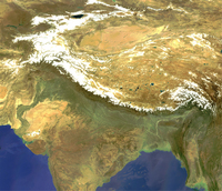
Himalaya
|
| • | Background (http://www.esa.int/SPECIALS/Eduspace_Weather_EN/SEM7XXJTYRF_0.html) |
|
Exercises
|
| • | Introduction (http://www.esa.int/SPECIALS/Eduspace_Weather_EN/SEMZYXJTYRF_0.html) |
|
| • | Manual exercises (http://www.esa.int/SPECIALS/Eduspace_Weather_EN/SEM17YJTYRF_0.html) |
|
| • | Study of water vapour in the atmosphere (http://www.esa.int/SPECIALS/Eduspace_Weather_EN/SEMY9ZJTYRF_0.html) |
|
| • | The summer monsoon and its floods (http://www.esa.int/SPECIALS/Eduspace_Weather_EN/SEM9EZJTYRF_0.html) |
|
Links
|
| • | Meteosat images (http://www.eumetsat.int) |
|
| • | Weather broadcast worldwide (http://weather.edition.cnn.com/weather/intl/forecast.jsp) |
|
| • | Climate system (http://www.espere.net/index.html) |
|
| • | CARE (http://www.careinternational.org.uk/) |
|
| • | DLR - Basemapping
of Dhaka (http://www.zki.caf.dlr.de/applications/2004/bangladesh/bangladesh_flood_2004_en.html) |
|
Eduspace - Software
|
| • | LEOWorks 3 (http://esamultimedia.esa.int/multimedia/LEOWorks3.exe) |
|
| • | ArcExplorer (http://esamultimedia.esa.int/multimedia/eduspace/ae2setup.zip) |
|
Eduspace - Download
|
| • | Climate zones (PDF) (http://esamultimedia.esa.int/docs/eduspace/climatezones.pdf) |
|
| • | Climate diagrams (PDF) (http://esamultimedia.esa.int/docs/eduspace/Diagramm.pdf) |
|
| • | Temperature and precipitation diagrams (PDF) (http://esamultimedia.esa.int/docs/eduspace/himalaya_climate_temperature.pdf) |
|
| • | Ready-made diagrams (PDF) (http://esamultimedia.esa.int/docs/eduspace/Diagramm_fill.pdf) |
|
| • | Himalayas water vapour images (ZIP) (http://esamultimedia.esa.int/docs/eduspace/MERIS_WV_2003.zip) |
|
| • | SPOT XS images of Bangladesh (ZIP) (http://esamultimedia.esa.int/docs/eduspace/flood88.zip) |
|
| • | Landsat images of Bangladesh (ZIP) (http://esamultimedia.esa.int/docs/eduspace/ganges1989_2000.zip) |
|
| • | Shape files for Bangladesh (ZIP) (http://esamultimedia.esa.int/docs/eduspace/shapes_bangladesh.zip) |
|
| • | Map of climate zones (http://www.esa.int/images/climatemap,0.jpg) |
|