
Mars Express peers into Mars' 'Grand Canyon'
The latest image release from ESA’s Mars Express takes us over two ruptures in the martian crust that form part of the mighty Valles Marineris canyon system.
Valles Marineris cuts across Mars like the Grand Canyon cuts across the United States, except the latter is miniscule in comparison. At 4000 km long, 200 km wide and up to 7 km deep, Valles Marineris is almost ten times longer, 20 times wider and five times deeper than the Grand Canyon. As the largest canyon system in the Solar System, it would span the distance from the northern tip of Norway to the southern tip of Sicily.
There’s another big difference between the two: whilst the Grand Canyon was formed as the Colorado River eroded away rock, Valles Marineris is thought to have formed because of extension (stretching) of the crust, associated with the rise of the nearby Tharsis plateau and its volcanoes. This 'crack' in the crust subsequently widened through erosion.
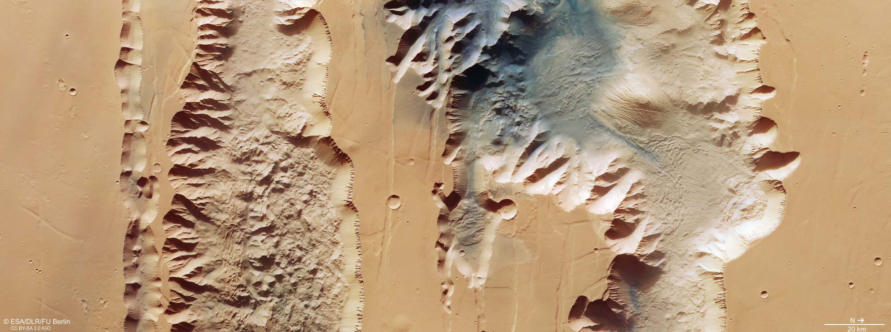
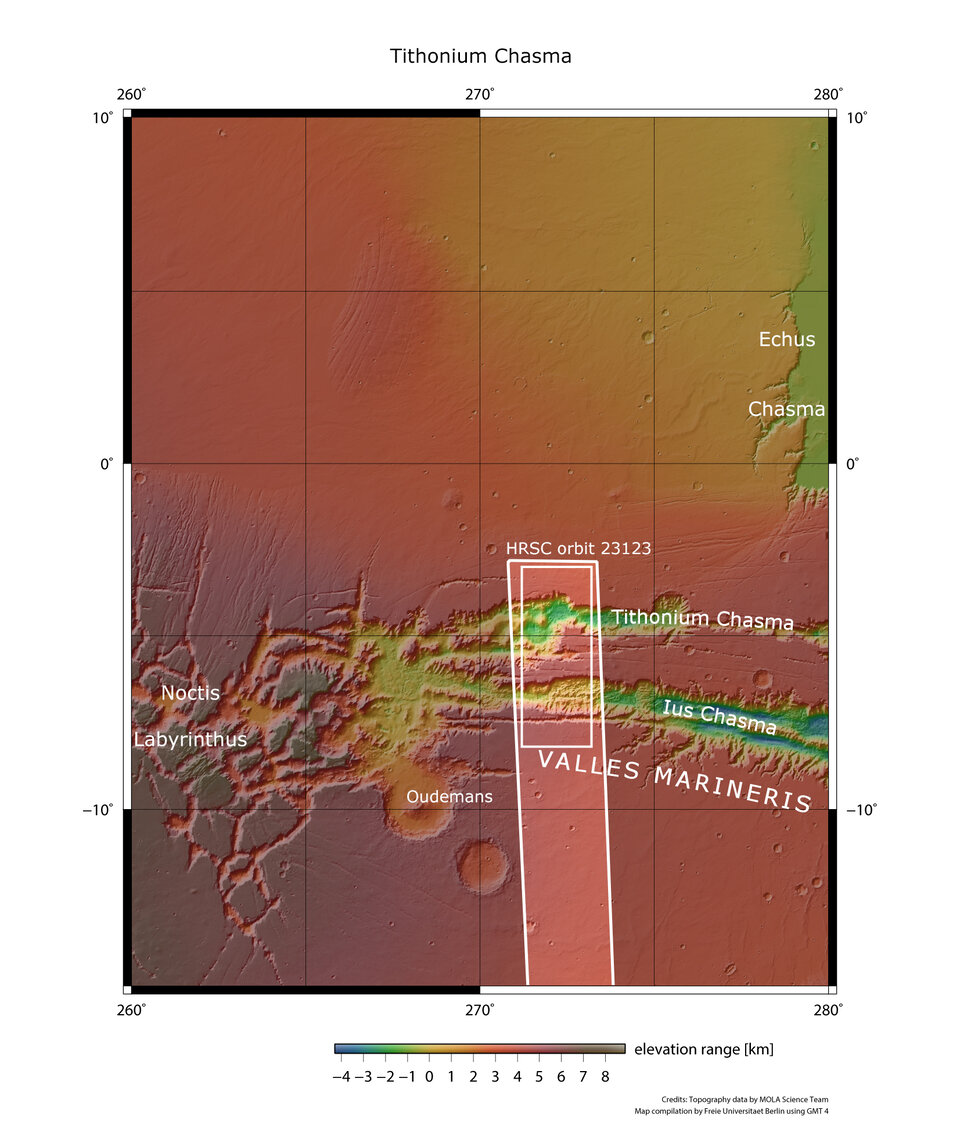
The image shows two trenches (or chasma) that form part of western Valles Marineris. On the left (south), is the 840 km-long Ius Chasma, and on the right (north) is the 805 km-long Tithonium Chasma. Whilst these high-resolution images show incredible surface detail, it is only when we look at an elevation map (see above) that we realise how spectacularly deep the chasmata are – up to 7 km! At 4809 m, the Alps’ tallest mountain Mont Blanc would be dwarfed if it was put inside Tithonium Chasma.
At the top of Tithonium Chasma, a patch of dark sand brings colour contrast to the image. This sand may have come from the nearby Tharsis volcanic region.
Next to the dark sand dunes are two light-toned mounds (one cut in half by the upper image border). These ‘mounds’ are more like mountains, rising more than 3000 metres in height. Their surfaces have been strongly eroded by Mars’ strong winds, indicating that they are made of a weaker material than the surrounding rock.

Between the two mounds we see a series of smaller bumps, as shown in the second perspective view. Investigations by Mars Express have found water-bearing sulphate minerals in this region. This suggests that these bumps may have formed when liquid that once filled the chasma evaporated, although this theory is still hotly debated.
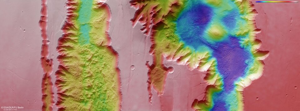
To the lower right of the mound that we see fully (upper right in the second perspective view), we can see parallel lines and debris piles that indicate a recent landslide. This is also visible as a large purple area in the topography image below. The landslide was caused by the collapse of the canyon wall on the right, and is likely to have occurred relatively recently because it has not been strongly eroded.
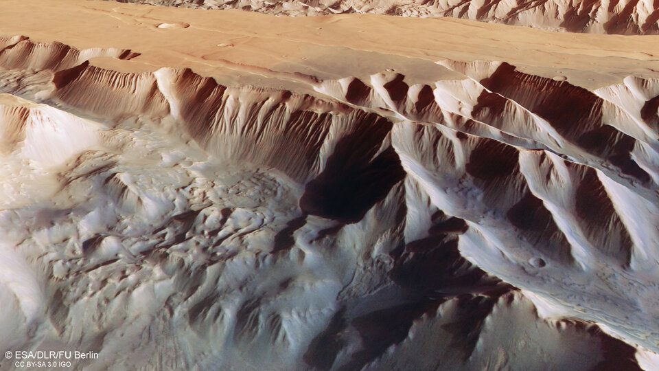
The gnarly floor of Ius Chasma is equally fascinating. As the cracked crust continued to widen through erosion and the uplift of Tharsis, it appears to have caused jagged triangles of rock to form that look like a row of shark teeth. Over time, these rock formations have collapsed and eroded.

Exploring Mars
Mars Express has been orbiting the Red Planet since 2003, imaging Mars’ surface, mapping its minerals, identifying the composition and circulation of its tenuous atmosphere, probing beneath its crust, and exploring how various phenomena interact in the martian environment.
The mission’s High Resolution Stereo Camera (HRSC), responsible for these new images, has revealed much about Mars’ diverse surface features, with recent images showing everything from wind-sculpted ridges and grooves through impact craters and channels that once carried liquid water to volcanoes, tectonic faults, river channels and ancient lava pools.