Mysteries in Nili Fossae
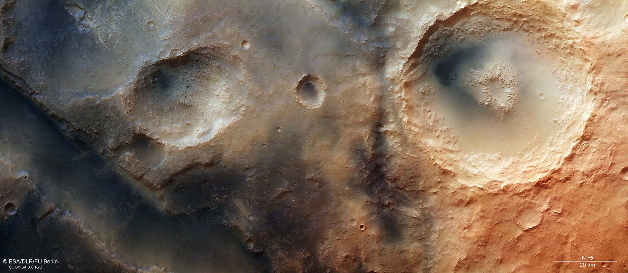
These new images from the high-resolution stereo camera on ESA’s Mars Express show Nili Fossae, one of the most enticing regions on Mars. This ‘graben system’ lies northeast of the volcanic region of Syrtis Major on the northwestern edge of the large Isidis impact basin – and intriguing hints of methane have been seen here.
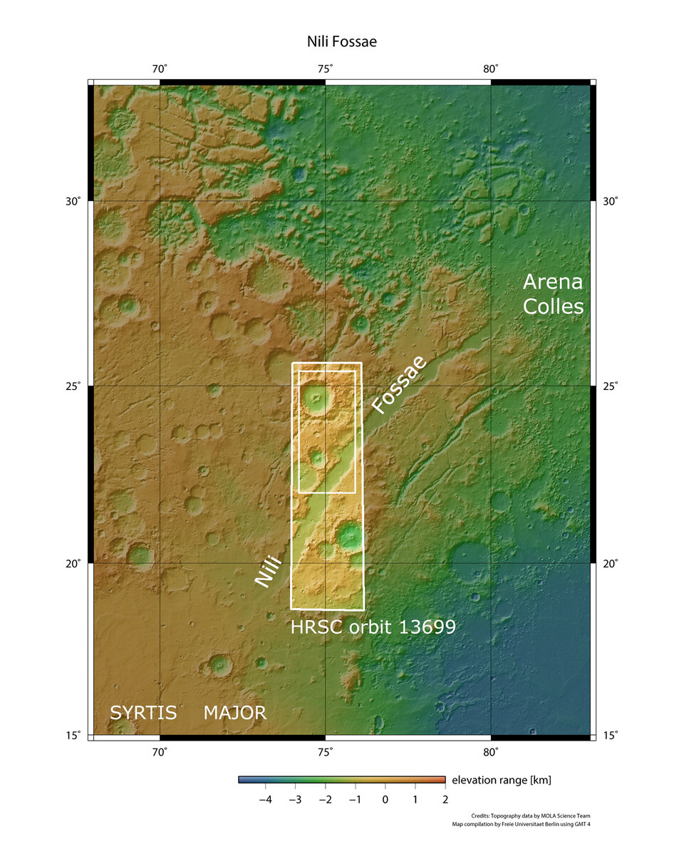
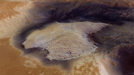
Grabens are blocks of land that have fallen between parallel faults, sometimes forming rift valleys. The graben system in Nili Fossae contains numerous troughs oriented concentrically around the edges of an impact basin, as can be seen in the context map.
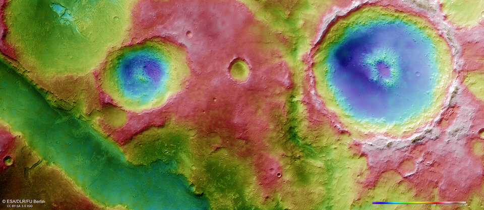
The easternmost of these troughs is partially visible at the lower left of the images. It is perhaps most obvious as a depression in the topography map from Mars Express.
The graben is most likely associated with the formation of the Isidis impact basin. Flooding of the basin with basaltic lava may have resulted in subsidence, which added stress to the planet’s crust and was then released through fracturing and trough formation.
Mars Express and other spacecraft have shown that the region displays a fascinating mineral diversity, drawing the attention of many planetary scientists. The minerals include phyllosilicates (clays), carbonates and opaline silica. These indicate a diverse history for this area resulting from the huge geological and tectonic forces that have been at play.

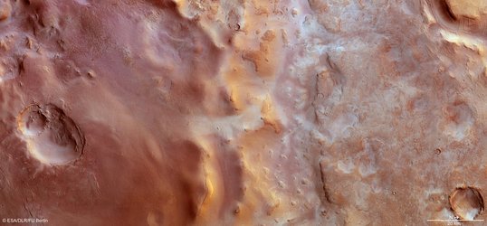
Water has played an important role here, too. The visible trough’s flanks are very steep (see the topography map) and some layered materials can be spotted at the walls. On the plateau, several depressions can be observed. Some of them appear to extend into the trough and show a resemblance to small ‘sapping valleys’.

Sapping valleys develop when groundwater removes material from underneath the surface. This gradually relocates the spring line further upstream, carving a valley in the process.
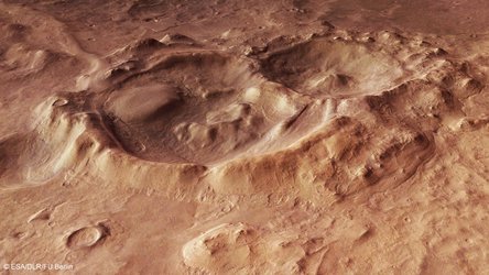
The images also contain evidence for percolating hydrothermal fluids in the subsurface of the region. A large, 55 km-diameter impact crater with a central pit is clearly seen in the main colour, topography and 3D images. The pit is believed to have been excavated when water or ice, trapped below the surface, was rapidly heated by the impact that shaped the crater. The sudden heating caused a violent steam explosion that either weakened the rocky surface, leading to its collapse, or it may even have blasted it away, leaving the rocky hole and rocky debris.
In addition to the variety of interesting geological features, Nili Fossae is of particular interest because it is a site where atmospheric methane may have been detected by Earth-based telescopes. Methane may be produced here, but its origin remains mysterious, and could be geological or perhaps even biological.
There is certainly a huge amount to study here. Nili Fossae was on the shortlist of landing sites for NASA’s Curiosity rover, even though ultimately the choice was made to send the robotic explorer to Gale Crater.