
Emergency services
Earthquakes, tsunamis, wildfires, floods, storms and industrial accidents can claim human lives and cause serious damage to property all over the world.
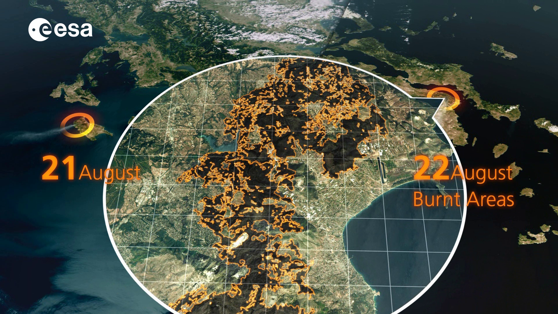
The Copernicus Emergency Management Service (EMS) aims to reinforce Europe's capacity to respond to emergency situations, be they caused by extreme weather, geophysical hazards such as earthquakes, manmade disasters such as oil spills and humanitarian crises.
EMS has been operational since April 2012 within GMES Initial Operations (GIO). It supports all phases of the emergency management cycle: preparedness, prevention, disaster risk reduction, emergency response and recovery. The service is provided free of charge and can be activated by authorised users such as national civil protection authorities.
The service can be provided in:
- 'rush' mode, for emergency management activities that require immediate response. This is available on a 24/7 basis and products are provided as soon as possible (from a few hours to a few days after the user request)
- 'non-rush' mode, to support activities that do not require immediate response, i.e. for prevention, preparedness, disaster risk reduction and recovery phases.
The service builds on a series of projects developed within the EC Framework Programmes 6 and 7 (FP6/FP7) and on ESA’s GMES Service Element (GSE) projects such as Risk EOS, Respond and Terrafirma.
The emergency services and projects are based on the provision of satellite imagery from the Sentinels and the contributing missions that are made available through the Space Component Data Access system operated by ESA since 2008.

Access the video
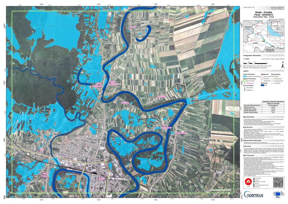
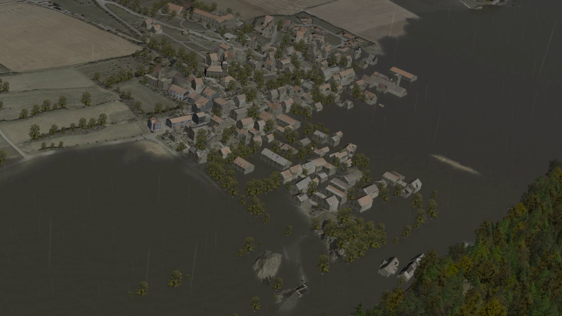
Sentinel-1 SAR imagery provides a major contribution for precise terrain deformation monitoring over landslide, seismic or subsidence areas by providing regular and frequent interferometric observations (every 12 days). It can also support impact assessment analyses for many types of hazard including hydro-meteorological and geological events by, for instance, providing rapid and wide-extent observations of plain flooding.
Wide swath Sentinel-2 data can support the buildup and frequent update of globally consistent background reference maps to be used for impact assessments. It also contributes monitoring land-use change that triggers erosion, forest and wildfires, and slow onset floods.
Sentinel-3 can complement activities where systematic monitoring is at stake (e.g. worldwide wildfire detection).
The EMS mapping service also collaborates with the International Charter Space and Major Disasters for major crises outside the EU area. An agreement has been set up to exploit the advanced crisis mapping capability of the EMS to support Charter requests pertinent to European policy sectors.


