Lava deposits in Mangala Fossae
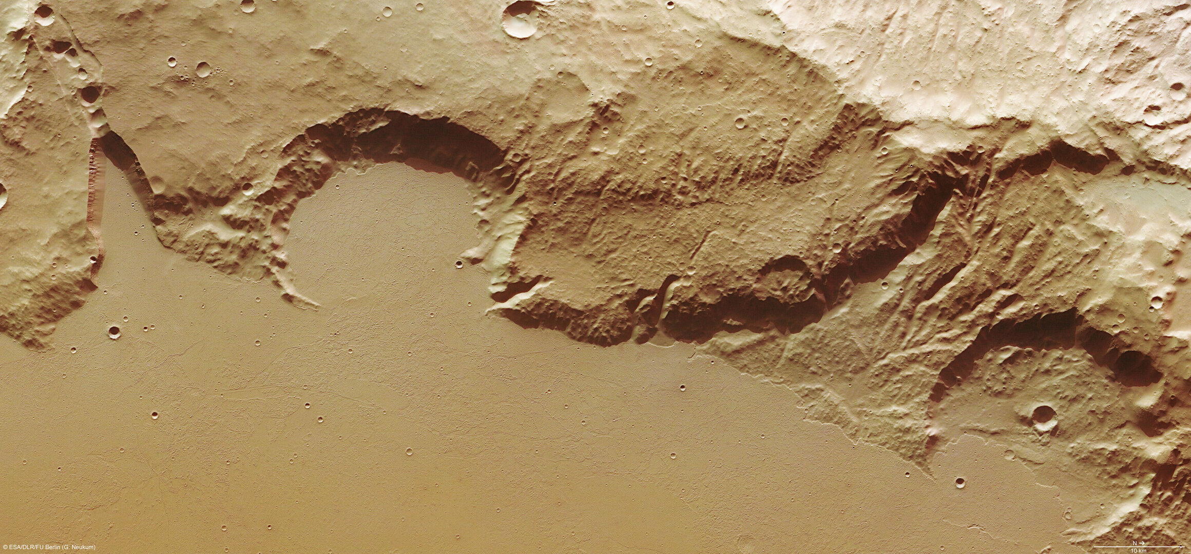
The High Resolution Stereo Camera obtained images of the Mangala Fossae trough, a system of outflow channels on Mars that bears evidence of lava deposition and catastrophic floods.
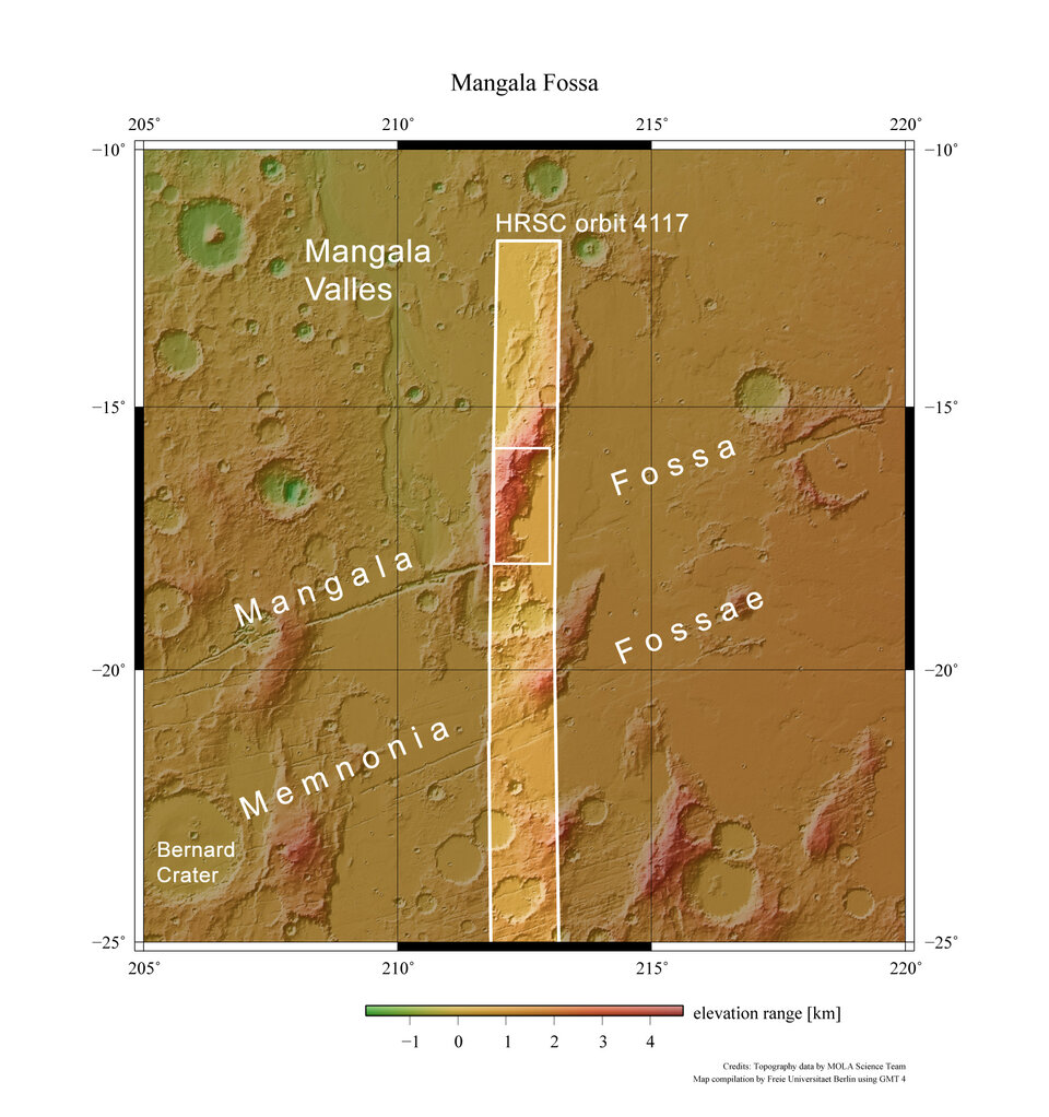
Mangala Fossae lies at approximately 17° south and 213° east. The region is approximately 1000 km long, located south-west of the volcanic region Tharsis, where the highest known volcano in the Solar System, Olympus Mons, is located. The images were obtained on 21 March 2007.
The large outflow channels were most likely formed due to sudden flash floods during which large amounts of water were mobilised underground. This may have been triggered by heat from magma that arose in the Mangala Fossae region, melting and discharging enormous amounts of frozen groundwater.
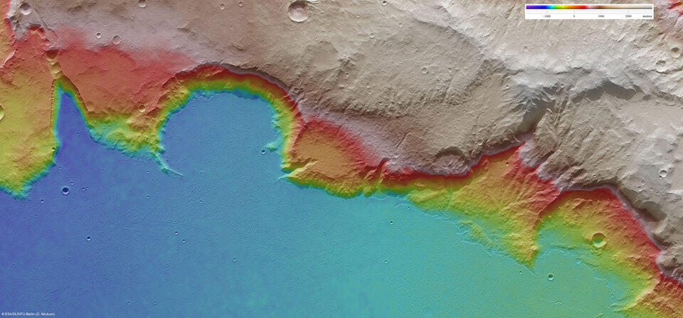
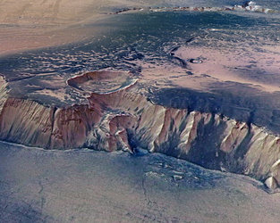
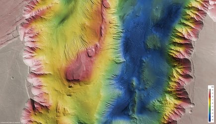
The images show a section of the southern end of Mangala Fossae, which may have been the catchment area of Mangala Valles.

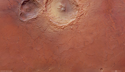
The western part of the region is remarkably smooth and exhibits just a few small impact craters, larger craters being absent. Since the crater count relates directly to the age of the region (the more the number of craters, the older the uppermost layer of material), and only few small craters are seen in the area, this indicates that the uppermost surface layer is young and that the basaltic lava was put in place relatively recently.

The lava flows most likely originated in the Tharsis Region located to the north-east of Mangala Fossae. Sharp edges of the 100-m thick lava blanket are visible in some places.

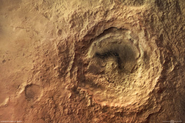
The flanks of two 30-km large impact craters were eroded during the floods and were later partially filled by lava. This indicates that the craters are older than the channel system and the lava blanket.
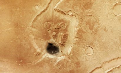
The upper-left of the image shows a number of funnel-shaped depressions lined up parallel to the slope inclination. These features most likely formed when the surface material collapsed into small cavities.
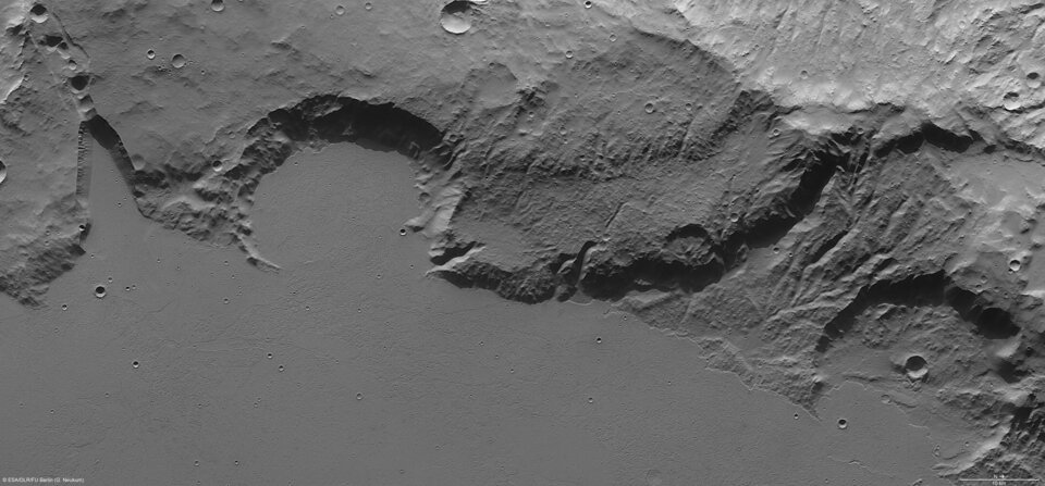
The colour scenes have been derived from the three HRSC-colour channels and the nadir channel. The perspective views have been calculated from the digital terrain model derived from the stereo channels. The anaglyph image was calculated from the nadir channel and one stereo channel. The black and white high-resolution images were derived form the nadir channel which provides the highest detail of all.