ERS-2 displays slick threatening Swedish coast
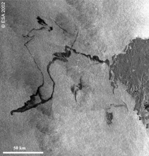
A 39 sq km oil slick produced by the sinking of a Chinese freighter threatened the southern coast of Sweden last week. As the glistening oil headed landward ESA's ERS-2 satellite used its SAR radar instrument to image the slick.
Freighter Fu Shan Hai collided with another ship north of the Danish island of Bornholm in the Baltic Sea, around local noon on Saturday 31 May. The crew made it off safely but as the ship settled 68 metres underwater more than 100 tonnes of oil began streaming from its breached hull, and currents carried the oil towards Sweden.
This 100-km swath ERS-2 SAR image was taken on the evening of Monday 2 June, and shows the oil slick poised ominously close to Sweden's south coast, on the bottom right of the image.
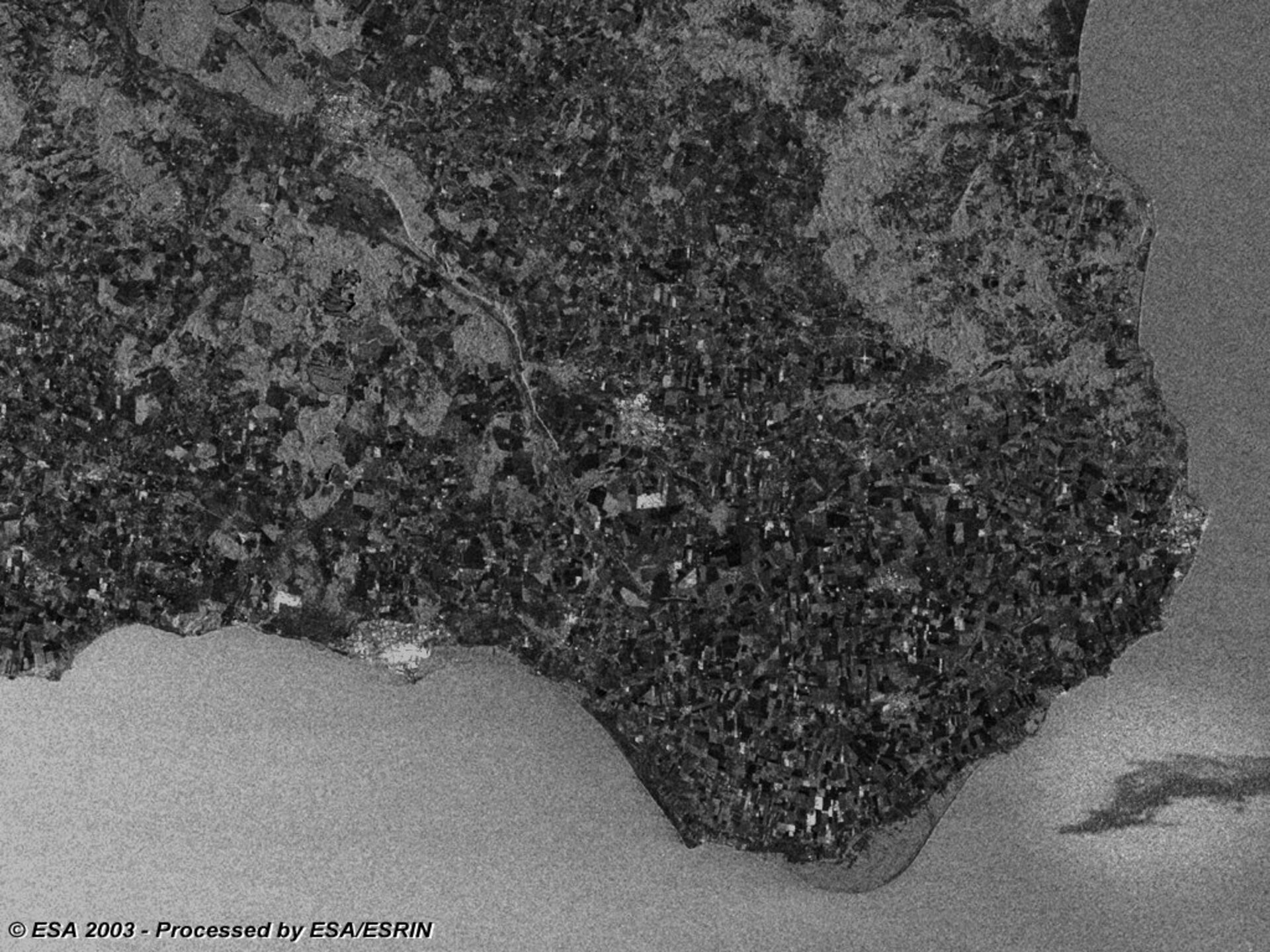
Unlike a conventional visual picture, SAR images record the relative roughness of different surfaces. This makes them especially useful for charting oil spills – a capability well demonstrated during the much larger Galicia oil spill off Spain last autumn – because oil has a smoother surface than water, and so shows up blacker. On land it can also be seen how the SAR distinguishes between different vegetation types across Swedish farmland.
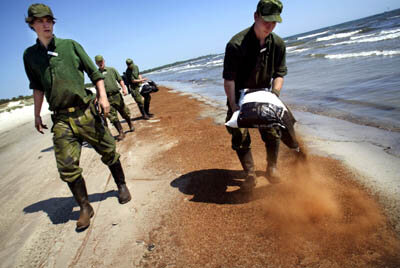
Local authorities responded quickly to the threat, and six oil containment ships from Denmark, Sweden and Germany succeeded in skimming much of the oil up before it reached the coast. Hundreds of people helped clear up what oil did make it ashore.
The sunken freighter poses no threat to shipping – upwards of 160 000 craft use the Danish straits annually – but as well as its cargo of 66 000 tons of fertiliser, the ship retains another 1600 tons of oil aboard which might still leak out.
ESA plans to carry out follow up imaging of the area starting next Wednesday 11 June, using Envisat's ASAR instrument as well as ERS-2. These images will be placed at the disposal of civil protection authorities if needed.
For more information on the current and upcoming activities of ESA's Earth Observation satellites, go to http://earth.esa.int/ew/planning