Preparing for data from SMOS
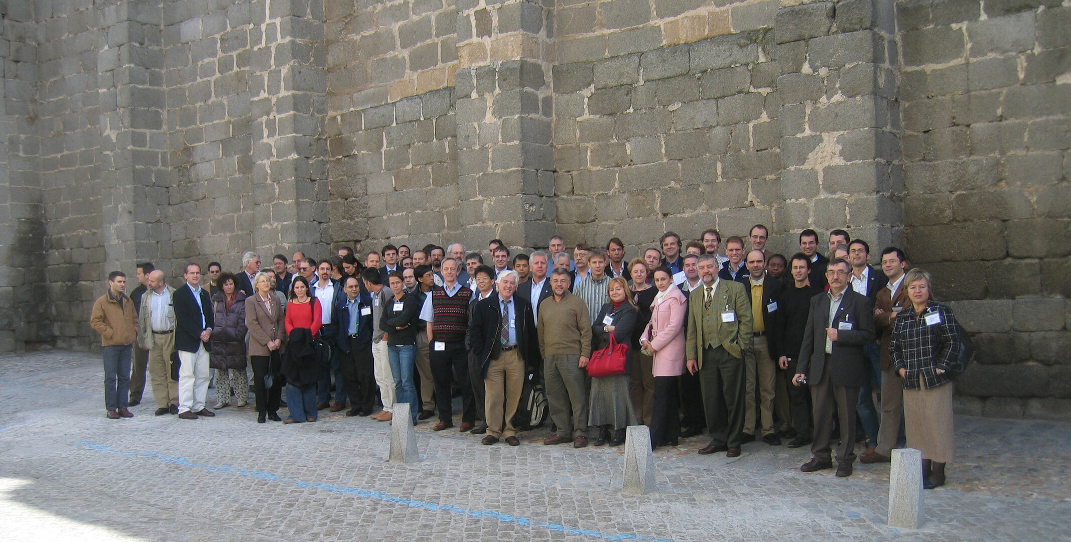
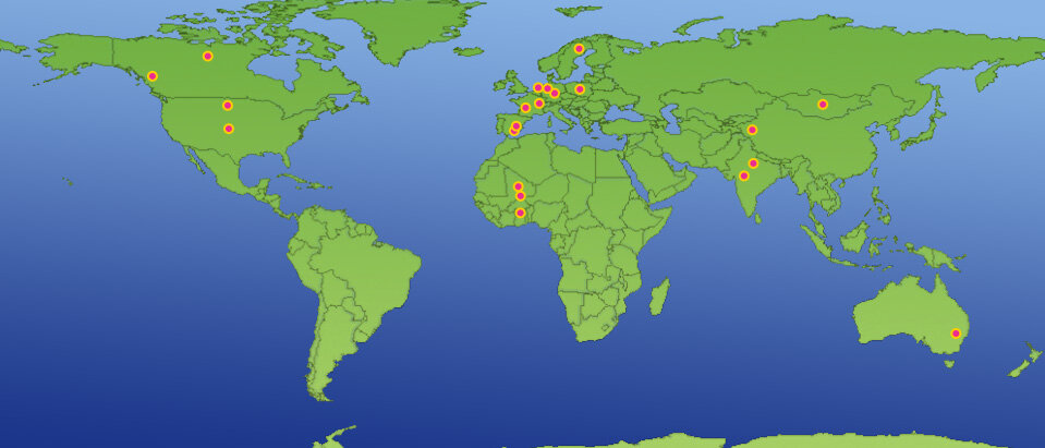
Around 60 scientists from all over the world recently gathered for the first time to prepare for when ESA's Soil Moisture and Ocean Salinity mission releases its first data. The SMOS Validation and Retrieval Team met in Avila in Spain for the 4-day meeting to discuss how best to ensure that the eventual data from the mission is as accurate as possible.
The scientists attending the meeting were selected following an Announcement of Opportunity released by ESA earlier this year and the team's first meeting marks an important step in the progress of the SMOS mission due for launch in 2007.
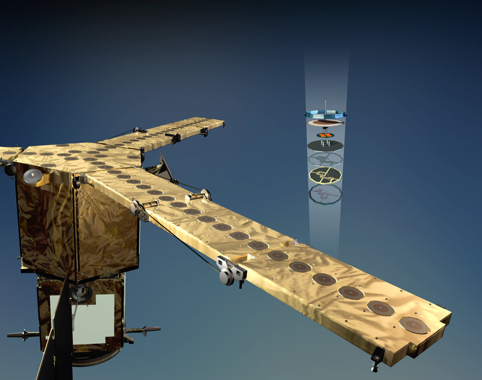
Whilst the instrument is thoroughly calibrated on the ground prior to launch, the actual in-orbit configuration still holds a number of possible uncertainties; for example, will the antenna patterns have changed due to the rigors of launch? Is the temperature distribution between the 69-licef receivers really as it was when modelled on the ground? Do radiation, solar heating and the Earth's albedo have an effect on the measurements? These are all important questions that cannot be fully answered before launch. Also, while ground-based or airborne instruments can be regularly recalibrated this can't be done for an instrument in space. In fact, the calibration equipment on board the spacecraft is subject to the same environmental stress as the instrument itself leading to another area of uncertainty.
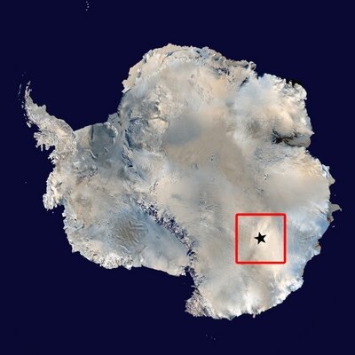
Therefore, it is important to validate the SMOS data by comparing it with data taken on the ground or from the air over spatially and temporally stable sites – referred to as 'vicarious calibration'. These areas include the Taklimakan desert in northern China, and the vast homogeneous ice field at Dome Concordia in Antarctica, which is well suited for extended calibration activities relating to space-borne radiometer missions.
Another major issue that the SMOS Validation and Retrieval Team will deal with is how the data from SMOS is processed. Initially, all the internal calibration measurements should take account of temperature effects, fluctuations etc. The result of this first processing is the 'L-band brightness temperature' as a function of the observation geometry and the polarisation of the measurements. However, in order to arrive at the final information, namely, soil moisture data over land and salinity over the oceans, numerous external data are needed. These data include soil type, vegetation type and density, surface temperature for soil moisture, sea-surface temperature and surface roughness for salinity. All these measurements, which will come from other satellites or geophysical maps, are not error-free – so the big question is how do these errors affect the final accuracy of the SMOS data?
This is where validation comes into play. One common means of stating that a data product is 'valid' is to compare it with independently acquired reference measurements. This can be by way of probing large areas with instruments that measure moisture, or measuring salinity from buoys or meteorological platforms in the oceans. The tricky thing is then to asses to what degree these relatively local measurements compare to measurements made from space with a spatial resolution in the order of 25-50 km. For this, the scientific community has developed techniques for scaling from point measurements to large areas, by, for example, using airborne measurements taken from different altitudes.
All these points were the subject of intense discussion at the meeting in Avila last week and form the starting point of a very busy period in preparing for the launch of the SMOS mission. To properly prepare for the mission's new sensor technology and retrieval approaches, many of the proposed calibration and validation activities will take time to implement. Large areas, later to be observed by the satellite, will need to be set up with many probes, instrumentation has to be prepared to operate in remote deserts and ice fields, aircraft have to be equipped for remote sensing campaigns and so on.

However, the first step has been taken and the project looks forward to the next steps in making sure that SMOS will deliver reliable data on soil moisture and ocean salinity to further our understanding of the Earth's water cycle and improve climate, weather and extreme-event forecasting.