SMART-1 impact: last call for ground based observations
If you are a professional or amateur astronomer and want to contribute to the final phase of the SMART-1 mission, join ESA on the impact ground observation campaign.
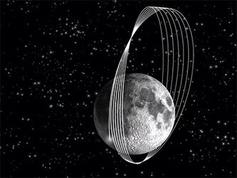
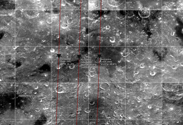
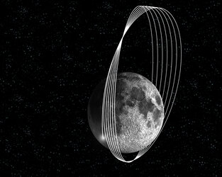
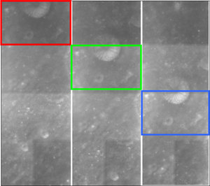
Like most of its lunar predecessors, SMART-1 will conclude its scientific observations of the Moon through a small impact on the lunar surface. This is planned to take place in the lunar Lake of Excellence, located at mid-southern latitudes. A trim manoeuvre at the end of July has determined that the impact will most likely occur on 3 September 2006 at 07:41 CEST (05:41 UT), or at 02:36 CEST (00:36 UT) on the previous orbit due to uncertainties in the detailed knowledge of the lunar topography.
If impacting on 3 Sept at 07:41 CEST, SMART-1 will touch the Moon at the lunar coordinates 36.44º South and 46.25º West. If impacting on 3 September at 02:36 CEST the lunar coordinates will be 36.4º South and 43.5º West.
The Lake of Excellence is very interesting from the scientific point of view – it is a volcanic plain area surrounded by highlands, but also characterised by ground mineral heterogeneities.
“We call for ground-based observations mostly to study impact physics, the release of spacecraft volatiles, and the lofted soil mineralogy,” says Bernard Foing , SMART-1 Project Scientist at ESA. “We look for fast imaging of the impact and of the associated ejected material, and for spectroscopic analysis, for example to find hints about the mineralogy of the impact area.”
“Even if the impact at 2 kilometres per second is of modest energy, the plume might be observable if it reaches sunlight, with an amateur telescope or binoculars,” continues Foing. “For sites not covering the time of impact, we ask for context observations before and after impact to look for the ejecta blanket”.
A number of worldwide observatories have already confirmed their participation to the campaign. They include the network of VLBI Very Long Baseline Interferometry and radio observatories, the South African Large Telescope SALT, the Calar Alto observatory in Andalucia, Spain, the ESA OGS Optical Ground Station at Tenerife, Spain, the CEA Cariri observatory in Brazil, the Argentina National Telescope, the Florida Tech Robotic telescopes, NASA IRTF and Japanese telescopes at Hawaii, as well as a number of professional and amateur astronomy telescopes around the world, and the ODIN observatory from space.
ESA invites the scientific community and amateur astronomers to join in the observation campaign. For more information follow this link.
For more information
Bernard Foing, ESA SMART-1 Project Scientist
Email: Bernard.Foing @ esa.int