FAO workshop highlights sharing of satellite data
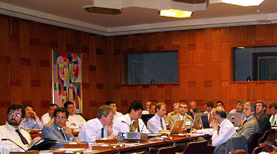
Some 50 scientists and engineers gathered at the United Nations’ Food and Agriculture Organisation headquarters in Rome, Italy, on 27 April for a workshop to discuss the use of gathering, cataloguing and sharing satellite imagery, spatial databases and interactive maps.
The amount of data acquired by satellites is increasing at an exponential rate, with many images able to be used for numerous applications. Sharing and reusing these data are beneficial for organisations as it allows them to gain access to more information and to decrease costs. In order to share, the data must be collected and catalogued and users must know such collections exist and how to search for them.
The Catalogue/Discovery Services Standardisation workshop – organised jointly by ESA, the Food and Agriculture Organisation (FAO) and the Joint Research Centre (JRC) – highlighted current and future standardisation efforts of each agency that is making Earth observation (EO) data available to users together with the relevant geospatial data.
Opening the workshop, FAO Assistant Director-General Alexander Julius Müller said: "Whereas FAO has a record of longstanding and productive cooperation with both the European Space Agency as well as the EU-Joint Research Centre, this is the first time the three agencies meet in one room for a full day to review and discuss common experiences and ways forward to use standardized approaches for locating and using geospatial data."
Maps derived from satellite imagery play an important role in the work of decision makers, sustainable development planners and humanitarian and emergency managers in need of quick, reliable and up-to-date user-friendly cartographic products as a basis for planning and monitoring their activities.
Global Monitoring for Environment and Security (GMES), a joint initiative of the European Commission and ESA, will harmonise in-situ and space-based data to provide timely and quality data at global, regional and local levels. GMES will join all available scientific data on environmental and security issues and customise it to users’ specific needs.
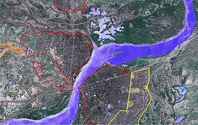
GMES will be of great value throughout the developing world because it is able to provide infrastructure information which may not otherwise exist. For instance, by providing and disseminating high-quality data sets of road networks, ports and airstrips, agencies will be able to better deliver food aid.
JCR’s Infrastructure for Spatial Information in Europe (INSPIRE), a proposed directive of the European Commission, will deliver integrated spatial information services to the largest possible number of users, including policy-makers, planners and managers at national and local levels and citizens. Such services include visualisation of information layers, overlay of information from different sources, spatial and temporal analysis, among others. JRC’s INSPIRE team and ESA are working together to ensure coherence of INSPIRE and GMES developments.
In September 2005, the ESA launched the “Heterogeneous Mission Accessibility -Interoperability (HMA-I) Project”. HMA-I will define the necessary interfaces and a generic, service-oriented architecture to ensure interoperability within the GMES Space component comprising a constellation of satellites together with its Ground Segment and the interfaces to the other components of GMES.
Thanks to the HMA project, the interoperability of ESA’s Envisat, the European Organisation for the Exploitation of Meteorological Satellites’ (EUMETSAT) meteorological missions, the French Space Agency’s (CNES) Pleiades, the Canadian Space Agencies Radardsat-2 and the German Space Agency’s (DLR) Terrasar-x will be ensured to provide the EO data necessary to allow an operational rollout of the GMES services starting in 2008.