Plan to combine an armada of satellites to map Earth's land
A new ESA office opening this week in the 'Green Heart' of Germany will serve as a focus for an ambitious project to create a continuously updated map of global land surfaces using observations from space.
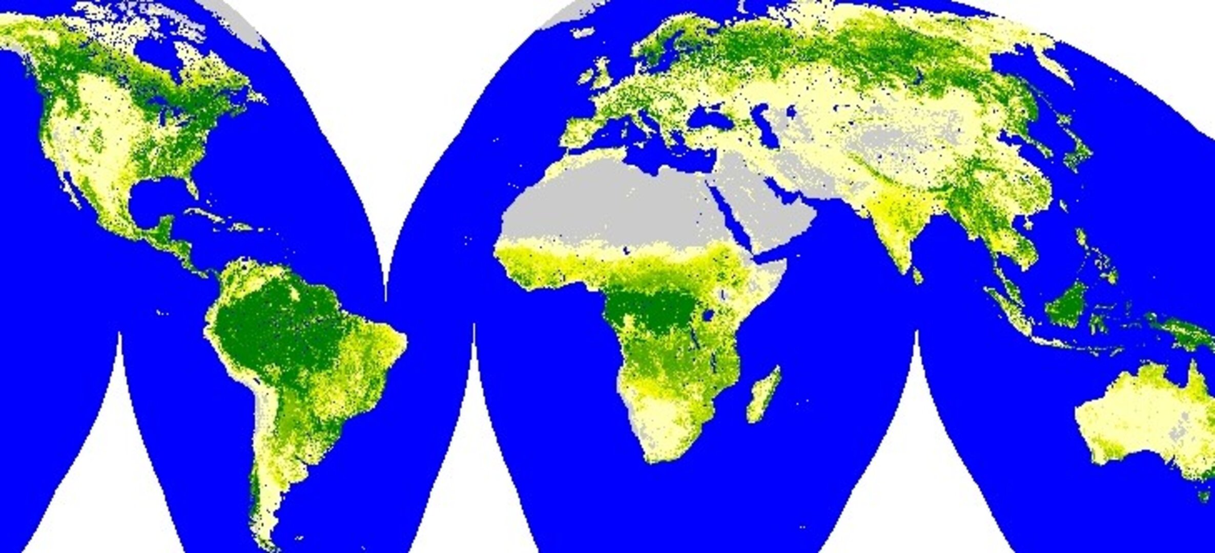
Global Observation for Forest and Land Cover Dynamics (GOFC/GOLD) is a co-ordinated international effort to provide ongoing observations of land cover types.
Its aim is to support sustainable development of terrestrial resources as well as improve scientific understanding of how carbon is stored on land surfaces and in particular within forests – important for anticipating how alterations in land use could accelerate future climate.
Implementing GOFC/GOLD requires action in a number of different fields, and one of the most important is to develop standardised methods, tools and products for land cover measurements using space-based plus in-situ observations.
Achieving this within an operational system is the purpose of the ESA GOFC/GOLD Land Cover Implementation Team Project Office, located at the Geoinformatics Department of Friedrich Schiller University in Jena, nestled within Germany's Thuringian Forest.
A three-day GOFC/GOLD Workshop at Jena starting 2 March has marked the formal opening of the office, with attendees including GOFC/GOLD participants from all over the planet as well as Earth Observation experts and attendees from partner organisations including the United Nations Food and Agriculture Organisation, ESA and the European Commission.
"Dynamic changes occurring on the Earth's surface are to be recorded and evaluated with the help of as many existing satellites as possible," says Dr Chris Schmullius, head of the Jena Office. "This is where our task begins, because the different satellite instruments and formats are not yet standardised and easily comparable.
"The Workshop is making a start because gathered together we have experts in global mapping who can identify which satellite projects can supply the worldwide data we need and which cannot. In addition we are beginning to specify the long-term strategy by which satellite products will be harmonised and standardised for future mapping."
Using all satellites and sensors available, the intention is to carry out a systematic programme of so-called 'coarse' resolution mapping – between 250 to 1000 metres – on a five-year cycle, supplemented with periodic mapping and monitoring of forested areas at 'fine' resolution to around 25 metres.

Making good this ambitious goal requires the synthesis of many disparate data sets and techniques, but Schmullius believes it is doable because she has previous experience of using combined instruments to map the vast Siberian forest, using imagery from ESA's ERS spacecraft as well as Japan's JERS to map 1.2 million square kilometres during a three-year period.
ESA is funding the GOFC-GOLD Land Cover Implementation Office for a duration of three years. GOFC-GOLD was first developed as a pilot project of the Committee on Earth Observation Satellites (CEOS) as part of their Integrated Global Observing Strategy (IGOS). It is now a panel of the Global Terrestrial Observing System (GTOS).