MERIS/AATSR Workshop: focus on Envisat sensors measuring heat and light
ESA's Envisat satellite has been continuously observing the Earth with a suite of ten instruments for the last three and a half years. A major workshop is about to bring together users of Envisat's two most complementary sensors: MERIS, which acquires multispectral imagery of the planet's ocean, land and atmosphere, and AATSR, a radiometer measuring global surface and cloud temperatures down to a fraction of a degree.
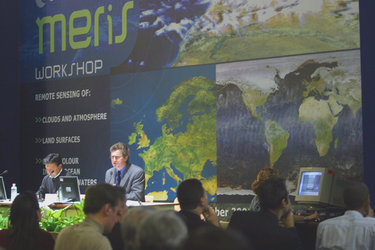
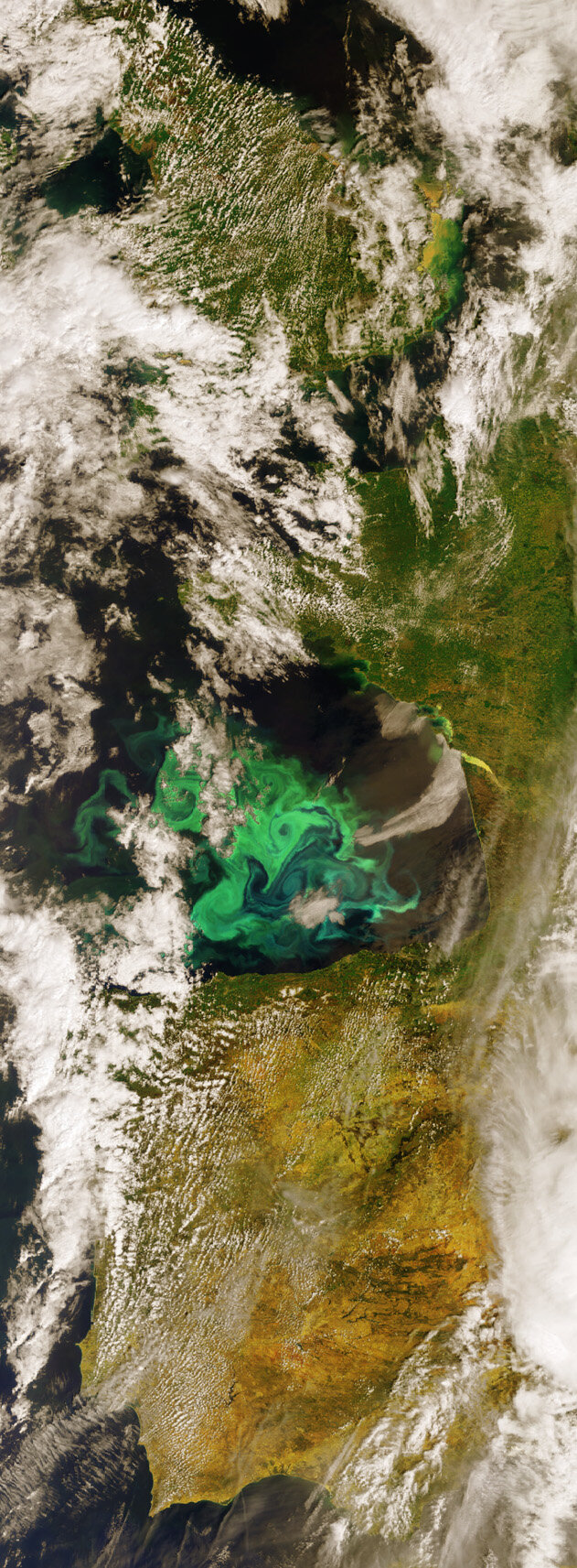
The five-day MERIS/AATSR Workshop is scheduled to take place in ESRIN, the European Centre for Earth Observation in Frascati overlooking Rome, from Monday 26 September. More than 200 Principal Investigators from over 30 countries, including ESA's 17 member states and Canada, as well as India, New Zealand, Nigeria and Japan are expected to attend. There will be 90 presentations during the Workshop and around 65 posters on show. The Medium Resolution Imaging Spectrometer (MERIS) takes visible-light images of the precise 'colour' of the ocean and coastal zones, enabling determination of the biological and sediment loading of the water.
The instrument also acquires land-based images showing land use and vegetation cover. Because these images are acquired in up to 15 spectral bands, they provide additional environmental information such as chlorophyll levels, plant health and local geology. MERIS can also monitor the distribution of atmospheric aerosols and otherwise invisible water vapour concentrations.
The Advanced Along Track Scanning Radiometer (AATSR) also has a visible-light imaging capability for land surfaces and atmospheric clouds and aerosols, but its view also extends further than that of MERIS into near and thermal-infrared wavelengths.

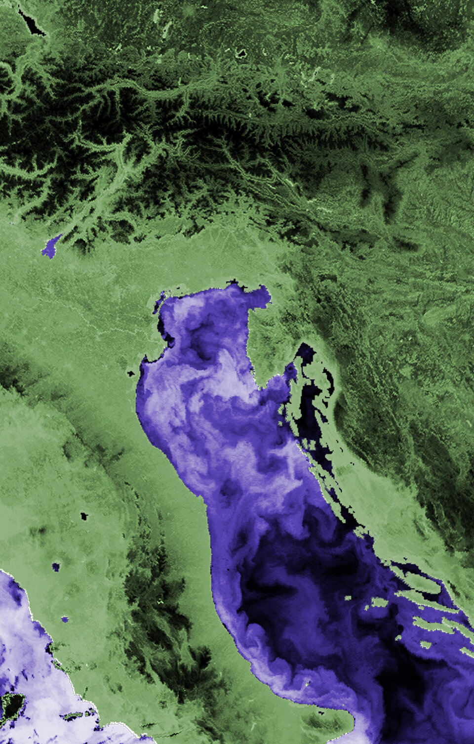
Working day and night AATSR measures global sea surface temperature (SST) to an accuracy of 0.3º K, constantly extending a 14-year satellite dataset commenced by predecessor ATSR instruments flown aboard ERS-1 and 2. The top two metres of the ocean alone contain more energy than the entire atmosphere, and so this long, continuous time-series of SST data is important for predicting the magnitude of climate change. AATSR also delivers land-based images, and is especially sensitive to soil moisture, vegetation extent and anomalous heat sources such as volcanoes or the central cores of forest fires.
AATSR is also used to study clouds and aerosol concentrations in the atmosphere. It has a dual view design which means it can takes forward as well as nadir-looking images. Because its twin views of the same scene pass through different atmospheric path lengths, the instrument has an enhanced ability to estimate and correct for distortion effects from the atmosphere – information which could potentially be applied to improve MERIS data quality in turn.
"Following on from a successful MERIS event in November 2003, this Workshop is an opportunity for us to have a dialogue with the scientific community," explains Workshop organiser Peter Regner of ESA. "The event will begin with updates on the status of the spacecraft and instruments, data quality and dissemination. The emphasis then splits to us receiving ideas from the users – in particular what can be done with the MERIS and AATSR datasets. Research utilising data from one or both sensors will be presented over a series of thematic sessions.
"We are particularly interested in stimulating discussion on what can be done by merging data from the two instruments. For MERIS products over land we still need to improve our algorithms to deal with the effects of atmospheric aerosols, and here it is possible that merging MERIS with AATSR data could be a way forward."
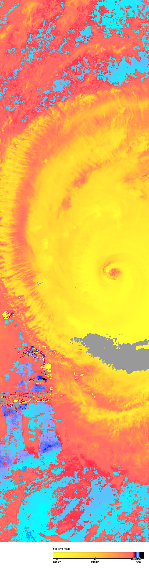
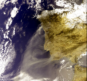
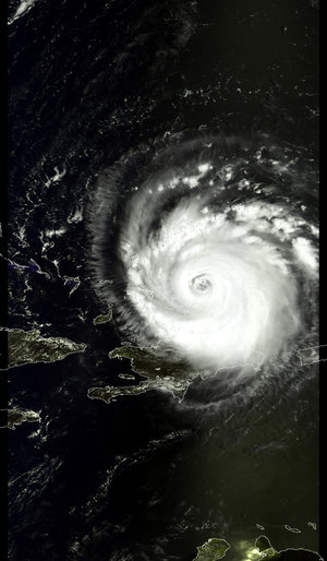
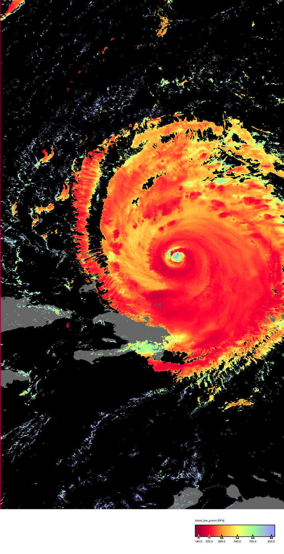
Researchers already combine results from the two sensors in many cases. While MERIS detects smoke and burned areas from wildfires, AATSR can identify central hot spots. The spread of colourful phytoplankton blooms across the face of the sea can be better forecast utilising SST data. And merged optical and thermal infrared views of the sea and the clouds above it give an enhanced understanding of the dynamics of storms and hurricanes.
The workshop will include training sessions for using the software tools used to process images from both sensors - known as the Basic ERS & Envisat AATSR and MERIS (BEAM) toolbox. An additional half-day course will cover how to programme new processing algorithms using the BEAM Application Programming Interface as a basis.