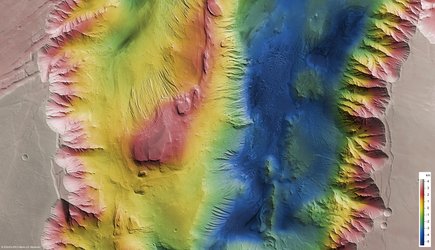
The Euminedes Dorsum mountains on Mars
The High Resolution Stereo Camera on board ESA’s Mars Express imaged the Eumenides Dorsum mountains on the Red Planet.
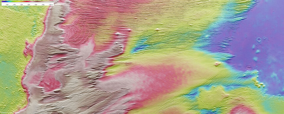
Eumenides Dorsum lies at approximately 2° south and 206° east. The images, taken on 26 December 2007, have a ground resolution of about 13 m/pixel. They cover an area of about
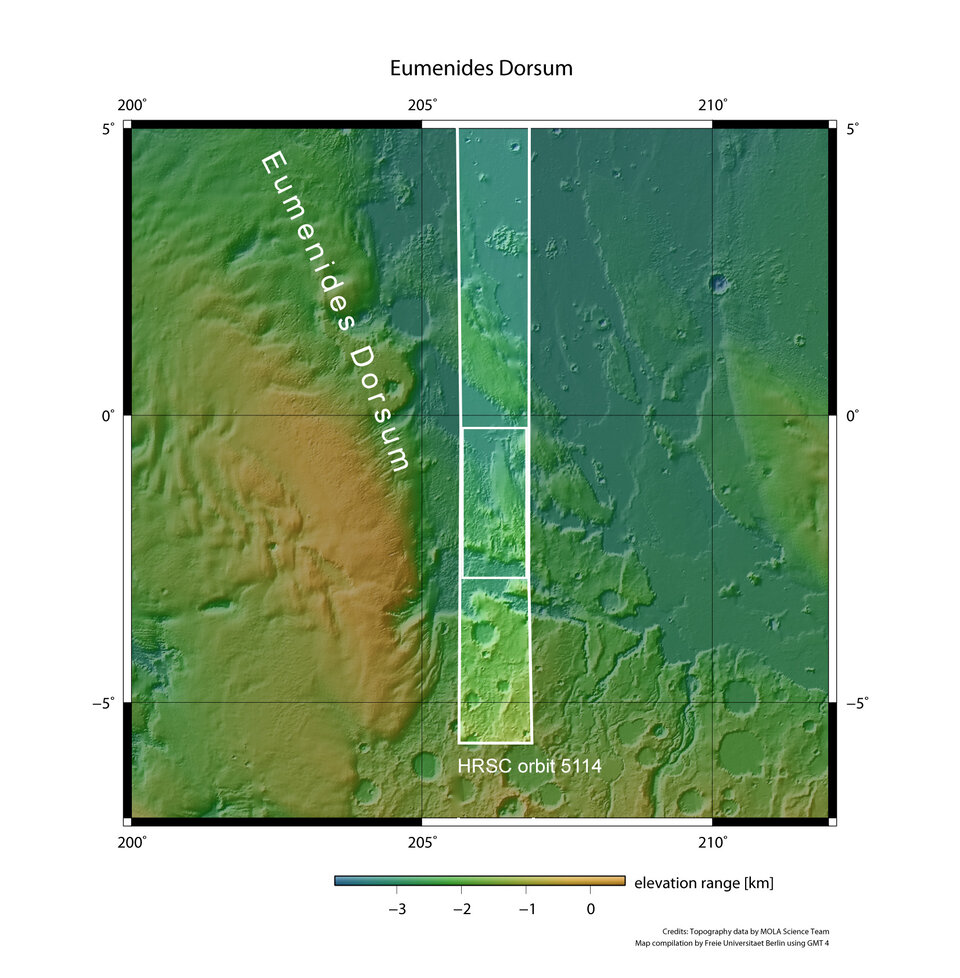
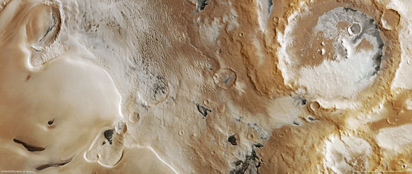
The mountains are located to the west of the Tharsis Region, and form part of the Medusae-Fossae Region, which is most likely covered by a blanket of volcanic ash.
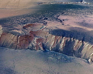
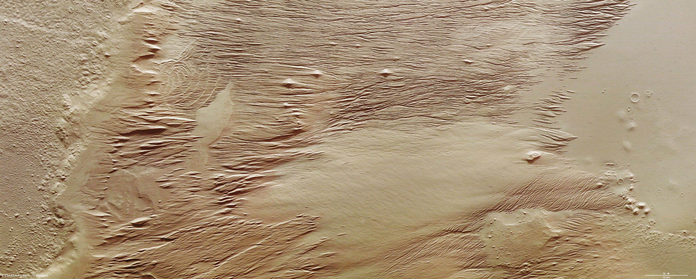
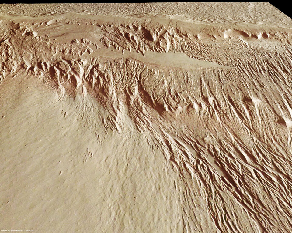
The region exhibits several kilometre-long linear structures interspersed with channels. The entire area bears evidence of the erosional force of wind, and possibly water, on Mars.
Although the martian atmosphere is rather thin compared to the Earth’s atmosphere – just 0.75% of mean surface pressure on Earth, corresponding to an altitude of about 35 km above Earth’s surface – it can be very dynamic and plays a major role in shaping the Red Planet’s landscape over a long period of time.
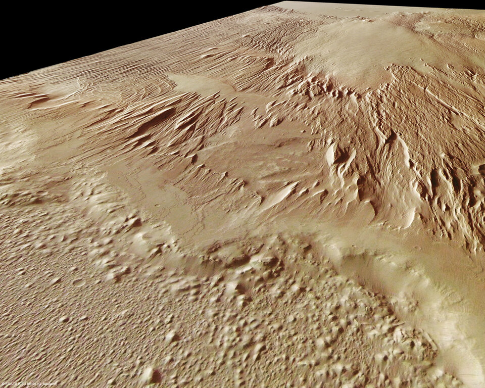
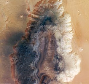
The region is dominated by features carved in sedimentary rocks created by the erosional action of the wind. The wind transports loose material, such as sand, and erodes the soft sedimentary rocks along existing structures like gaps, fault lines or incisions, removing the material.
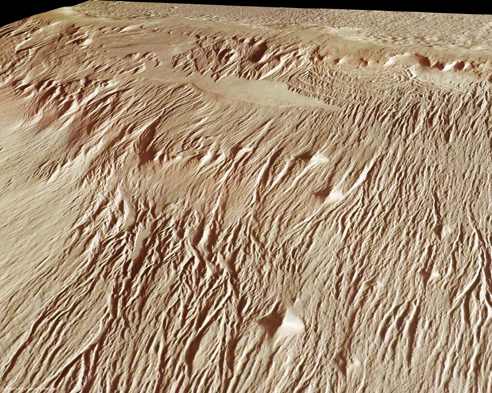
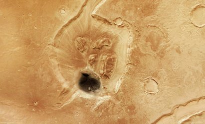
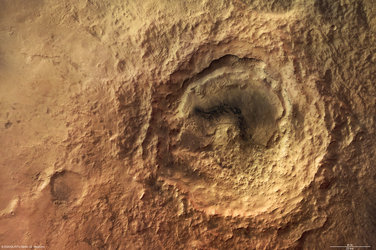
Smaller mounds in the image centre have been eroded and look pyramid-shaped. In the imaged area, most of these features are oriented from north to south. Such preferential orientation develops in areas where the wind direction remains the same.

The smooth areas in the centre of the image and in the northern part of the region are most likely made of more resistant volcanic material. This is because magmatic rocks are usually harder than sedimentary rock and are less affected by erosion.

Arched structures pervade the southern part of the region. The linear erosional features are superimposed on the concentric structures, indicating that the arched structures are older. Their origin is a matter of debate: they may be older structures laid open by the wind, or they may be lava flow fronts or deposits of ancient glaciers. They may also have been formed by several layers of landslide deposits which were first eroded, experienced sediment deposition, and then were exposed again.

The colour scenes have been derived from the three HRSC-colour channels and the nadir channel. The perspective views have been calculated from the digital terrain model derived from the stereo channels. The anaglyph image was calculated from the nadir and one stereo channel.