ESA releases new set of Envisat Earth images
Spectacular images of the Earth are now available in the Envisat Earth Images gallery.
These images highlight the enormous potential of Envisat, the world’s largest and most capable environmental satellite.
Launched in March 2002, Envisat carries a suite of 10 powerful instruments designed to provide valuable information about our environment and perform the most thorough set of observations of our planet ever made from space.
Data from these sensors will play a vital role in helping scientists, governments, and others in better understanding the causes, and consequences, of global environmental changes --from detecting El Nino events and unravelling the mysteries of global warming, to gaining crucial insights into the rise in ocean levels and tracking global deforestation.
The Envisat Earth Images gallery contains both high- and low-resolution versions of images acquired by Envisat’s three imaging sensors since the launch of the satellite, including:
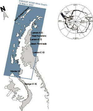
Advanced Synthetic Aperture Radar (ASAR)
The ASAR instrument uses radar to map the surface of the planet below. It is able to map the shape of the land, profile waves and ice, monitor land use and types of vegetation, and measure some of the properties of the surface.
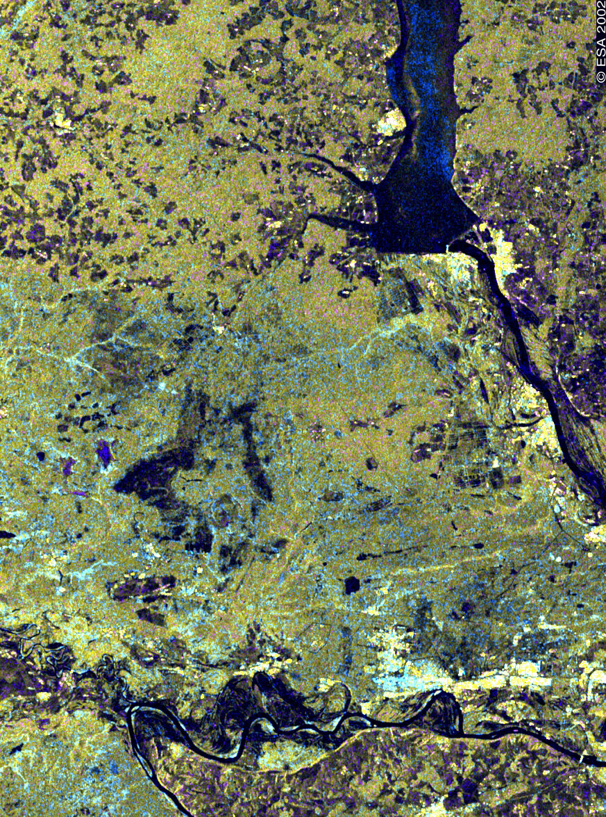
The image at left shows an area, 100-km wide, around the Russian city of Dzerzhinsk, 300 km east of Moscow. Visible in the north is the lower part of the Gorkovskoye Reservoir, formed by a dam across the Volga River, Europe’s longest. The river in the south is a Volga tributary, the Oka River.
ASAR can be operated in several different modes to allow broad views or detailed snapshots. Envisat’s ASAR instrument is the first permanent spaceborne radar to incorporate dual-polarisation capabilities - the instrument can transmit and receive signals in either horizontal or vertical polarisation.
This Alternating Polarisation (AP) mode improves the capability of a SAR instrument to classify different types of terrain. Because the reflective properties of a surface are dependant on the polarisation of the incoming radar signal, the use of more than one type of polarisation provides valuable extra information.
Medium Resolution Imaging Spectrometer (MERIS)
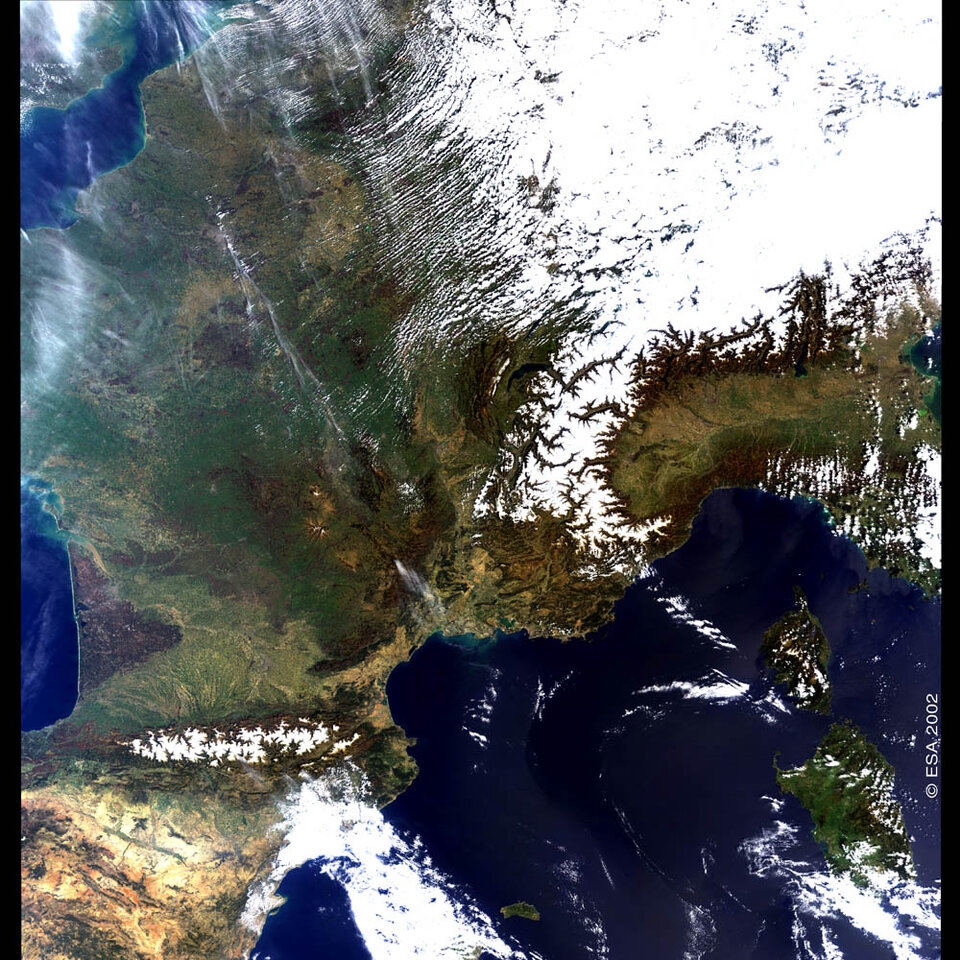
MERIS acquires images of the planet’s surface and clouds in sunlight, capturing visible light and some of the infrared part of the spectrum.
MERIS capabilities include: determining the exact colour of the oceans and coastal zones to reflect biological activity and other processes; monitoring clouds and detect invisible water vapour in the atmosphere; identifying plants at various growth stages, and; measuring chlorophyll levels, allowing calculation of the amount of vegetable biomass.
France is visible in the MERIS image, along with portions of several other European countries, including Austria, Belgium, England, Italy, Spain and Switzerland. Two mountain ranges filled with snow can clearly be seen: the Pyrenees and the Alps, with their highest points, respectively, at 3404 meters (Aneto peak) and 4807 meters (Mont Blanc).
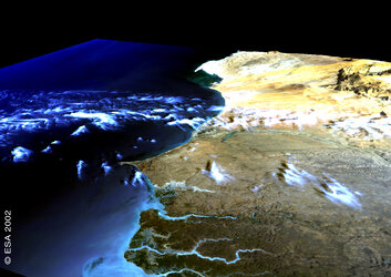
Advanced Along-Track Scanning Radiometer (AATSR)

The AATSR sensor scans land and ocean surfaces at several infrared and visible frequencies to measure temperatures. It is able to measure sea surface temperatures to an accuracy of 0.3°C, detect hot spots from forest fires, and map the extent of vegetation in different regions.
The AATSR image at left features a long strip of a 500-km swath extending from Euphrates valley in the Middle East to Lake Tanganyika in Central Africa, with the Red Sea separating Saudi Arabia from Sudan. To the south, Lake Victoria is visible, bordered by the Uganda, Kenya and Tanzania.
Additional Envisat imagery will be made available in this gallery periodically.
Visit the Envisat Earth Images gallery here.