ERS-2 has new role 'nowcasting' Europe's weather
After nine years in orbit, veteran ESA satellite ERS-2 has taken on a new role, supporting real-time 'nowcasting' of swiftly moving weather systems in the seas around Europe.
Most major European weather events have their birth in the North Atlantic or seas to the north of our continent. Limited observations across these regions mean that weather forecasters are often blindsided by sudden storms and associated phenomena that may wreck havoc upon reaching land.
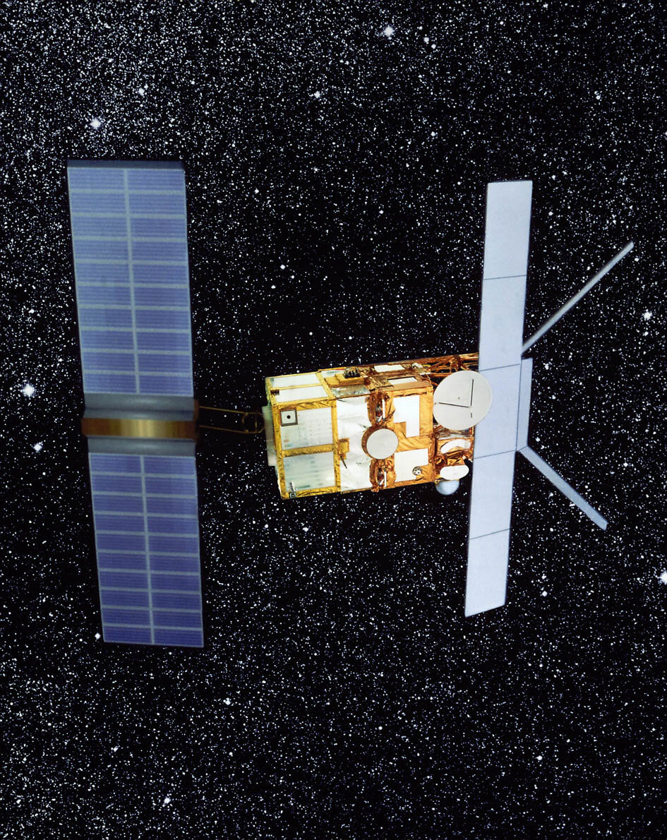
However an instrument aboard ERS-2 called a radar scatterometer can 'see' wind fields over the ocean surface in all weathers. It is now giving Europe's meteorologists an enhanced ability to generate real-time nowcasts of the current climate state as well as more reliable short-range weather forecasts.
An increase in the number of European and Canadian-area acquisitions carried out by ERS-2, coupled with speedier processing and delivery, means that meteorologists now receive wind field products on their desks within an average 30 minutes of the scatterometer acquiring raw data.
"You want observations of current weather on your desk immediately, otherwise you are already getting behind the actual facts," says Ad Stoffelen of the Royal Dutch Meteorological Institute KNMI, which has made its ERS-2 wind field products publicly available since the start of April. "For weather forecasting the World Meteorological Organisation defines nowcasting as within one hour, with short term forecasting falling between one hour and a day.
"For the first time ERS-2 results are available for nowcasting, which represents a whole new application for the satellite."
The old saying that every cloud has a silver lining may be faulty in meteorology terms, but it turns out to be true in the case of ERS-2. Back in June 2003 the satellite lost its onboard data storage capability, effectively ending its global coverage. Now the spacecraft returns data when in line of sight of an appropriately equipped ground station.
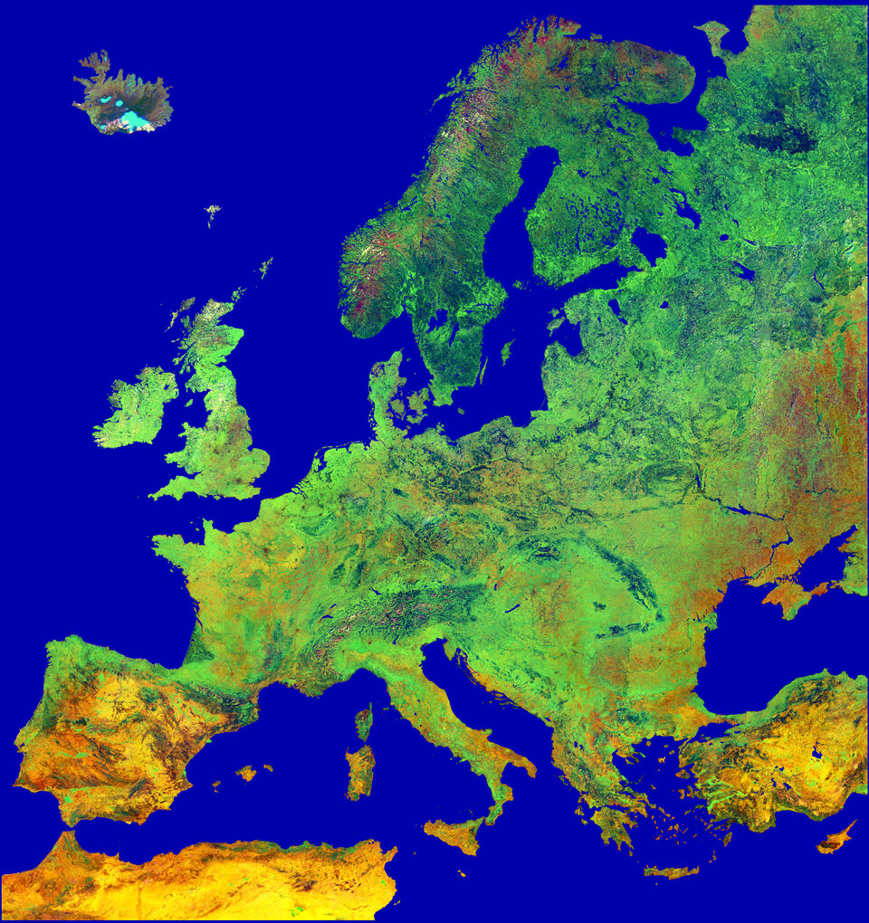
Because the majority of such stations are found around Europe and Canada, ensuring good observation of the North Atlantic, ERS-2 coverage of these regions has been able to continue.
"ERS-2's orbit period is about 100 minutes," Stoffelen explains. "In the past it would store 100 minutes worth of data on its tape then perform a single data dump for ten minutes down to its assigned ground stations, mostly in the northern hemisphere around the North Pole.
"So the first data on the tape would already be pretty old, then it would have to be sent to ESA's ESRIN centre in Frascati, Italy, for processing before it gets distributed to users.
"Now we only get data on the Atlantic and European seas for ten minutes at a time, but to make up for it the new mission scenario has optimised the number of real-time ground stations acquisitions, increasing them radically from 14 up to 50 a day, thereby providing very good coverage in our region.
"And because 10-minute segments of data take much less time to be processed than 100-minute segments, they become available for use sooner than before."
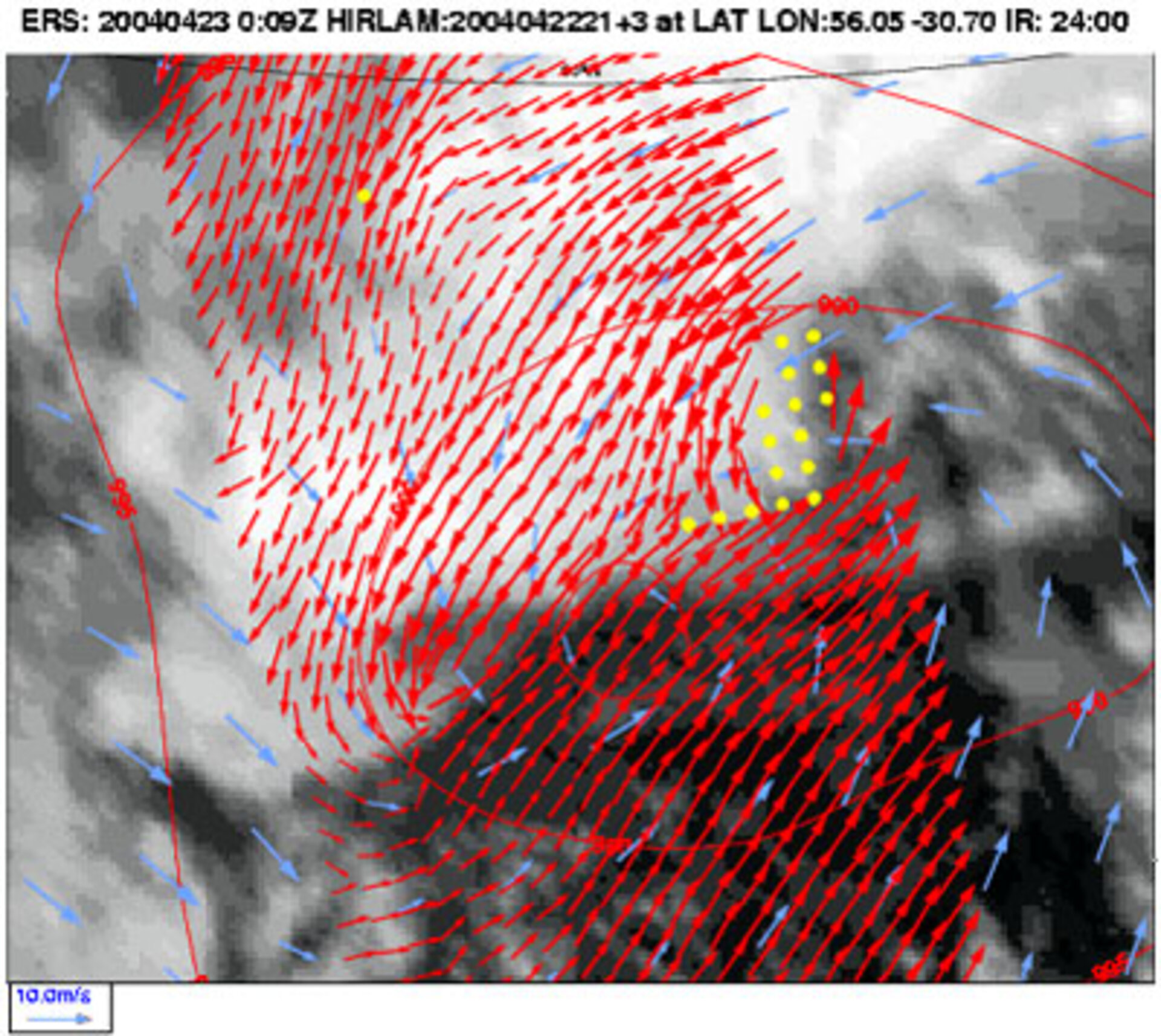
KNMI combines ERS-2 scatterometer data acquired from multiple ground stations. The instrument bounces 'triplets' of radar signals in three directions simultaneously – fore, aft, and sideways – and different ground stations may acquire different directions. These acquisitions are combined to increase the number of backscatter triplet measurements while throwing away overlapping material.
The data are then run through KNMI's wind processor algorithm to obtain the final wind field product. KNMI ran this system in-house for the past couple of months before making it publicly available in April.
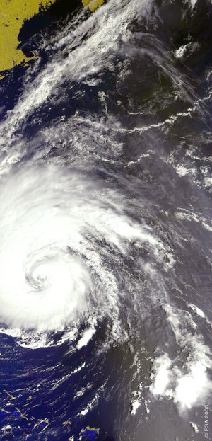
The ERS-2 results are particularly useful when it comes to identifying such fast-paced turbulent features as winter polar lows – sometimes dubbed 'Arctic hurricanes' these are often associated with gales and blizzards and powered by intrusions of Arctic air masses – along with so-called baroclinic storm developments in the Gulf Stream region, plus cyclones and anti-cyclones. All of these events can develop in under 24 hours, greatly impacting the accuracy of weather forecasts.
The fall and rise of ERS-2 scatterometry
ERS-2's payload includes a radar scatterometer that works by firing a trio of high-frequency radar beams down to the ocean, then analysing the pattern of backscatter reflected up again.
Wind-driven ripples on the ocean surface modify the radar backscatter. As the energy in these ripples increases with wind velocity, so backscatter increases as well. Scatterometer data enable the measurements of wind speed and direction across the water surface.
What makes ERS-2's scatterometer especially valuable is that its C-band radar frequency is almost unaffected by heavy rain, so it can return useful wind data even from the heart of the fiercest storms – and is the sole scatterometer of this type currently in orbit.
On 21 April 2004 ERS-2 celebrated its ninth anniversary in orbit, its scatterometer working better than anyone could have hoped for just a few short years earlier.
Following its launch from Kourou in 1995, the spacecraft payload functioned well but problems began to occur with its gyros used for positioning in space.
After six years of service ESA engineers evolved an innovative 'gyro-less' mode of operating the spacecraft, but the new mode's pointing accuracy was initially insufficient to maintain an operational scatterometer service, since the instrument requires simultaneous pointing accuracy across three axes.
In the summer of 2003 a development took place that led to ERS-2 wind field products publicly available once more: a new software algorithm developed by the Belgian Royal Military Academy succeeded in compensating for the pointing degradation, regaining access to scatterometer measurements.
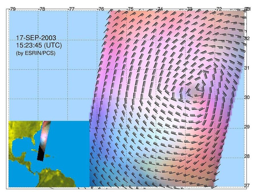
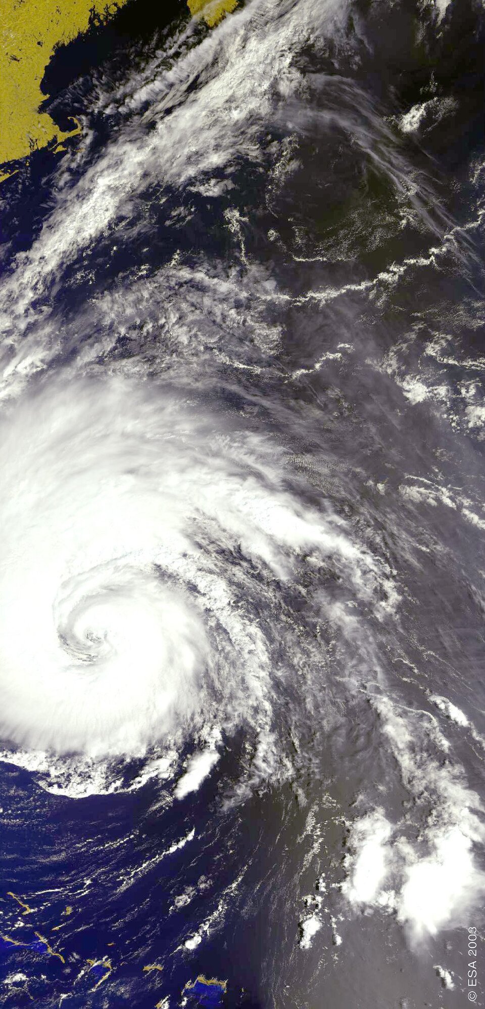
The return to service came in time for ERS-2 to provide a unique view of the pressure system at the centre of Hurricane Isabel as it descended upon the United States in September 2003.
Meanwhile researchers at KNMI began working with wind experts at the European Centre for Medium-Range Weather Forecasts (ECMWF) to improve the accuracy of the mathematical model that turns raw scatterometer data into geophysical facts. The success of this endeavour gave greater accuracy than before, and in March 2004 ECMWF resumed routine assimilation ERS-2 scatterometer data into its medium range forecasts.
With key engineering issues resolved, the last six months has shown ERS-2 to be an extremely stable platform and payload, with the satellite's overall performance as good as it ever has been, and ESA has received several new research proposals for ERS-2.
To maintain continuity of scatterometer coverage into the future, a new more advanced instrument called ASCAT is part of the payload for the ESA-designed and EUMETSAT-operated MetOp mission, due for launch in 2005. When ASCAT comes into service, ground station acquisitions are planned that support use of its wind data for nowcasting and short-range forecasting.